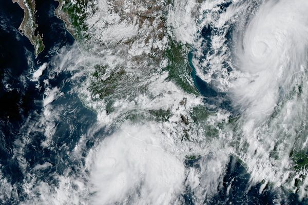
The Met Office has warned the El Niño event developing over the Pacific is shaping up to be the most significant in living memory - and it will impact the weather in London over the coming months.
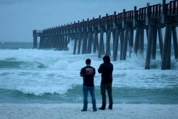
Forecasters have said that the phenomenon will cause the UK to experience more storms and rain over the coming autumn and winter.
It comes as Britons have been urged to stock up on food and water as the government plans a campaign urging citizens to prepare for emergencies.
Environment secretary Angela Eagle told the Guardian: “We’re about to experience probably the largest El Niño that has ever been seen, and that will lead to drier summers, wetter winters, with more extreme storms in this country.
“If you’ve got a store of a bit of food that can keep you going for a while before the emergency services can get to you, you’re going to be a lot better off than if you haven’t. So some of it is that kind of preparation for just being a bit more resilient.”
An El Niño event is declared when sea surface temperatures in the tropical eastern Pacific rise to 0.5C above the long-term average, impacting global rainfall patterns and average temperatures.
Current measurements show that they are over 2C above normal - and the Met Office is predicting that it could measure over 3C more than average later this year.
That would make this year’s weather event the largest since at least 1950, and possibly since the 19th century, according to the national forecaster.
Other climate groups have projected temperatures to even reach 4C above average.
How will El Niño impact London’s weather?
The impact of such an event would mean that London, along with all of northwest Europe, would experience wetter and stormier conditions in the coming autumn and early winter.
El Niño can also increase the odds of cold weather late in the winter.
Professor Adam Scaife, head of long-range forecasting at the Met Office, said: “We should be clear that this is an unprecedented event. I have never seen an El Niño signal this intense in our forecasts.”
He added: “If the forecast is accurate – and other forecast systems show similar extreme values – then 2026 will far exceed our recent experience of El Niño and its worldwide climate influences.”
The Met Office said that El Niño events also drive an increase in global average temperature, with 2027 “very likely” to be the hottest year on record.
Met Office Science Fellow Dr Nick Dunstone said: “During large El Niño events significantly more heat is released from the ocean to the atmosphere leading to an increase in global average temperature, particularly in the calendar year following the winter peak of the El Niño.
“Hence, 2027 is very likely to replace 2024 as the warmest year on record and be another year to temporarily exceed plus 1.5C above the pre-industrial period”.
Grahame Madge, Met Office climate spokesman, told The Standard: “The El Niño that is currently still developing in the tropical Pacific is estimated to be the most significant El Niño in living memory.
“Across the globe there will be significant impacts, including the potential for drought in a wide swathe of southern and south-eastern Asia and Australasia. These drought conditions are likely to exacerbate concerns around food security and wildfire risk in affected regions. It is anticipated that the global annual temperature for next year is likely to set a new record.
“Closer to home, there are likely to be some impacts, such as a wetter autumn. But in the UK we have to remember that although El Niño is going to be a powerful global event, it is happening a long way from the UK, so its affects here will be moderated by other drivers of weather.
“Our conditions are also influenced by conditions in the Atlantic, the Arctic and Continental Europe. Our forecasters will be looking at the relevant influences of all of these drivers to determine the forecast for the rest of autumn and winter.”
Climate change ‘stress’ is increasing
El Niño is not thought to have been a major factor in the record-breaking heatwaves that have swept the capital this summer.
Professor Stephen Belcher, the Met Office’s chief of science and technology, said: “This summer we have experienced heatwaves across Europe reminding us of the effects of climate change, this large El Niño is a reminder that natural variations in the climate system are also at play, adding to the stresses of climate change.”
The unprecedented string of heatwaves and lack of rainfall meant that England saw the driest July on record, with no meaningful rain in London, putting unprecedented pressure on the capital’s cherished parks and beauty spots.
Almost three-quarters of England and all of Wales have been pushed into drought, putting severe pressure on the water system, wildlife, farmers, emergency services and infrastructure.
During the UK’s fifth heatwave of the summer, the hottest day of the year was recorded in Kew Gardens last Thursday when temperatures reached 38.1C.
Wildfires have ravaged parts of the UK, with a blaze in Stourbridge destroying 19 homes and London Fire Brigade (LFB) taking huge numbers of calls to fires amid sweltering temperatures.
The National Fire Chiefs Council said that 1,132 wildfires have now been recorded across England and Wales in 2026 so far – a record high for the amount between January and this time of year.
Following an emergency meeting to discuss the heatwaves, Prime Minister Andy Burnham warned: “We might be in for a wet autumn and winter straight after this, because of El Nino and some of the issues there, which was reported to Cobra.”
Forecasters and officials have warned that it could take months of sustained rainfall before rivers, reservoirs and groundwaters are completely replenished.
The National Drought Group has warned that drought conditions could persist into the new year as, despite El Nino, current forecasts do not suggest this autumn will have the amount of rainfall required to drive recovery before December.