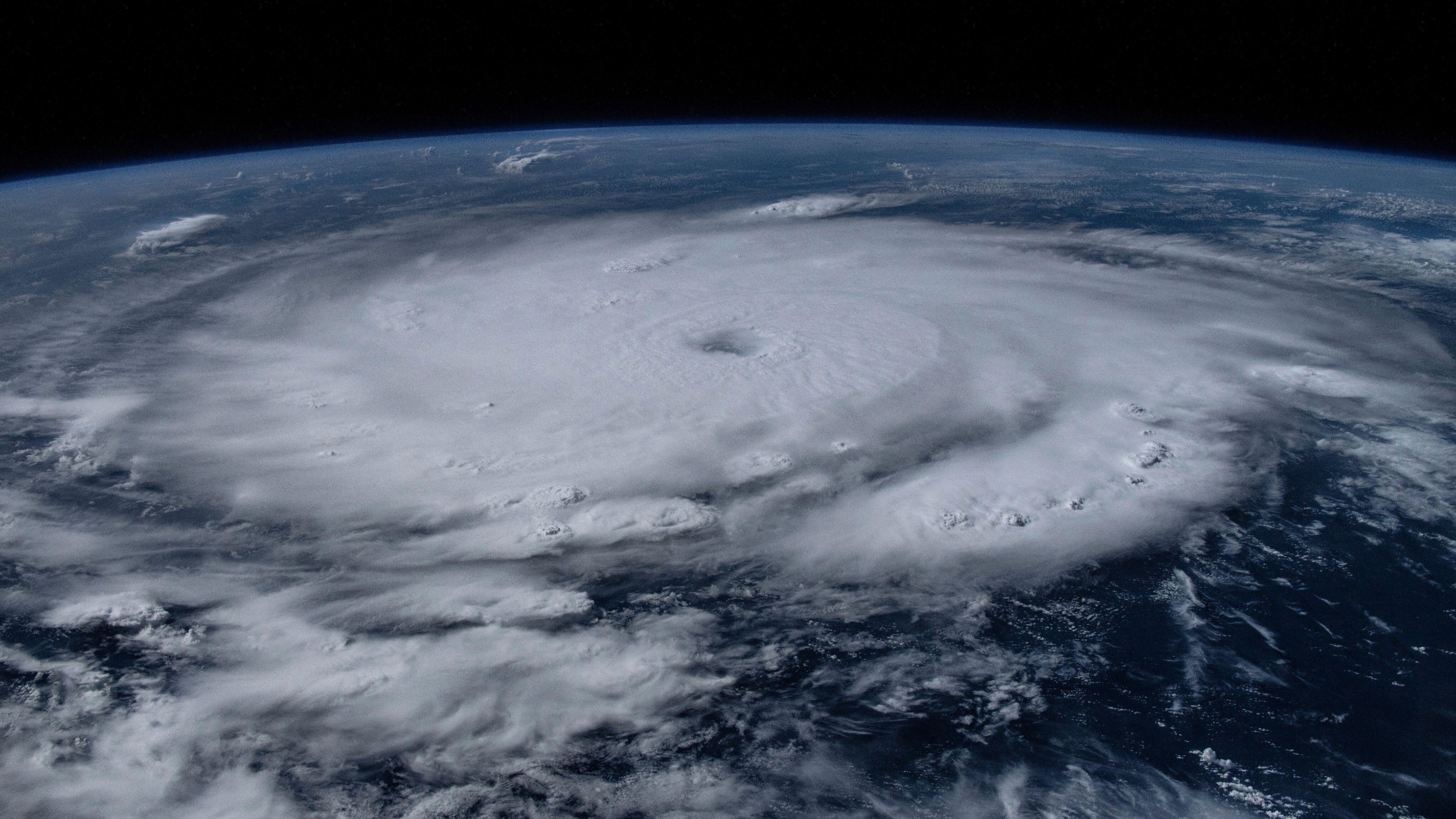
Hurricane Beryl has become the earliest Category 5 storm on record, as unprecedentedly warm oceans cause powerful storms to form earlier in the year than ever before.
The monster storm is currently sowing devastation across the Caribbean.
Despite appearing at the usually subdued beginning of the 2024 Atlantic hurricane season — a period running from June to November — the freak hurricane exploded from a tropical depression into a Category 5 storm between Friday (June 30) and Monday (July 1) as it traveled west.
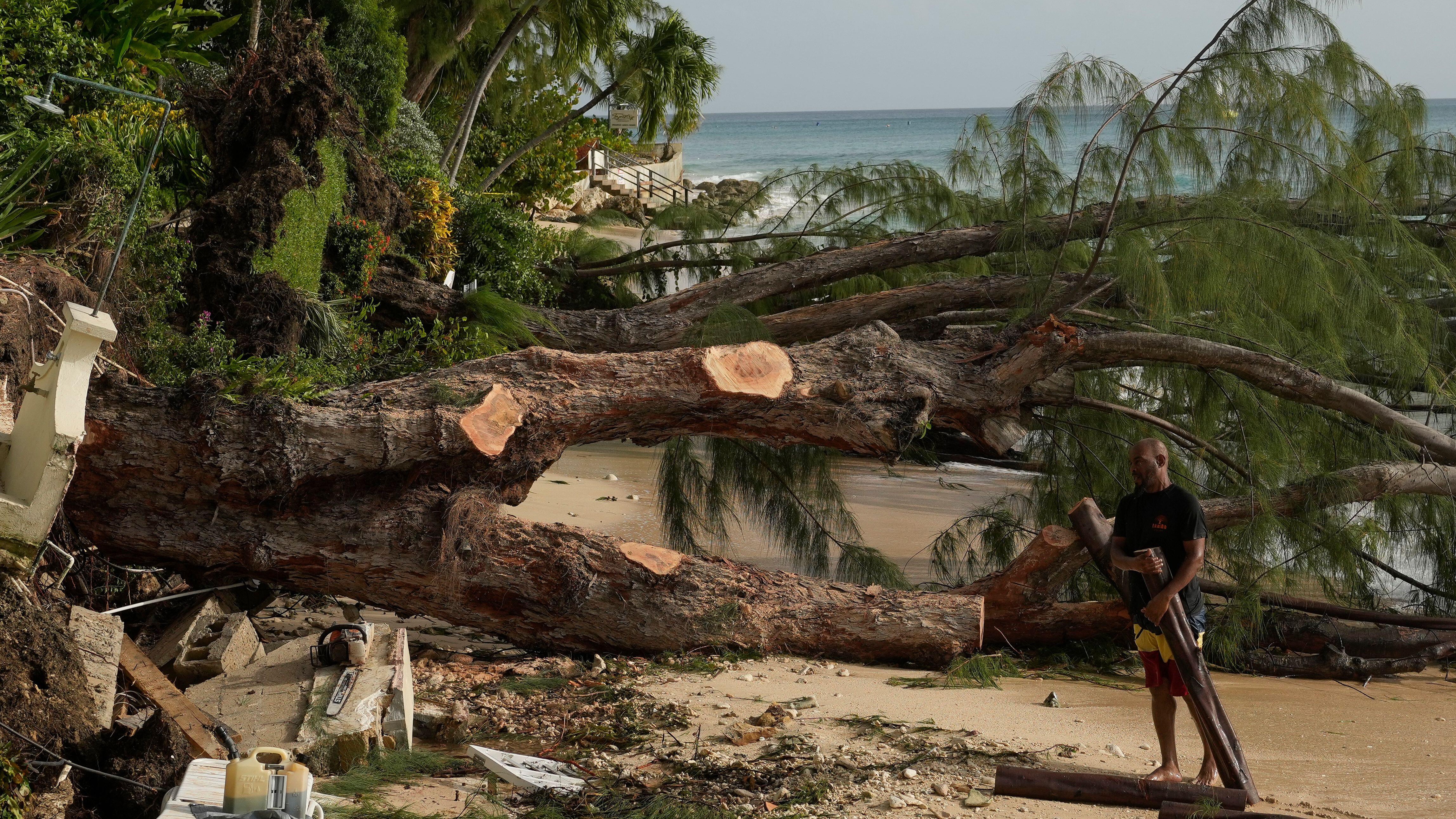
With winds topping out at 165 mph (265 km/h), Beryl has already caused widespread damage and killed several people across Carriacou (an island in Grenada), St. Vincent and the Grenadines. The storm, which has since slowed to a Category 4, is expected to next make landfall in Jamaica and then the Cayman Islands.
"In half an hour, Carriacou was flattened," Dickon Mitchell, the prime minister of Grenada, said at a news conference on Monday (July 1). "There is really nothing that could prepare you to see this level of destruction. It is almost Armageddon-like. Almost total damage or destruction of all buildings, whether they be public buildings, homes or private facilities. Complete devastation and destruction of agriculture, complete and total destruction of the natural environment. There is literally no vegetation left anywhere on the island of Carriacou."
Related: We may need a new 'Category 6' hurricane level for winds over 192 mph, study suggests
Scientists have been shocked at the storm's ferocity and how quickly it developed so early in the hurricane season. Brain McNoldy, an atmospheric scientist at the University of Miami, noted on June 30 that the previous record for a Category 4 hurricane in the same region as Beryl was set on Aug. 7, 1899, and the previous earliest date that a storm intensified at the same rate was on Sept. 1.
"It's hard to communicate how unbelievable this is," McNoldy wrote in a blog post. "With La Niña on the way and the ocean temperatures already looking like the second week of September, this is precisely the type of outlier event that people have been talking about for months heading into this season. When you have an unprecedented favorable environment, you're bound to see unprecedented tropical cyclone activity."

Hurricanes grow from a thin layer of ocean water that evaporates due to winds and rises to form storm clouds. The warmer the ocean is, the more energy the system gets, pushing the formation process into overdrive and enabling violent storms to rapidly take shape. This is why the most powerful storms in the Atlantic usually occur between August and September, when sea temperatures peak for the year.
Scientists previously discovered that climate change has made extremely active Atlantic hurricane seasons much more likely than they were in the 1980s.
Since March 2023, average sea surface temperatures around the world have hit record-shattering highs — providing storms like Beryl with more energy in order to grow.
Another factor in the storm's record-breaking advance is the end of the El Niño weather pattern in April, according to the Australia’s Bureau of Meteorology. El Niño is a climate cycle where waters in the tropical eastern Pacific grow warmer than usual, affecting global weather patterns.
During El Niño, winds in the Atlantic are typically stronger and more stable than usual, limiting hurricane formation. But its end has removed the handbrake on Atlantic storm development.
Beryl could just be the start of a tumultuous hurricane season. As El Niño is set to be replaced by La Niña, it could make for an unusually stormy summer. That's because La Niña weakens trade winds and in turn lessens vertical wind shear, which is what breaks up incipient storms.
These factors led scientists at the National Oceanic and Atmospheric Administration (NOAA) to make their highest-ever May forecast for an Atlantic hurricane season, predicting 17 to 25 named storms. According to the forecast, 13 of these storms will be hurricanes, with winds of 74 mph (119 km/h) or higher; and four to seven will be major hurricanes, with winds of 111 mph (179 km/h) or higher.


