Get all your news in one place.
100's of premium titles.
One app.
Start reading
The Conversation
The Conversation
James Cheshire, Professor of Geographic Information and Cartography, Department of Geography, UCL

Adding an AI tool to Google Earth shook our trust in maps that has been centuries in the making

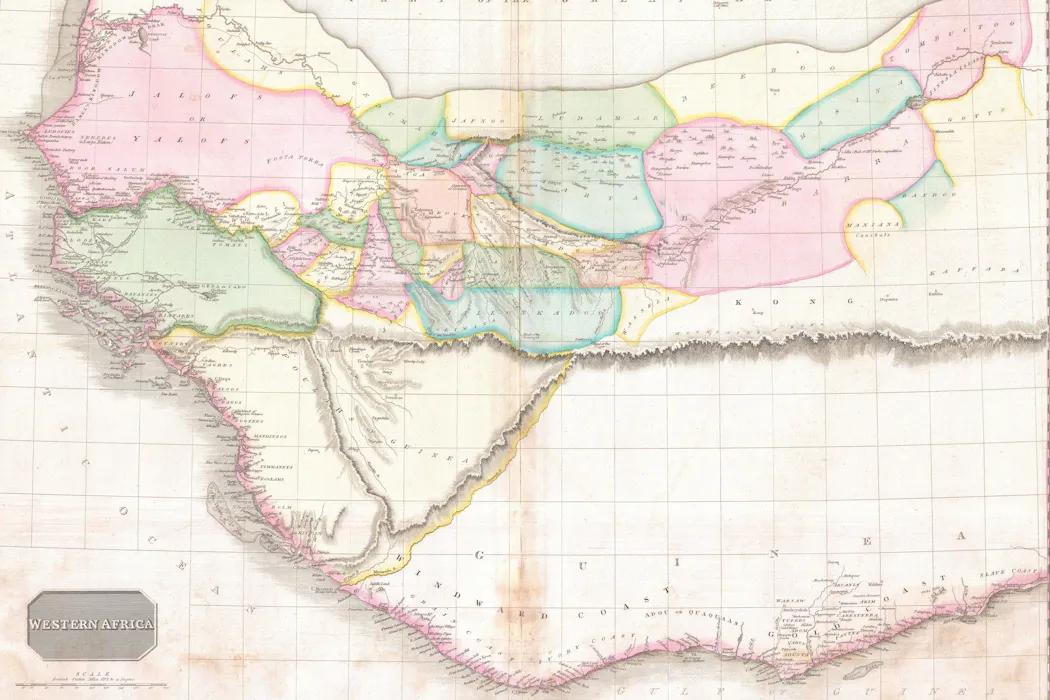
An 1818 map of western Africa shows the continent bisected by the mythical 'Mountains of Kong', based on the explorations of Mungo Park. Image: John Pinkerton's A Modern Atlas via Wikimedia Commons

Throughout the 18th and 19th centuries, Europe’s cartographers traded on their reputation for accuracy and detail at a time of huge societal change. But as demand grew for increasingly detailed maps of the world to support industrialisation at home and colonisation overseas, they didn’t always get it right.

For over a century, the Mountains of Kong festooned maps of Africa after the Scottish surgeon and explorer Mungo Park returned from an expedition in the 1790s and described them to his cartographer, James Rennell, as a possible source for the Niger river.

Sign up to read this article
Read news from 100's of titles, curated specifically for you.
Already a member? Sign in here
Related Stories
Top stories on inkl right now
One subscription that gives you access to news from hundreds of sites
Already a member? Sign in here
Our Picks
Fourteen days free
Download the app
One app. One membership.
100+ trusted global sources.