In leafy South Kensington there is a 3,000 sq m artificial ocean in a basement. I kid you not. Dave de Ruyter has been managing the Hydrodynamics Laboratory at Imperial College for nearly 20 years. His enthusiasm remains undimmed. “Look at that,” he says, pulling open a hatch in the floor to reveal water running below our feet. “Not many places have this! When it’s full, the system contains 1.2 million litres of water.” The pumps and sump supply two large wave basins and six flumes that can recreate everything from deep-water swells to currents and wind-driven seas.
Under the watchful eye of PhD student Oliver Millar, we begin with a neat wave. “This is a very nice mathematical wave,” he says approvingly. Then he begins to move some of the 56 paddles. The surface becomes restless, the pattern changes. As the waves build, he raises his voice above the clanking and sloshing. “OK, this is really a very good representation of a North Sea storm at a scale of one to 100. In real life the largest waves here would be around 10 metres.” By shrinking a storm, researchers can safely recreate extreme conditions, measure exactly how waves behave and scale the results back up.
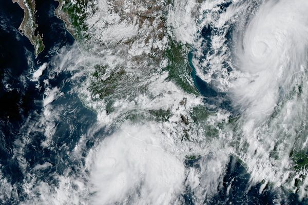
But a very real extreme weather-maker is brewing thousands of miles away. The developing El Niño — a mass of unusually warm water across the tropical Pacific with the power to shift weather patterns around the planet — could be one of the strongest on record. It has even earned the nickname “Godzilla”. The Met Office says it increases the chances of wetter, stormier conditions across the UK and north-west Europe this autumn and winter.
What is El Niño?
El Niño is the term for when sea surface temperatures in the central and eastern tropical Pacific rise above average, disrupting normal wind patterns and shifting rainfall around the world.
The climate is already wetter. Research shows the extra rain now falling across the UK each winter as a result of fossil-fuel-driven global warming would fill three million Olympic swimming pools. London is particularly exposed, facing flood risk from three directions: North Sea storm surges pushing up the tidal Thames; swollen rivers and tributaries; and intense rainfall overwhelming the drainage of a densely built city.
A monitoring revolution
After the flash floods of 2021 and 40C heat of 2022, Sadiq Khan commissioned the London Climate Resilience Review. Published in 2024, it warned that the capital is “not prepared for another major surface water flooding incident” and that “lives and livelihoods are at risk”.
Ocean monitoring is a key tool — and the way it’s conducted is changing fast. Satellites give us the view from space, while the Global Ocean Observing System draws on thousands of instruments in the water. Scientists once depended far more on ships; now mathematician Dr Adam Sykulski can read the Pacific from South Kensington, in part thanks to thousands of drifting buoys equipped with sensors. He shows me their tracks on a “spaghetti plot”: extraordinary strands criss-crossing the planet, measuring temperature, currents and the movement of heat as they go.
For the Standard’s visit, Sykulski plotted around 500,000 temperature readings taken since January by buoys passing through the Niño 3.4 region, a key area for monitoring El Niño. They show temperatures climbing sharply from slightly below average at the start of the year into very strong El Niño territory.
The technology might be deceptively simple but these direct observations are critical. “These aren’t satellites or models,” says Sykulski. “These are just actual temperature sensors in the field inside that box.” So harder to dispute, then? “Yes, exactly.” Better observations mean better forecasts — and better information about when and how to prepare.
From warnings to action
The next challenge is coverage. The more of the ocean we observe directly, the better the forecasts. Anahita Laverack, founder and CEO of Oshen (and an Imperial alumna), had a different idea about how to achieve it. “Instead of doing these big shiny robot boats, why not do 100 really small, low-cost ones that are able to get much better coverage over a wide area?” she tells me from Oshen’s Plymouth headquarters. The resulting Sea Stars are one-metre wind- and solar-powered robot boats, deployed in fleets.
They sail into position, measure weather and ocean conditions and beam back live data. They can also be redirected to wherever scientists need observations. Thirty-two are currently at sea, including 13 collecting data for the US National Oceanic and Atmospheric Administration in the Atlantic hurricane belt.
They are not currently monitoring El Niño, but Sea Stars can measure at depth and are already being used to observe variable thermoclines — the boundary between warm surface water and colder water below, a major source of uncertainty in El Niño modelling.
“London comes top for all hazards — flooding, overheating, subsidence”
Emma Howard Boyd, National Heat Risk Commission
Early warning needs to translate into action. Emma Howard Boyd, chair of the National Heat Risk Commission and lead of the London Climate Resilience Review, knows the capital’s risk profile is formidable. “London comes top for all hazards — flooding, overheating, subsidence,” she says.
But preparedness can be surprisingly low-key. She points to the Tolworth roundabout, which looks like a wildflower island but is designed to hold water; roadside rain gardens that soak up cloudbursts and provide shade; and stormwater storage tanks buried beneath parks. The next step, she says, is to make resilience part of how London operates, so every time we upgrade a road, railway, hospital or home, we build for “the weather we know they’re going to experience for decades to come”.