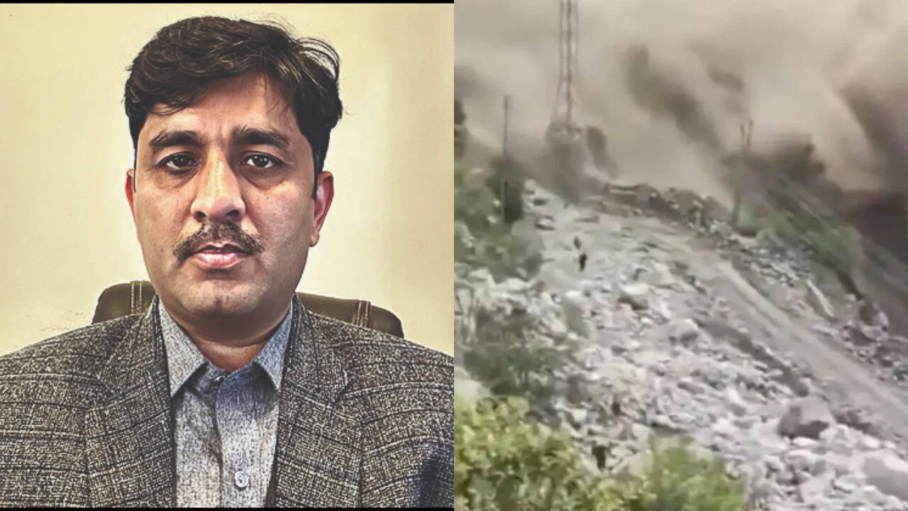
The images from the devastating floods in Nepal were hauntingly familiar, recalling scenes from Sikkim in 2023, Uttarakhand’s Chamoli Valley in 2021, and Kedarnath in 2013. The disaster — in which flash floods swept away bridges and settlements in seconds — raises questions about the wisdom of expanding development in the Himalayas and the role of climate change in aggravating the region’s risks. Vaishnavi Chandrashekhar spoke to scientist Sher Muhammad , who leads cryosphere monitoring at the Kathmandu-based International Centre for Integrated Mountain Development (ICIMOD), about what happened in Nepal and the challenges of early warning systems
Get breaking news anytime, anywhere. Download the TOI app now!
What do we know so far about the cause of the flood?
The current understanding based on satellite images is that there was a rock-and-ice avalanche caused by a part of a glacier collapsing. Images also show a 0.25-sq-km lake has formed in the area of glacier detachment, and part of it may have already burst. We need more data to understand the incident in detail.
You have worked in Langtang, where the glacier collapse occurred. Can you tell us about the area?
This incident occurred not in Langtang itself but west of Langtang. There are several glaciers in the area, but there isn’t a huge amount of ice. The glacier that collapsed is not big — there are much larger ones in the Himalayas. But it is a hanging glacier, so it is steep, and the gradient is high.
Is this incident comparable to any others in the region? Was there a warning system in place?
There have been several such events in recent years. In 2016, two glaciers collapsed in the Tibetan Plateau. It is also similar to the 2021 Chamoli disaster in India in the sense that we saw a similar cascading effect far downstream. But the scale of the impact here is bigger, more like that of the Kedarnath disaster more than ten years ago. We don’t know the numbers yet, but the potential loss of life is huge. As for early warning systems, a seismic monitoring instrument was triggered by the glacier collapse, which led to early reports of a quake. But it turned out not to be a quake. This incident and the previous one show that seismic signals can help provide early warnings in combination with other datasets.
How much did climate change contribute to the disaster?
Individual events are difficult to attribute to climate change. There are many factors in play. But we can’t ignore the impact of global warming, especially when we see the increase in the rate of glacier melting in the Himalayas in the past decade. Last year, we released a study that found a 65% increase in the rate of ice melt between 2011-2020 compared with the previous decade. Recent assessments have found glacier mass loss has accelerated sharply since 2020, signalling a significant increase in melt rates and associated risks for water resources and glacier-related hazards. Snowfall has been below normal for the past four years and is the lowest recorded this year. With less snow, glaciers are more exposed to higher temperatures. It’s possible that with more melt, there is greater subsurface lubrication, which could trigger such incidents especially in glaciers set at a high gradient.
ICIMOD helped launch the Hindu Kush Himalaya Disaster Risk Reduction Hub in Dec 2024 to coordinate research across the region and improve early warning systems. What is the status of this work?
There is a significant amount of work going on in different countries. But mountainous regions are difficult to work in, and quite expensive for installing monitoring infrastructure. A significant amount of investment is needed — warning systems are not a one-time thing; they require continuous monitoring and maintenance. As for the disaster hub, we are currently holding our second meeting in China; expert representatives of India, Pakistan, Nepal, China, and Bhutan are here to present findings. We hope to be able to put out an assessment report and policy recommendations later this year.
What do you think is most urgent for reducing risk?
We need a policy for land-use planning in the Himalayas. Traditionally, people have lived in the high mountains, and these groups have a lot of knowledge of the terrain. But in recent decades, there has been an increase in commercial activity and residential settlements along rivers. And we are also seeing more infrastructure being built in the mountains. This is happening in almost every country in the region. We are exposing ourselves to risk, and at a time when climate change is increasing the severity of such events. All countries should come up with land-use policies based on risk-assessment maps. We cannot stop these events, but we can avoid exposing ourselves to them.
Is data sharing across borders adequate?
Very few glaciers are monitored on the ground; we mostly depend on satellite data. Every country focuses on the areas that concern them. They may not be interested in monitoring, say, an area at the border where a river flows into another country. So that information may not be available. It’s not true that countries don’t share data. And social media also helps. But sometimes the disaster unfolds so quickly that we don’t have enough time to react.