There are a lot of great features in Google Maps, and a lot of them have absolutely nothing to do with navigation. One of those features is one you may not know about, or forgot was even possible — and it's designed to help you learn more about different areas throughout history. I am, of course, talking about Street View's "time travel" feature.
Everyone knows Street View is a great way to get a view of different spots from street level, but it is possible to give you a glimpse at history as well. In the past you stuck with the last load of Street View photos that Google's roving band of camera-laden cars had taken, but that changed a few years back when archived photos were added to Google Maps.
This essentially lets you travel back through time and see back into the past through the portal of Google Street view. I've found that this is a really great way to learn about the area around you, and just how much things have changed since Street View first launched. Here's how to time travel through Google Maps.
1. Open Google Maps
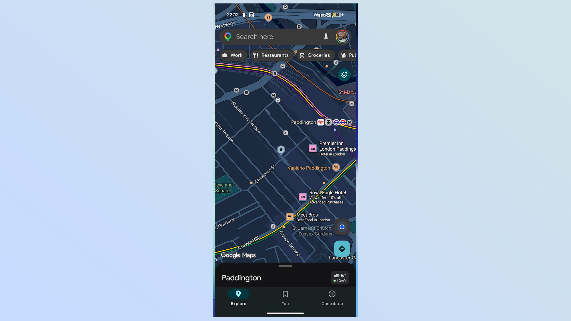
First up you need to open up the Google Maps app on your phone, and navigate to the area you want to see
2. Open layers and select Street View
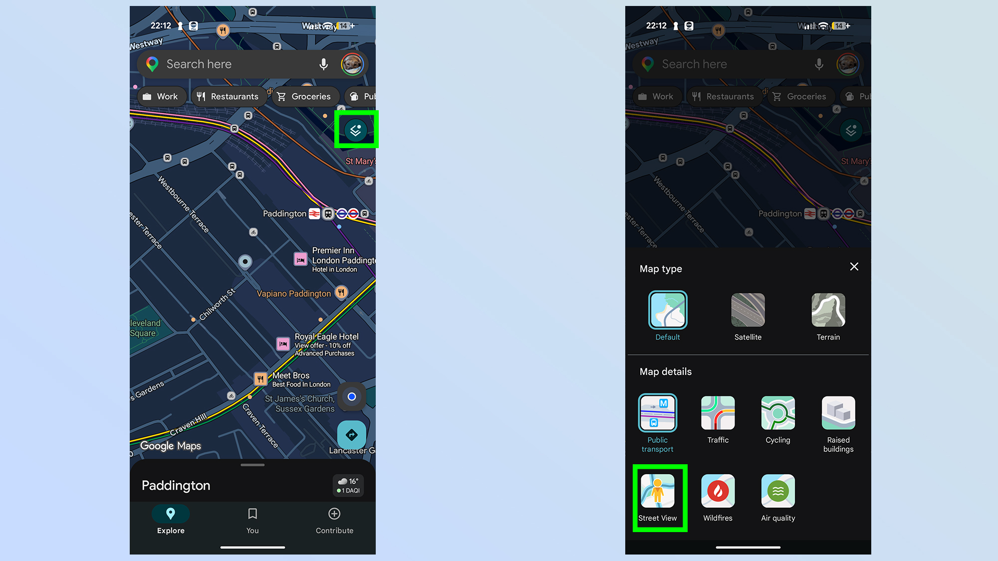
Next up you'll need to open the layers menu, which is the odd-looking double-square in the right-hand corner. Then select the Street View option on the bottom left.
3. Tap the street you want to see in Street View
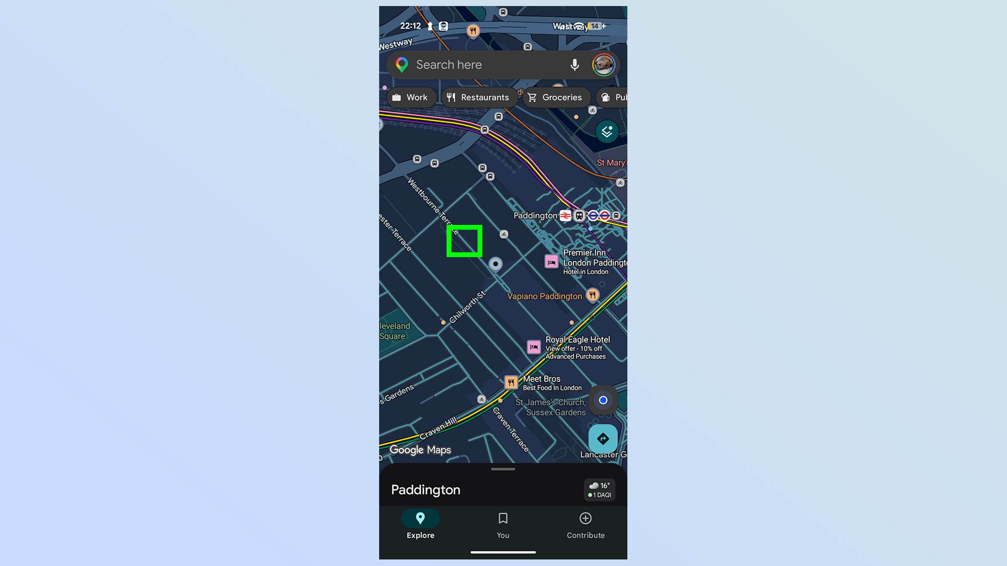
Street View layers the map with a lattice of blue lines, most of which follow the roadways. These are areas that have been covered by Street View cars. If the street is gray, then it's never been covered by Google Maps' drivers.
Tap the spot you want to see from street level to continue.
4. Pick your period of history
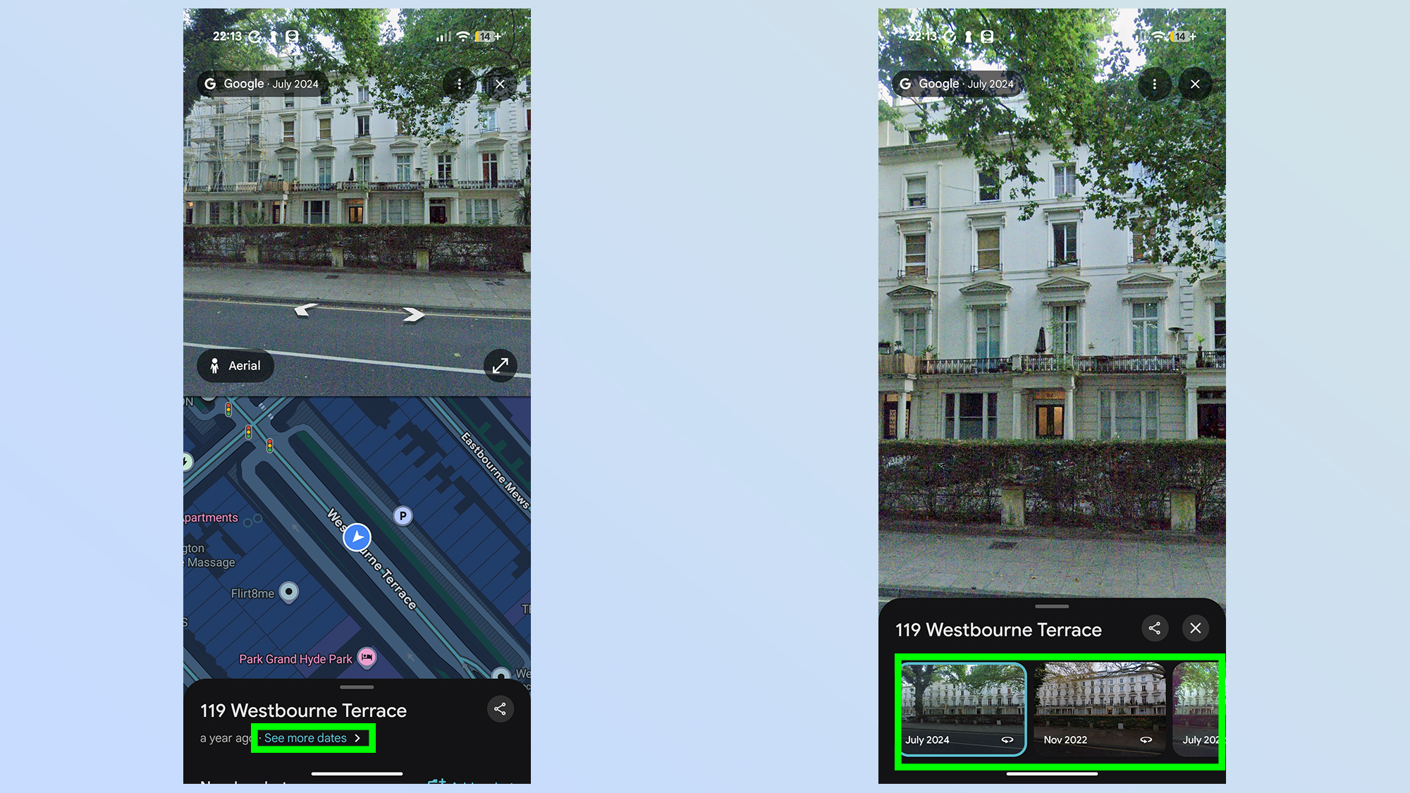
At the bottom of the screen you'll see a menu with a blue link that says See more dates. Tap this, and Google Maps will show a bunch of different months and years that the Street View gallery was updated.
You can pull up this menu to expand it if you prefer, but otherwise you simply need to scroll through the gallery from left to right and pick the month you want to see.
5.
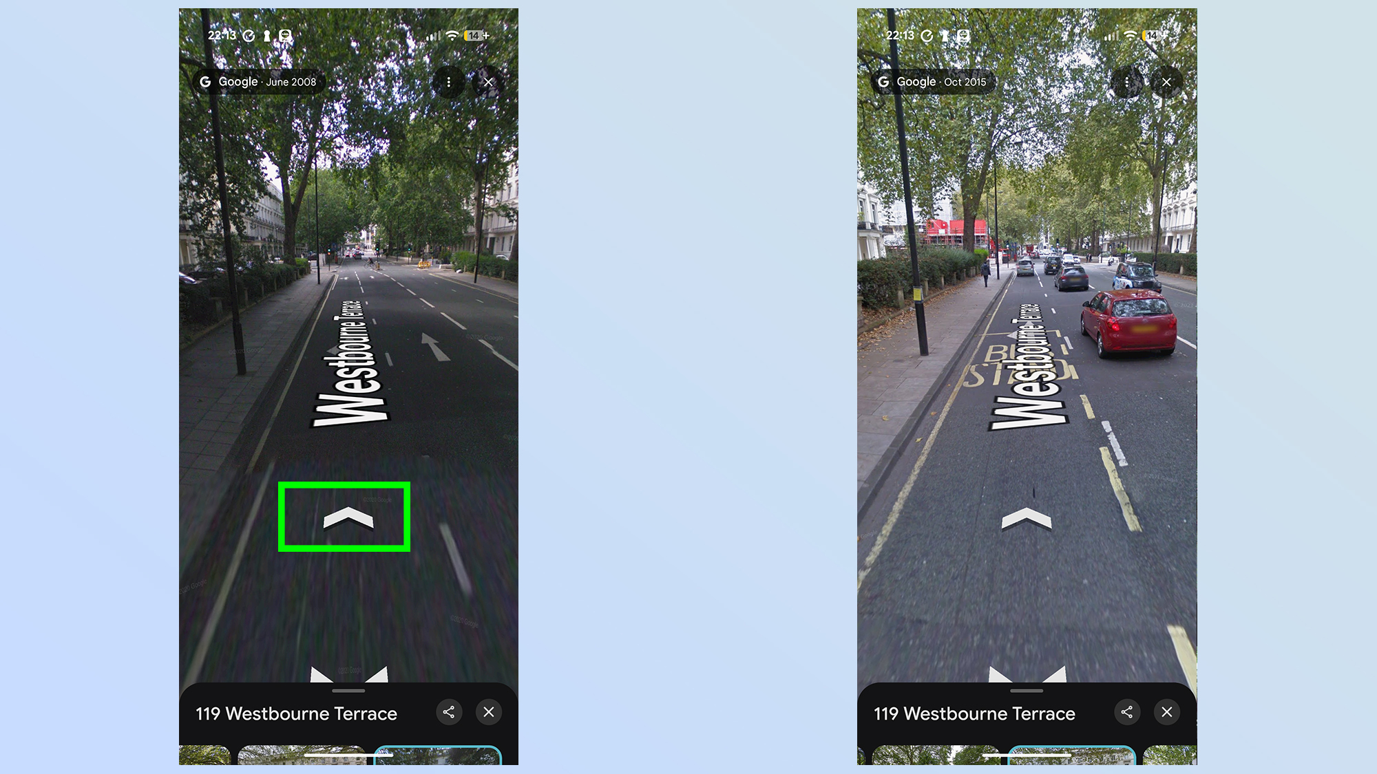
The best part about Time Travel on Google Maps is that you can navigate just as freely as you can with the current iteration of street view. Tap on the virtual world to move around or, alternatively, use the on-screen arrows instead.
Just be aware that if you end up in a spot that doesn't have the right historical Street View photos, you'll be pushed forward in time to the next available year. This could be a small jump of just a few months, but depending on the location it could be several years. So make sure to keep an eye on the Street View gallery at the bottom to keep track of the year you're visiting.
There you have it, that's how you time travel in Google Maps, and see different parts of the world throughout history. Or throughout the period that Street View has been active, at the very least. In this case, we can see that the Central London street that houses Future Publishing's London office (Westbourne Terrace) hasn't actually changed all that much over the past 18 years, but other locations may see much more impressive transformations. Which is the biggest benefit of using time travel in the first place.