
Get all your news in one place.
100's of premium titles.
One app.
Start reading
The Independent UK
The Independent UK
National
Joseph Rachman

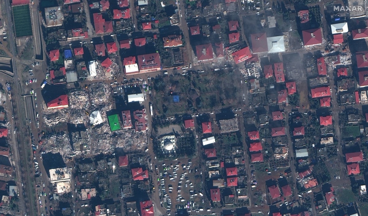
Satellite images show shocking destruction caused by Turkey earthquakes

Satellite image ©2023 Maxar Technologies.

Satellite images of three Turkish towns reveal the extent of the devastation caused by the worst earthquakes to hit the country in decades.

The region was hit by two major quakes measuring 7.8 and 7.5 on the Richter scale at 4.17 am and 1.24pm local time on 6 February.

Sign up to read this article
Read news from 100's of titles, curated specifically for you.
Already a member? Sign in here
Related Stories
Top stories on inkl right now
One subscription that gives you access to news from hundreds of sites
Already a member? Sign in here
Our Picks
Fourteen days free
Download the app
One app. One membership.
100+ trusted global sources.