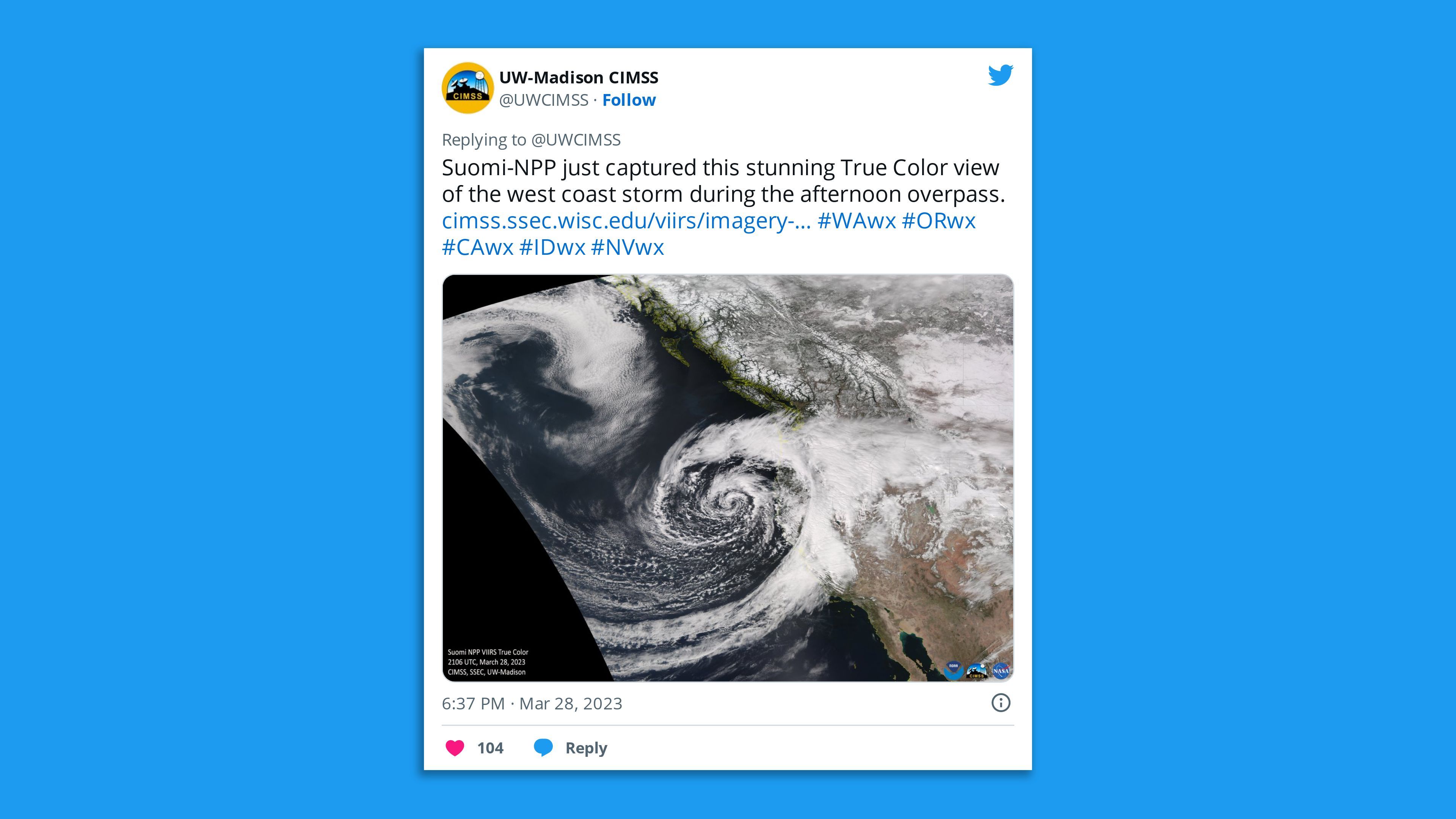
The second bomb cyclone to hit California in a week is buffeting the state after two rapidly intensifying storms combined off the West Coast on Monday.
Threat level: This "dynamic" storm combo that's set to continue through Wednesday includes a low pressure area rotating south from the Gulf of Alaska and subtropical moisture moving east.
- Unlike last week's damaging and deadly storm, this one is reaching its peak intensity over the ocean, rather than making landfall in the Bay Area. The low will gradually weaken as it slides south through midweek.
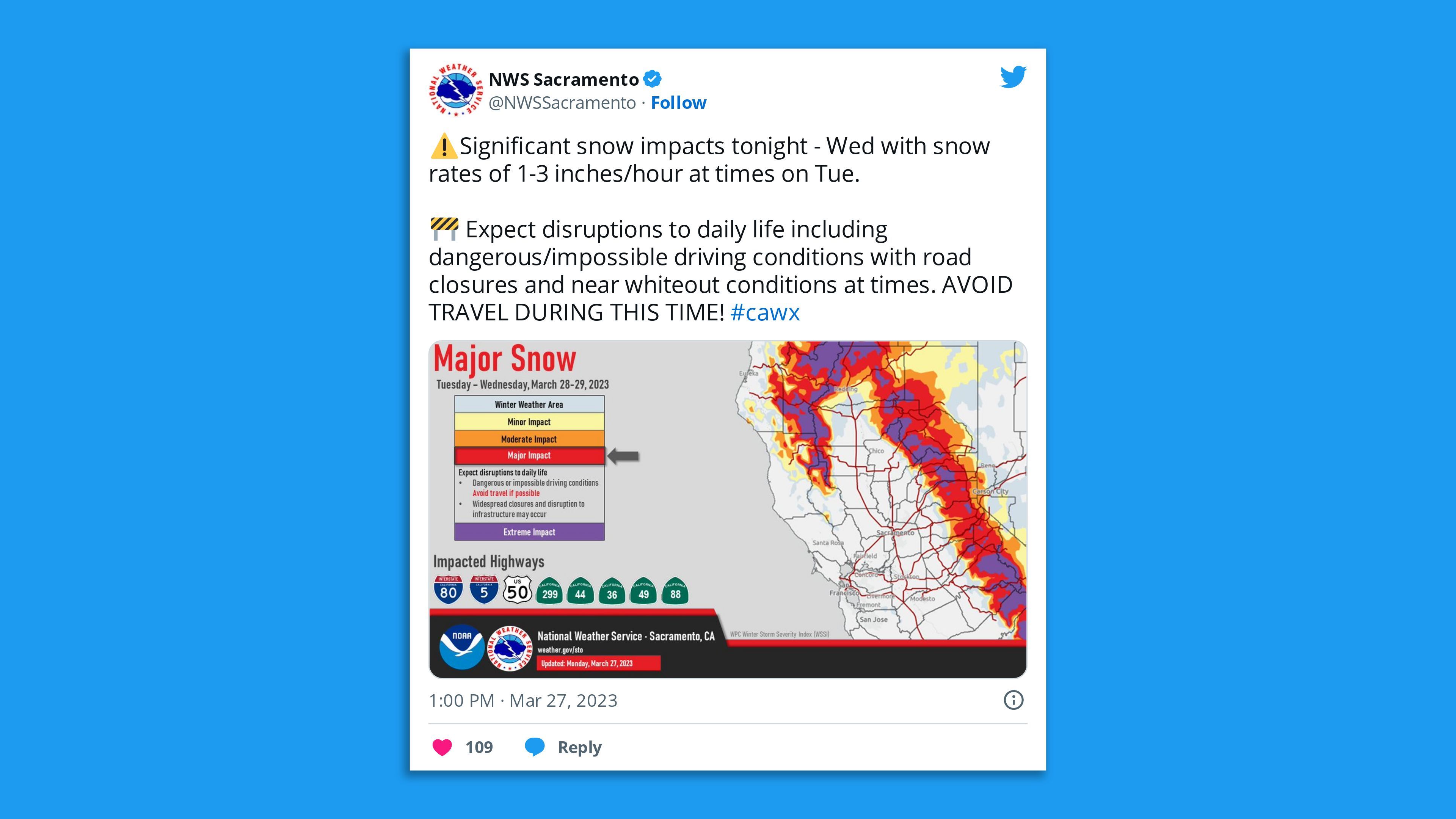
State of play: Winter storm warnings were in effect in the mountains as the latest bomb cyclone associated with an atmospheric river is bringing additional rounds of heavy rain, mountain snow of 1 to 5 feet, and high winds to California from Tuesday morning through Wednesday — particularly in Northern and Central California.
- Officials in Placer County, which includes the Greater Sacramento metropolitan area, reported Tuesday that "heavy winds have brought down trees and power lines throughout the county and caused multiple power outages."
- The National Weather Service's Bay Area office, located in a region that got slammed in last week's deadly storm, began issuing flood advisories as rain moved in Tuesday morning.
- Wind gusts of up to 55 mph were possible in the San Francisco Bay Area, and officials warned it's likely to bring more tree damage and power outages.

- "Very heavy snow is forecast for higher elevations of the northern coastal ranges and Sierra through Tuesday," per the NWS, with the possibility of 1 to 3 inches of snowfall per hour.
- The weather service's Sacramento office noted Monday evening that precipitation was spreading inland and "will continue through Wednesday," with the heaviest rain and snow amount expected overnight through Tuesday.
Meanwhile, Southern California was not projected to have rain until Wednesday.
- "This upcoming storm is looking to be generally weaker than past storms of this winter, except for a slight chance of thunderstorms late Wednesday-Thursday," per the NWS' Los Angeles office.
- About 4-8 inches of snow are expected at elevations above 5,000 feet, and about 8-14 inches are forecast for the San Gabriel Mountains.
By the numbers: More than 22,000 customers in the state were without power on Tuesday night, mostly in Monterey County, according to poweroutage.us.
What we're watching: With a record snowpack already in the central and southern Sierras, the state is headed for an all-time record on April 1, the typical seasonal peak.

Go deeper: California's looming snowmelt to resurrect lost Tulare Lake
Editor's note: This article has been updated with additional details throughout.


