Get all your news in one place.
100's of premium titles.
One app.
Start reading
Space
Space
Science
Kenna Hughes-Castleberry

NASA satellite watches January's polar vortex | Space photo of the day for Feb. 4, 2026

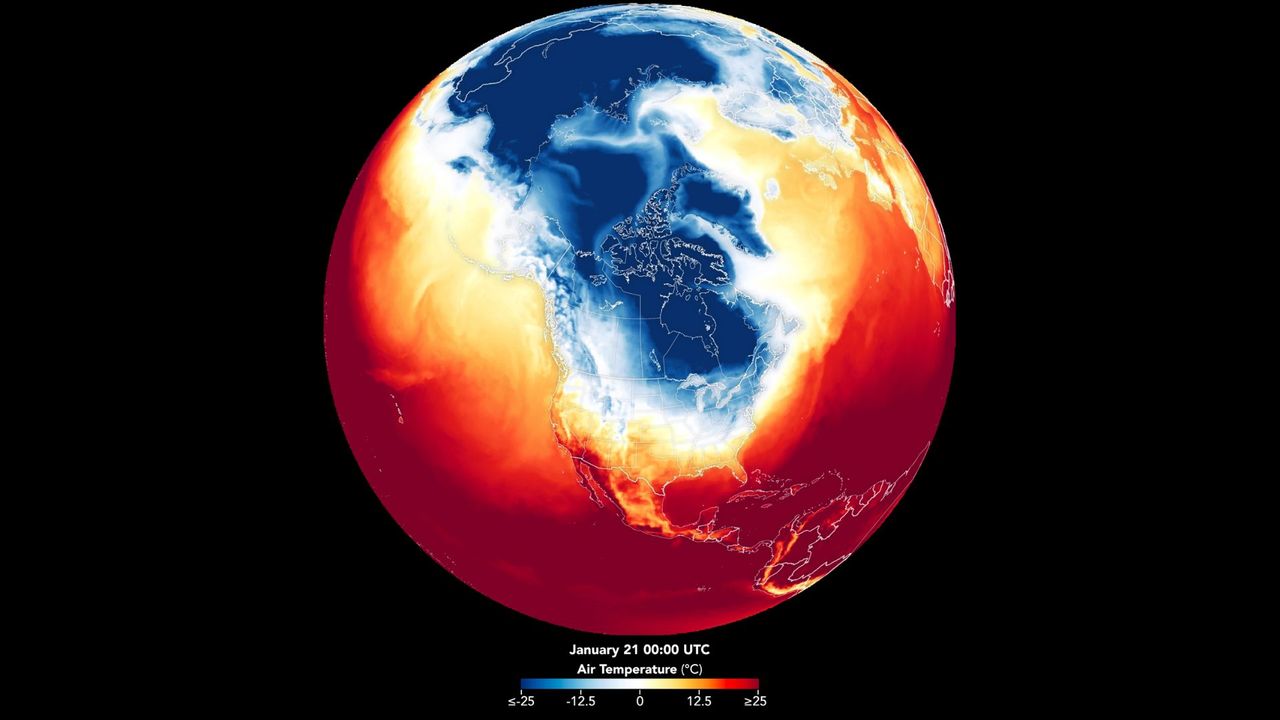
A heat map of the Earth's northern hemisphere, with a dark blue shape over the US showing a severe winter storm.

After a major winter storm swept across the country in late January, a prolonged surge of Arctic air tightened its grip on large areas of the U.S. pushing temperatures well below normal. From the Midwest to the South, the impacts of snow and ice became more extreme.

Even after the storm dispersed across the continent, the frigid chill remained. To understand the larger effects that winter storms like this one has, NASA used its Earth Observatory satellite observations, combined with temperatures calculated by the Goddard Earth Observing System (GEOS) global model, to map out the temperatures from the polar vortex.

Sign up to read this article
Read news from 100's of titles, curated specifically for you.
Already a member? Sign in here
Related Stories
Top stories on inkl right now
One subscription that gives you access to news from hundreds of sites
Already a member? Sign in here
Our Picks
Fourteen days free
Download the app
One app. One membership.
100+ trusted global sources.