Get all your news in one place.
100's of premium titles.
One app.
Start reading
Space
Space
Science
Samantha Mathewson

Japanese earthquake on Jan. 1 shifted coastline over 800 feet, satellite photos show

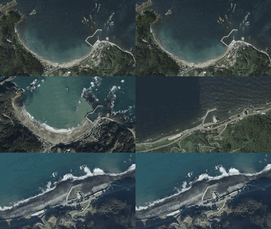
Four images showing a coastline moving after an earthquake.

Satellite images captured striking changes in the coastline of Japan's Noto Peninsula following a massive earthquake on New Year's Day. 

A 7.6 magnitude earthquake struck Japan on Jan. 1 around 2:10 a.m. EST (0710 GMT, or 4:10 p.m. local time in Japan), prompting orders for residents to evacuate affected coastal areas that experienced significant uplift. Satellite imagery of the area before and after the quake shows that the intense uplift extended the coastline by up to 820 feet (250 meters), which is greater than the length of two American football fields.

Sign up to read this article
Read news from 100's of titles, curated specifically for you.
Already a member? Sign in here
Related Stories
Top stories on inkl right now
One subscription that gives you access to news from hundreds of sites
Already a member? Sign in here
Our Picks
Fourteen days free
Download the app
One app. One membership.
100+ trusted global sources.