Most bridges try to stay above water. This one does something else. Midway across the Pearl River, the road dips down into a tunnel under the seabed and comes up again on the other side. According to a paper by engineers Ming Lin and Wei Lin, published in the journal Engineering, the tunnel section was one of the most technically demanding parts of the entire project. If you’ve ever wondered how a road can disappear into the sea, this bridge is a good place to start.
A bridge that disappears into the sea

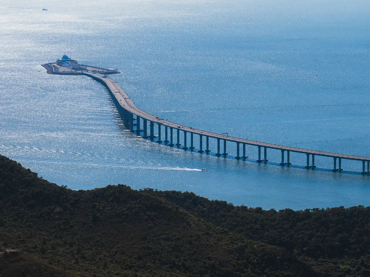
The Hong Kong-Zhuhai-Macao Bridge, or HZMB, opened to traffic in October 2018. It connects three cities in the Pearl River Delta with an unbroken road. The full crossing is some 55 kilometers long and links Hong Kong, Zhuhai and Macao by road for the first time. The majority of the distance is an overpass. But about halfway, cars leave the bridge deck and go into a 6.7-kilometer tunnel that goes under the seabed. For this project, two artificial islands were built. They mark the transition points where the road descends into the tunnel and reappears on the bridge on the other side. NASA’s Earth Observatory compared the completed crossing to 15 Golden Gate Bridges lined up end to end, giving an idea of just how massive this project really is.
Why engineers decided to go underwater
This wasn't a design choice for aesthetic reasons. The Pearl River Delta is one of the busiest shipping areas in the world, and a tall bridge across the entire channel would have blocked large vessels. It is also near the airport in Hong Kong. A study in Tunneling and Underground Space Technology explained that this stretch had to be kept clear of the flight paths of planes landing at or taking off from Hong Kong International Airport, which ruled out a taller bridge over that section. Going under water solved both problems at once. The same study also notes that the Pearl River Estuary is considered a sensitive environmental area, and regulators imposed tight restrictions on the amount of disturbance the tunnel could cause to the natural water flow of the estuary.