
Get all your news in one place.
100's of premium titles.
One app.
Start reading
Motor1
Motor1
Business
Dan Mihalascu

How Does Google Maps Know There's Traffic When You Can't See It?

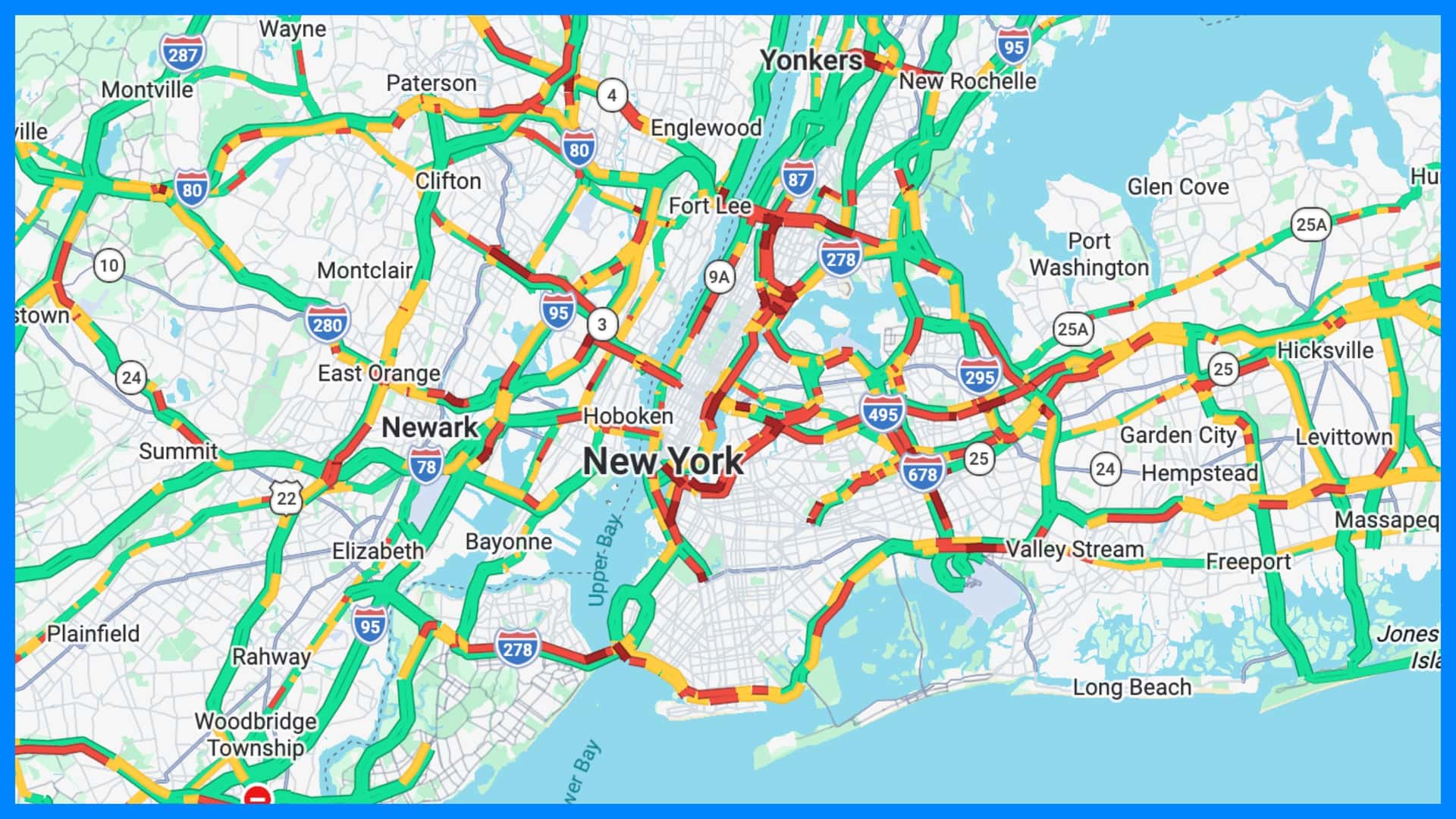
You turn onto the highway, glance at your navigation screen, and there it is: a stretch of road ahead has suddenly turned red. Maybe there's a 20-minute delay, too. But how does your car—or your phone—know there's a traffic jam when you haven't even reached it yet?

The answer is surprisingly simple: your navigation system is learning from other vehicles.

Modern navigation services collect enormous amounts of anonymous location and speed data from connected devices. By combining that live information with historical traffic patterns, reported incidents, road information, and increasingly sophisticated algorithms, they can build a remarkably detailed picture of what's happening on the road in real time.

Your Car Is Not Watching Traffic With A Camera

Your navigation system doesn't need to see a line of stopped cars to know that traffic is moving slowly. Instead, connected vehicles and smartphones can act as moving traffic sensors.

When navigation devices or apps provide location and speed information, the service can determine how quickly vehicles are traveling along particular sections of road. This is often referred to as Floating Car Data (FCD). TomTom, for example, says its traffic services use anonymized data from navigation devices, in-car systems, apps, smartphones, and other connected sources.

Google similarly says aggregate location data from people using Google Maps can be used to understand traffic conditions on roads around the world. In other words, a traffic jam doesn't necessarily need someone to report it manually. If enough connected devices suddenly slow down on the same stretch of road, the system can recognize that something has changed.

That's why a navigation app can sometimes warn you about congestion before you can see it yourself.

How Does It Know When Traffic Is Unusually Slow?

Knowing a car is moving slowly is not enough. A vehicle traveling at 20 mph might be perfectly normal on one road and a major traffic problem on another.

Navigation systems therefore compare current conditions with what would normally be expected on that particular road. Waze, for example, says it generates traffic-jam information using users' GPS locations and speeds, comparing current average speeds with free-flow speeds. It also compares conditions with historical traffic patterns for the relevant time period.

Historical information is important because traffic behaves differently at 8 a.m. on a weekday than it does at 2 p.m. on a Sunday. Navigation providers can use years of accumulated driving data to establish typical speeds and travel times for particular roads and times of day.

TomTom says its traffic-prediction system combines floating-car data with historical traffic information, including traffic flow, average speeds, travel times, and incident information. Its systems can then use statistical methods, simulations, and machine learning to predict how congestion may develop.

What About Accidents, Roadworks And Other Problems?

Speed data can reveal that something is wrong, but it doesn't necessarily explain why. That's where other sources of information come in.

Navigation services can incorporate road closures, construction, accidents, lane closures, hazards, and other incident reports. Some of this information can come from road authorities and other trusted sources, while some can come directly from drivers using navigation apps. Depending on the service, the information feeding into the traffic picture can include:

  • Vehicle speeds and locations: Connected cars and smartphones can show how quickly traffic is moving.
  • Driver reports: Users can report crashes, hazards, stopped vehicles, construction, and other problems.
  • Road-authority information: Official sources can provide information about closures, roadworks, and other restrictions.
  • Historical traffic data: Past driving patterns help establish what is normal for a particular road and time.
  • Weather and events: Conditions such as severe weather, holidays, and major local events can affect expected traffic patterns.

Waze is a particularly clear example. Its traffic system combines automatically detected slowdowns with user-generated reports about things such as accidents, construction, potholes, stopped vehicles, and objects on the road. User reports can also be evaluated using reliability information and feedback from other users.

TomTom similarly says its traffic system combines floating-car data with incident information from authorities, trusted partners, and community input. It can also incorporate factors such as weather, holidays, and local events when generating traffic predictions.

That combination of sources helps explain why your navigation screen can sometimes tell you not only that traffic is bad, but also that an accident or road closure is responsible.

Why Does The ETA Keep Changing?

Your estimated arrival time is not simply calculated once when you enter a destination. As you drive, the navigation system can continue receiving updated information about traffic conditions. If vehicles ahead begin moving more slowly, the expected travel time can increase. If congestion starts clearing, the ETA can fall again.

The system can also reassess your route. If a highway that looked fast when you started your trip suddenly becomes congested, another road may become quicker, even if it is physically longer.

This is one reason navigation systems can feel almost uncannily aware of what's happening ahead. They're continually comparing your journey with information coming from many other vehicles and data sources.

There is an important limitation, though: these systems are not omniscient. Only a fraction of vehicles on a road may be connected and contributing data, and unusual events can be difficult to predict. A sudden crash, severe weather event, or other unexpected disruption can change traffic faster than any prediction system can react.

Drivers Have Been Trying To Figure It Out, Too

The question of how navigation apps know about traffic comes up regularly on Reddit. In a recent r/explainlikeimfive thread, users discussed how location, direction, and speed information from people on the road can reveal when traffic is slowing down. The basic idea is that a large number of devices moving slowly along the same road provides a useful picture of what's happening in real time.

An older r/explainlikeimfive discussion reached a similar conclusion, with commenters pointing to location data, average speeds, user reports, construction notices, and road closures as pieces of the puzzle. Another thread from the same subreddit noted that historical traffic data and mathematical models can help navigation services distinguish an ordinary slowdown from an unusual traffic jam.

Your Navigation System Has A Lot Of Help

The next time your navigation system warns you about traffic several miles ahead, it is not necessarily because your car has somehow spotted the problem. It's more like a giant digital traffic survey happening continuously in the background.

Connected vehicles provide speed and location information. Drivers report incidents. Road authorities provide closures and construction information. Historical data establishes what traffic normally looks like. Algorithms then combine those pieces to estimate what's happening now and what might happen next.

And with millions of connected devices contributing information, a traffic jam can effectively announce itself long before you reach the back of the queue.

Sign up to read this article
Read news from 100's of titles, curated specifically for you.
Already a member? Sign in here
Related Stories
Top stories on inkl right now
One subscription that gives you access to news from hundreds of sites
Already a member? Sign in here
Our Picks
Fourteen days free
Download the app
One app. One membership.
100+ trusted global sources.