After a rare three-year La Niña event brought heavy rain and flooding to eastern Australia in 2020-22, we’re now bracing for the heat and drought of El Niño at the opposite end of the spectrum.
But while the World Meteorological Organisation has declared an El Niño event is underway, Australia’s Bureau of Meteorology is yet to make a similar declaration. Instead, the Bureau remains on “El Niño alert”.
The reason for this discrepancy is what’s called the Pacific Walker Circulation. The pattern and strength of air flows over the Pacific Ocean, combined with sea surface temperatures, determines whether Australia experiences El Niño or La Niña events.
In our new research, published today in the journal Nature, we asked whether the buildup of greenhouse gases in the atmosphere had affected the Walker Circulation. We found the overall strength hasn’t changed yet, but instead, the year-to-year behaviour is different.
Switching between El Niño and La Niña conditions has slowed over the industrial era. That means in the future we could see more of these multi-year La Niña or El Niño type events. So we need to prepare for greater risks of floods, drought and fire.
An ocean-atmosphere climate system
La Niña and its counterpart El Niño are the two extremes of the El Niño Southern Oscillation — a coupled ocean-atmosphere system that plays a major role in global climate variability.
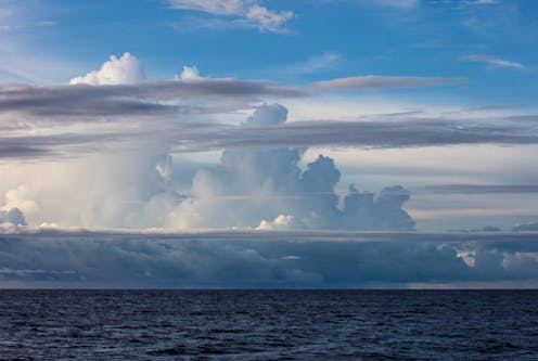
The Walker Circulation is the atmospheric part. Air rises over the Indo-Pacific Warm Pool (a region of the ocean that stays warm year-round) and flows eastward high in the atmosphere. Then it sinks back to the surface over the eastern equatorial Pacific and flows back to the west along the surface, forming the Pacific trade winds. In short, it loops in an east-west direction across the equatorial Pacific Ocean.
Read more: Curious Kids: where does wind actually come from?
But the Walker Circulation doesn’t always flow with the same intensity — sometimes it is stronger, and sometimes it is weaker.
Periods of stronger or weaker Walker Circulation have major impacts on Australian climate. A stronger Walker Circulation means stronger-than-average trade winds, and generally La Niña-like ocean conditions. This often brings wetter weather to eastern Australia.
On the flip side, a weaker Walker Circulation brings weaker-than-average trade winds, and El Niño-like ocean conditions. A weak Walker Circulation is often associated with drier weather across northern and eastern Australia.
So far, the Walker Circulation is what’s missing from the current El Niño event developing in the Pacific Ocean: it has not weakened enough for the Bureau to declare an El Niño event.
What’s happening to the Walker Circulation?
The Walker Circulation is a major influence on weather and climate in many places around the world, not just Australia.
A stronger-than-usual Walker Circulation even contributed to the “global warming slowdown” of the early 2000s. This is because a stronger Walker Circulation is often associated with slightly cooler global temperature.
So we need to know how it is going to behave in the future. To do that, we first need to know if — and if so, how — the Walker Circulation’s behaviour has changed due to human activities. And to do that, we need information about how the Walker Circulation behaved before humans started affecting the climate system.
We reconstructed Walker Circulation variability over the past millennium. We used global data from ice cores, trees, lakes, corals and caves to build a picture of how the Walker Circulation changed over time.
We found that on average, there has not yet been any industrial-era change in the strength of the Walker Circulation. This was surprising, because computer simulations of Earth’s climate generally suggest global warming will ultimately cause a weaker, or more El Niño-like, Walker Circulation.
There are a few possible reasons for this. One is that a buildup of fine particles in the air, such as smoke or industrial pollution, may be driving a stronger Walker Circulation, hence “cancelling out” the weakening effect of global warming.
Another is there may have been some weakening, but so far it is too small to be detectable among the Walker Circulation’s large year-to-year variability.
Read more: Smoke from the Black Summer fires could have made the triple La Niña more likely
Our research also does not rule out the possibility that with future increases in global temperature, the Walker Circulation will indeed weaken, in a trend to more El Niño-like conditions. In that scenario, Australians might expect decreased rainfall in the north and east, as well as warmer temperatures across the continent, and less snow in the Australian Alps.
Even though the average strength of the Walker Circulation has not changed in the industrial era, there has been a subtle change in the length of time taken for the Walker Circulation to switch from one state to the next.
The Walker Circulation now switches more slowly between weak and strong phases, and we suspect this is influenced by climate change. This has potentially important implications for climate extremes, as El Niño and La Niña conditions could hang around for longer.
Our research also found that major explosive volcanic eruptions — at least as big as the 1982 eruption of El Chichón — can trigger an El Niño-like weakening of the Walker Circulation one to three years after the eruption. Unfortunately, volcanic eruptions remain extremely difficult to predict, so this doesn’t help our long-term climate predictions.
What is the message for Australians?
In terms of predicting how the Walker Circulation will change in the future, we can now focus attention on the particular climate models whose outputs most closely match what we discovered from our reconstruction.
That is, models that show no industrial-era weakening trend. This approach might help us get more accurate predictions of future Walker Circulation change.
The other thing we can do is to be prepared for more consecutive-year El Niño and La Niña events, and the sustained wet or dry spells they could bring to Australia.
And if there is a major volcanic eruption? Be prepared for a couple of years of weak Walker Circulation, and the warm, dry weather that can bring.
Read more: New study helps solve a 30-year-old puzzle: how is climate change affecting El Niño and La Niña?
Georgina Falster receives funding from the Australian Research Council Centre of Excellence for Climate Extremes. This research was funded by the US National Science Foundation.
This article was originally published on The Conversation. Read the original article.
