Get all your news in one place.
100's of premium titles.
One app.
Start reading
The Conversation
The Conversation
Jack Swab, Assistant Professor Department of Geography & Sustainability, University of Tennessee

From flammable neighborhoods to moral hazards, fire insurance maps capture early US cities and the landscape of discrimination

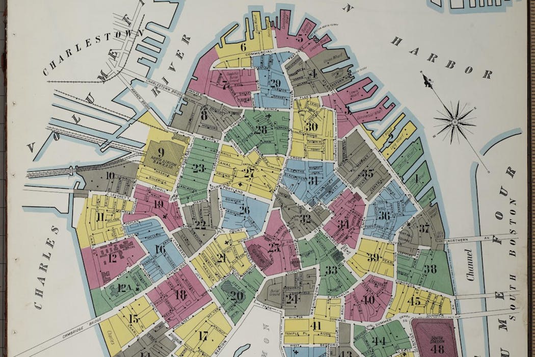
1909 Sanborn map of Suffolk County in Boston, Mass. Library of Congress

Imagine a map that allows you to see what your neighborhood looked like a century ago in immense detail. What you’re thinking of is probably very much like the fire insurance maps produced from the 1860s to the 1970s for insurance companies to identify potential fire risks.

Often referred to as Sanborn maps, after the Sanborn Map Co. that produced them, fire insurance maps were created for every city in the United States with a population greater than 1,000 people. Over a century, more than 50,000 editions of these maps were produced, comprising over 700,000 map sheets – many of which have been scanned and are publicly accessible through the Library of Congress.

Sign up to read this article
Read news from 100's of titles, curated specifically for you.
Already a member? Sign in here
Related Stories
Top stories on inkl right now
One subscription that gives you access to news from hundreds of sites
Already a member? Sign in here
Our Picks
Fourteen days free
Download the app
One app. One membership.
100+ trusted global sources.