QUICK FACTS
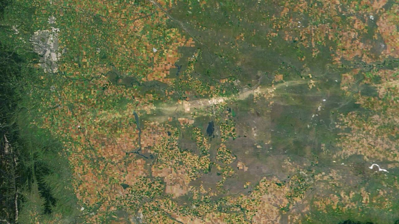
Where is it? Brooks, southern Alberta, Canada [50.586757475, -112.12895463]
What's in the photo? A 125-mile-long "scar" left behind by a destructive hail storm
Which satellite took the photo? NASA's Aqua satellite
When was it taken? Aug. 24, 2025
This striking satellite image highlights the aftermath of a major hailstorm in Alberta, Canada, which carved a giant "scar" in the landscape, around half as long as the Grand Canyon. The extreme event, which pelted the ground with golf ball-size ice chunks, killed at least two animals.