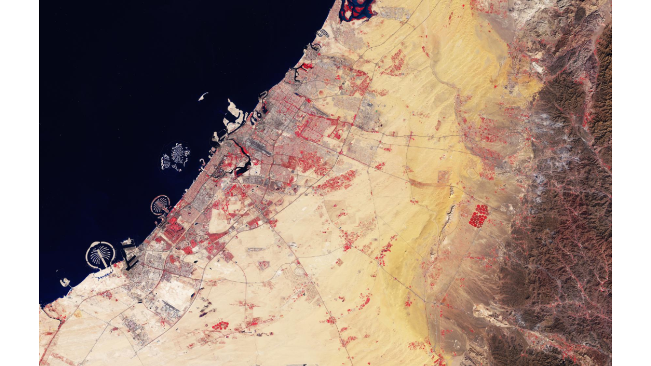
From the ground, Dubai's Palm Jumeirah is an impressive luxury destination lined with hotels, villas and beaches. But from hundreds of kilometres above Earth, it reveals its true scale. The palm tree-shaped artificial island, built entirely through land reclamation, is one of the few human-made structures that is instantly recognisable in satellite images and photographs taken from the International Space Station. More than two decades after construction began, Palm Jumeirah continues to fascinate scientists, astronauts and engineers alike. Modern satellites from the European Space Agency (ESA) regularly capture the island alongside Dubai's ever-expanding coastline, highlighting how human engineering has permanently reshaped part of the Persian Gulf.
Get breaking news anytime, anywhere. Download the TOI app now!

Why Dubai's Palm Jumeirah remains one of the world's most recognisable engineering marvels from orbit
The Palm Jumeirah was conceived in the early 2000s as an ambitious land reclamation project to expand Dubai's coastline. Instead of a conventional island, engineers designed it to resemble a date palm, a tree deeply rooted in Middle Eastern culture.
The island consists of a central trunk connected to 17 palm fronds, all surrounded by an 11-kilometre crescent-shaped breakwater that protects it from waves and coastal erosion. This distinctive geometry makes the island stand out clearly in satellite imagery.
According to the European Space Agency (ESA) , the relatively shallow waters of the Persian Gulf and the broad continental shelf made the enormous construction project possible. Around 100 million cubic metres of rock and sand were used to create the Palm Islands, adding approximately 120 kilometres of new coastline to Dubai.