Get all your news in one place.
100's of premium titles.
One app.
Start reading
The Conversation
The Conversation
Jacob L. Bongers, Tom Austen Brown Postdoctoral Research Associate, University of Sydney

A centuries-old grid of holes in the Andes may have been a ‘spreadsheet’ for accounting and exchange

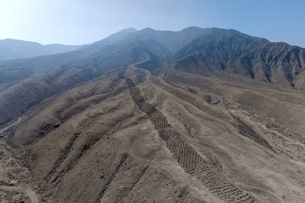
An aerial photo of Monte Sierpe, facing northeast. Jacob L Bongers

In 1931, geologist Robert Shippee and US Navy Lieutenant George R. Johnson led one of the first aerial photography expeditions in South America. They captured stunning photographs of landscapes across the Andes, including some peculiar “pockmarks” in the Pisco Valley of southern Peru.

These “pockmarks” make up the mysterious archaeological site of Monte Sierpe. Stretching 1.5 kilometres and consisting of approximately 5,200 precisely aligned holes, Monte Sierpe translates as “serpent mountain” in Spanish, but the site is also known as the Band of Holes.
Sign up to read this article
Read news from 100's of titles, curated specifically for you.
Already a member? Sign in here
Related Stories
Top stories on inkl right now
One subscription that gives you access to news from hundreds of sites
Already a member? Sign in here
Our Picks
Fourteen days free
Download the app
One app. One membership.
100+ trusted global sources.