
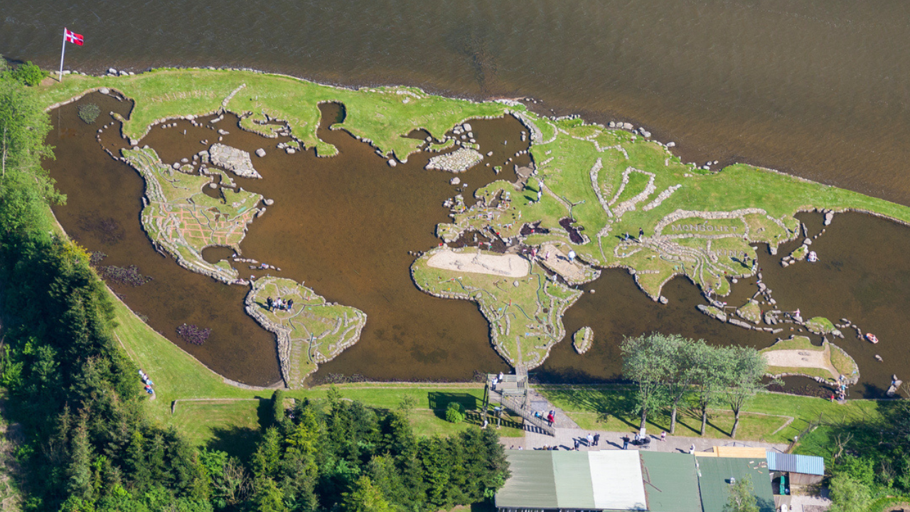
Long before satellite imagery and digital maps became common, a Danish farmer carved out one of the world’s most unusual geographical attractions entirely by hand inside a lake. Inspired by a stone near Klejtrup Lake that resembled Denmark’s Jutland Peninsula, farmer Soren Poulsen spent roughly 25 years transforming the waterbody into a giant miniature world map using rocks, soil, grass, and clay. At the World Map at Klejtrup Lake in Denmark, visitors can walk around scaled-down continents separated by water representing the oceans. Today, the handmade landmark remains one of Denmark’s most fascinating hidden attractions and continues to draw thousands of visitors every year.
How one rock inspired an entire world map