Temperatures are set to plunge this week, the Met Office has said, after a balmy Bank Holiday weekend and Friday’s 25C scorcher.
A cold Arctic blast will force wind to switch to a northerly direction on Tuesday and Wednesday, the forecaster said, as the early morning mercury is expected to drop to as cold as -5C in the rural north.
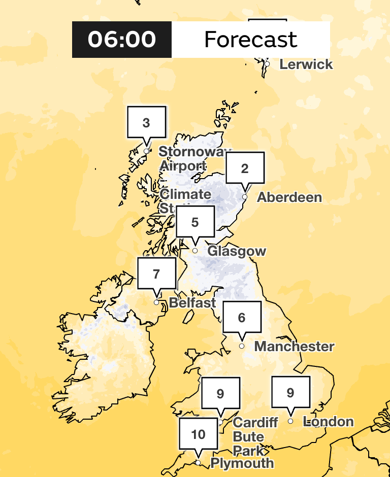
The coldest day of the week will be Wednesday, with temperatures dropping some 5 degrees lower than the average for May.
Tom Morgan, Met Office forecaster, said: “As the isobars space apart, the winds will ease down and that’s a recipe for not only one or two fog patches, but also a much colder night.
“So in the countryside we can see a fairly widespread frost to begin the day on Wednesday. In more northern parts of the UK, -4C or -5C is possible in some prone rural spots, so gardeners and growers, take note of that, we may have some damaging frost.”
The colder interlude in the middle of the week will inch into milder weather towards the end of the week.
On Thursday, temperatures will peak up slightly to 14C or 15C in the south, but no more than 9C or 10C in northern Scotland.
It will be also be windier day for northwestern parts of Scotland on Thursday, cloudier with outbreaks of showers. But for England and Wales, a drier day is expected.
Some hope remains for the end of the week as “strong May sunshine” will brighten up Friday morning, and the mercury will rise up to 16C or 18C.
By Friday afternoon, however, “anywhere in the UK could see some showers,” the forecaster said.
Met Office forecast
Today:
Dry for most places today with variable amounts of cloud and sunny spells. Showery outbreaks of rain in places, mainly in the north. Turning cold in the north
Tonight:
Cloud and patchy rain moving south tonight. but many places staying dry. Blustery showers in Scotland, turning wintry in the Northern Isles.
Wednesday:
Most places dry with patchy cloud and sunny spells. A few showers breaking out across Northern Ireland, Wales and southwest England. Temperatures below average for the time of year.
Outlook for Thursday to Saturday:
Largely dry at first with some sunny spells and fairly cool. Increasing chance of showers on Friday and rain possible in the south on Saturday. Turning warmer.