QUICK FACTS
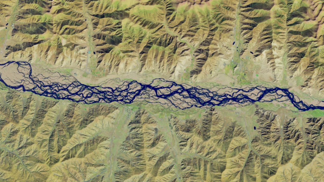
Where is it? Yarlung Zangbo River, Tibet Autonomous Region of China [29.2814054, 91.3256581]
What's in the photo? The braided branches of a river winding through the Tibetan Plateau
Which satellite took the photo? Landsat 9
When was it taken? Feb. 8, 2025
This striking satellite photo shows a particularly convoluted section of a record-breaking "braided river" in China, which drastically changes shape every year and could become more unstable over the coming decades due to climate change.