Get all your news in one place.
100's of premium titles.
One app.
Start reading
Space
Space
Science
Tereza Pultarova

Satellites watch wildfires rage across Canadian northwest (photos)

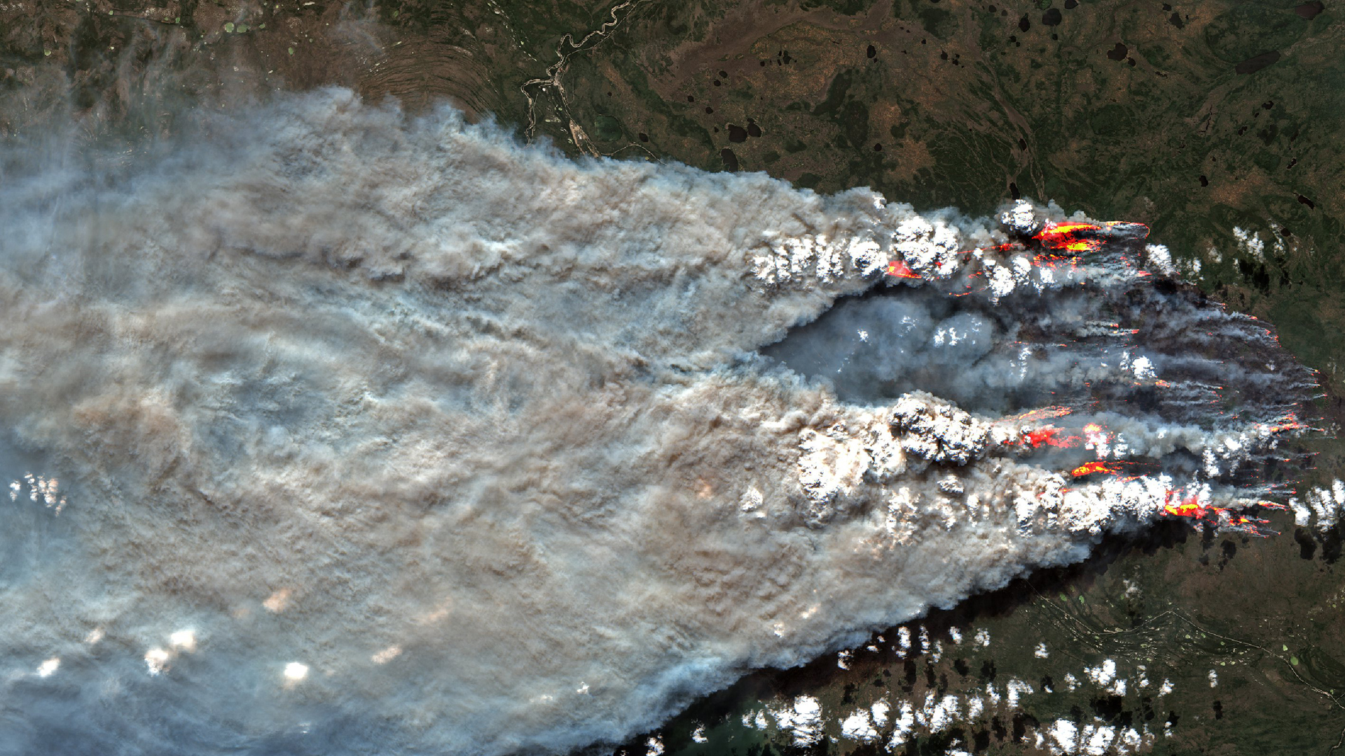
A huge plume of smoke spreading from several wildfires in Canada's Northwest Territories seen in an image taken by the European satellite Sentinel-2

Satellite images reveal the scope of devastating wildfires in the Canadian northwest where an entire capital city had to be evacuated due to approaching flames. 

Earlier this week, the European Earth-observing satellite Sentinel-2 observed several blazes raging in Canada's Northwest Territories, spreading thick plumes of smoke across an area wider than 60 miles (100 kilometers). The images were taken just days before authorities ordered the Territories' capital of Yellowknife, a town of 20,000, to be completely evacuated due to the encroaching flames. According to the Guardian, 236 wildfires are currently active across the Territories.

Sign up to read this article
Read news from 100's of titles, curated specifically for you.
Already a member? Sign in here
Related Stories
Top stories on inkl right now
One subscription that gives you access to news from hundreds of sites
Already a member? Sign in here
Our Picks
Fourteen days free
Download the app
One app. One membership.
100+ trusted global sources.