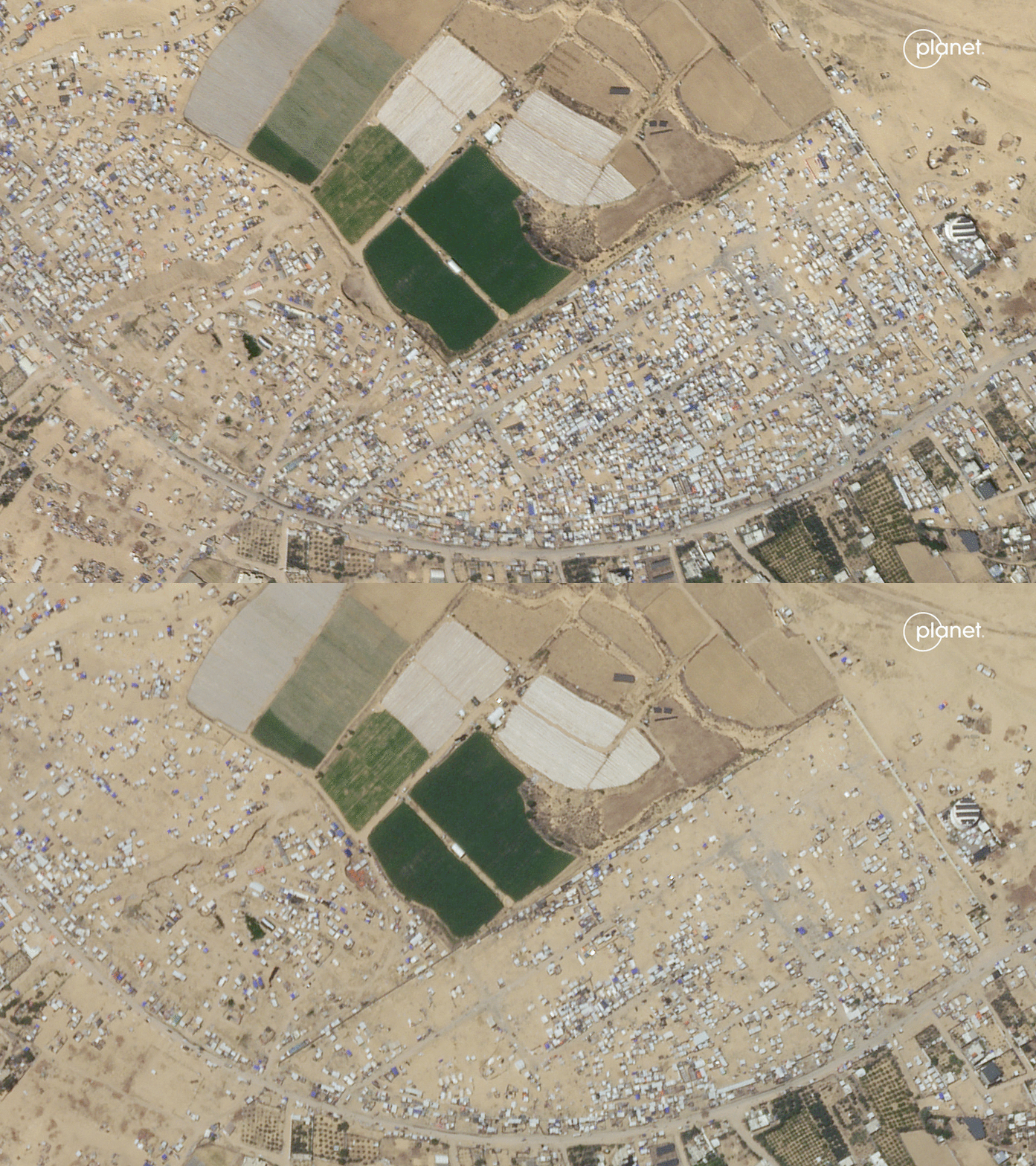
Satellite images taken earlier this month offer a spaceborne perspective of the ongoing Israel-Hamas war. They include scenes such as a before-and-after sequence that illustrates Palestinian civilians fleeing Rafah, a view of damaged buildings in the region and conglomerates of Israeli hardware.
For the past several months, Israeli Defense Forces (IDF) have destroyed major portions of areas in which Palestinian civilians live as a response to the Oct. 7 terrorist attack in Israel, an attack orchestrated by the radical militant group Hamas. As Reuters reported on May 14, Israel says Hamas killed more than 1,200 people, mostly civilians, and took 253 people to captivity in Gaza; the Palestinian Health Authorities say the IDF's military campaign since then has killed more than 35,000 people, also mostly civilians, and has driven 2.3 million people from their homes.