Ports are being cleared and additional emergency service workers flown in ahead of the first category four cyclone to hit Western Australia's north-west in a decade.
Tropical Cyclone Ilsa reached cyclone strength just before 3pm on Tuesday, after tracking along the Kimberley coast for several days as a tropical low.
Currently about 400km north of Broome, Ilsa is expected to make landfall along the coast between Port Hedland and Broome on Thursday or Friday.
The Bureau of Meteorology (BOM) expects the system to accelerate after that and pose a flooding risk to inland communities and mine sites, including the Telfer Gold Mine.
With heavy rain, gale force winds and potential flooding expected, BOM spokesman Todd Smith said locals should not take the potential for a cyclone lightly.
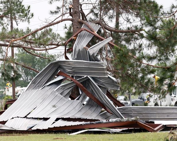
"Winds in excess of 200kph — they're going to cause a lot of damage to trees, vegetation and any buildings not up to code," he said.
"Cars, caravans, they're going to get blown around — coastal areas are not a good place to be in a cyclone as it's making landfall."
DFES Commissioner Darren Klemm said an additional six SES vehicles and drivers had been dispatched to Port Hedland and two helicopters had been flown into Karratha.
In Bidyadanga, the state's largest remote Aboriginal community and the closest community to the system's current track, enough food and fuel to last seven days has been shipped in.
Commissioner Klemm said it was likely Great Northern Highway would be closed in coming days, but DFES and Main Roads would balance that with the need to give people currently in the area time to leave.
In Port Hedland, the Pilbara Ports Authority will begin clearing vessels from the town's inner harbour – the state's largest export port – from 2am on Wednesday, at high tide.
Kimberley harbour master David Duncan said the Port of Broome would likely be closed from 6pm on Tuesday evening and would remain shut until midday Friday.
"Most of them are avoiding the port naturally until Friday, at the earliest, because of the likelihood of the 90-120kph winds," he said.
"We could get seas of up to four or five metres in Roebuck Bay."
Local shires and councils began warning residents to begin cyclone preparation, including tying down furniture and lopping trees, as early as last week.
Tourists in town
School holidays and the Easter long weekend brought hundreds of tourists to Broome, with flights expected to depart throughout Tuesday and Wednesday as normal.
"For caravans, now's the time to be changing your travel plans if you're heading up there," Commissioner Klemm said.
"If you're travelling in a caravan, leave the area prior to the warnings commencing.
"Flying into those areas is a decision the airlines will make."
Travellers are advised to remain in Broome or Karratha until the system has passed through the region.
Barn Hill Beachside Station Stay Caravan Park owner Janice Bell said they had already shut their gate to tourists as a safety precaution.
"We've lived here on the station for over 60 years, so we've been through plenty of cyclones, so we know exactly what we need," she said.
"You never know what a cyclone can do, but we are definitely well prepared."
Mr Klemm said it was critical that people were not complacent even if they had previous experiences with cyclones.
"This isn't just another cyclone that's going to impact the coast — people need to ensure they're well prepared," he said.
"It's going to be significant."
Region braces for impact
Anna Plains Station, about 150km south-west of Broome, sits close to the expected oath of the system
Owner David Stoate said he and his 12 staff were tidying up around the homestead and securing loose items before the wild weather began in earnest.
"A few of them might take off, depending on the track of the cyclone, but the rest of us will bunker down at the homestead," he said.
Mr Stoate said the system was coming "unusually late" in the season.
"In 2018 we had Kelvin go straight over the top of us, and that was only a category two," he said.
"But that still did quite a bit of damage."
Further along the highway at Sandfire Roadhouse, owner Ken Norton said the business was well prepared for the days ahead.
"We won't be running out of supplies in the near future," he said.
"[It's] pretty much common sense, really.
"We've done all our cyclone prep back in December.
"Really we haven't got a lot to do around the place."
Pilbara station owner Annabelle Coppin said she would wait for the predictions to become clearer before enacting her cyclone safety plan.
"We generally have a bit of a plan for at least four days out from a cyclone, which is today," she said.
"It will depend heavily on what happens in the next three days.
"Cyclones are very unpredictable, so we've just got to be prepared that it is coming towards us and hope we get some nice rain out of it."
It comes as the Kimberley community continues to deal with the aftermath of ex-Tropical Cyclone Ellie, which wreaked havoc on the Fitzroy Valley when it crossed in early January.
Commissioner Klemm said Fitzroy Crossing and the surrounding region would not experience the impacts of the tropical low pressure system, but locals were still nervous.
Traditional owner Joe Ross said there was concern about the amount of rain due to travel over the Kimberley in coming days.
"Everybody's … holding their breath that the rain doesn't come down south of Kalumburu," he said.
BOM spokesman Todd Smith said there were differences between this system and Ellie.
Ellie made slow progress across the central and West Kimberley, dumping enormous amounts of rain, but Ilsa is expected to move rapidly after it makes landfall.
"With this system, it's really going to keep accelerating towards the south-east," he said.
"Nothing like the sort of rainfall we saw in the Kimberley this year."
But he said the expected rapid intensification over coming days meant that the potential for inland rain and heavy wind across the Pilbara was still strong.
"The damaging winds and heavy rainfall will extend many hundreds of kilometres inland," Mr Smith said.
"Even though you might be well away from the coast, inland communities in the Pilbara should be watching carefully as well."
A flood watch remains in place for the De Grey River catchment, where rainfall of up to 200 millimetres a day is expected in some parts.
Additional reporting from Jessica Hayes and Alice Angeloni.


