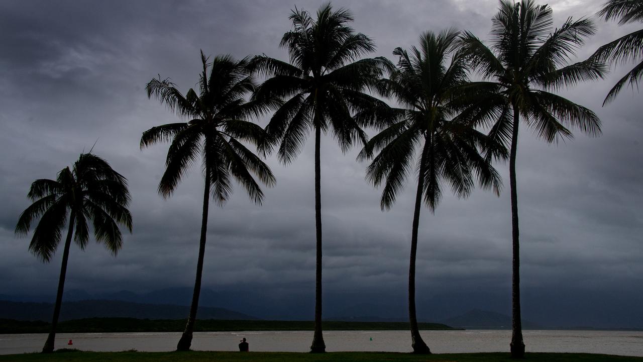
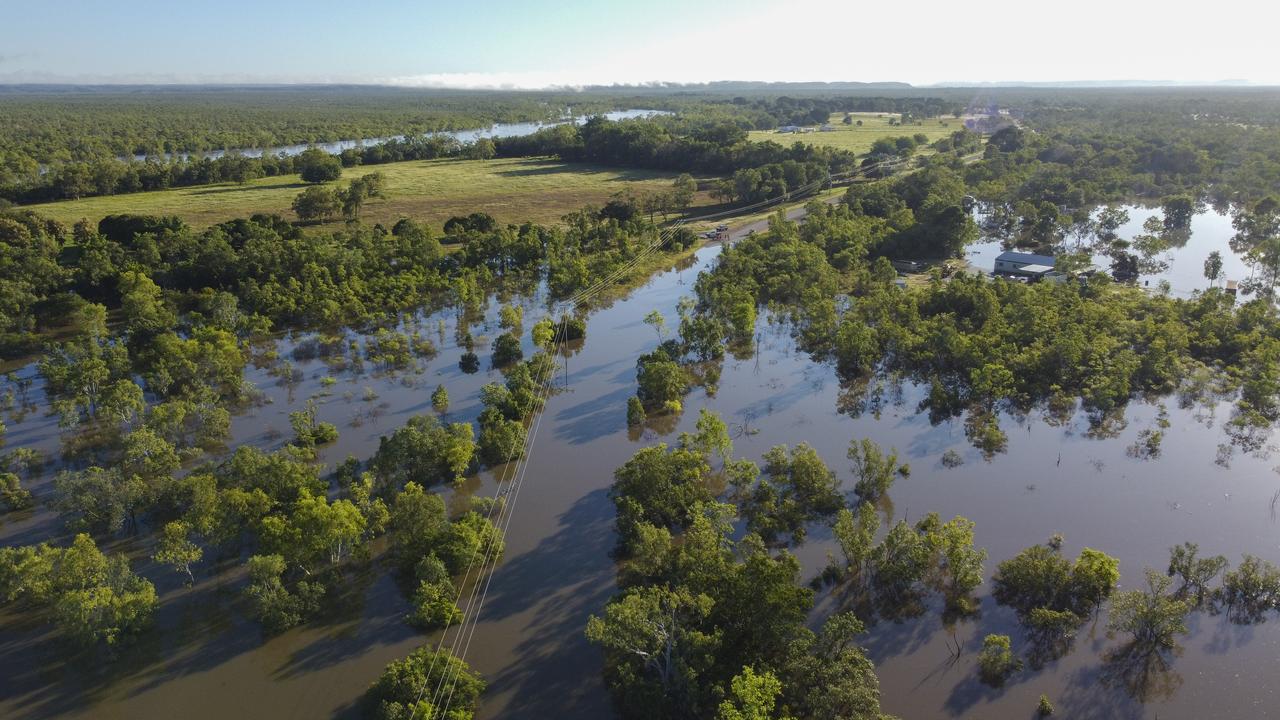
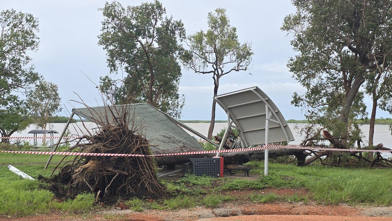
Flood-hit communities still in clean-up mode after being battered by Cyclone Narelle are on high alert as they keep a wary eye on a new threat developing offshore.
A tropical low between Papua New Guinea and the Solomon Islands is expected to strengthen into a cyclone by Sunday, with forecasters warning of a wide range of possible tracks that could include another threat to north Queensland.
Conditions in the Coral Sea were "very favourable" for further cyclone development, senior forecaster Jonathan How told AAP.
The system is forecast to strengthen over the weekend and into early next week before beginning to move from Monday.
"Most of the models do say that it will drift towards the south to southwest on Monday and Tuesday, which means into the Coral Sea," the Bureau of Meteorology's Mr How said.
That's when the predictions split sharply.
The European model, one of the major global forecast systems, suggests it could continue west and likely approach the far north Queensland coast on Saturday.
Other models suggest the cyclone will remain about 1000km from the coast or shift eastwards towards New Caledonia.
"There is still quite a bit of spread in the tracks it could take from Wednesday, and that means that there's still a range of scenarios possible," Mr How said.
He stressed that, while the European model currently showed it potentially crossing the Queensland coast as a strong cyclone, "that's just one model in a range of different scenarios".
A second cyclone to cross the Queensland coast in three weeks would be the shortest gap between direct strikes for the state since Anthony and Yasi in early 2011.
Coral Sea surface temperatures remain "around 30 degrees plus" – more than warm enough to support cyclone development and intensification.
"Sea surface temperatures are the biggest factor," Mr How said.
The system could potentially be the 11th cyclone of the season, close to average, but late in Australia's tropical cyclone season, which runs until the end of April.
It is also possible that the system follows the path of Cyclone Narelle where clean-up and repair efforts continue.
Far north Queensland residents are still firmly in "recovery mode", with damage assessments, paperwork and formal funding activations underway.
"It's hard because there's so much happening and we just really don't know where it's going to land," Cook Shire Mayor Robyn Holmes told AAP from Cooktown, north of Cairns.
"We are aware that it's there. However, it hasn't formed, and we don't have a clear indication of whether it's going to have an impact on the Queensland coast."
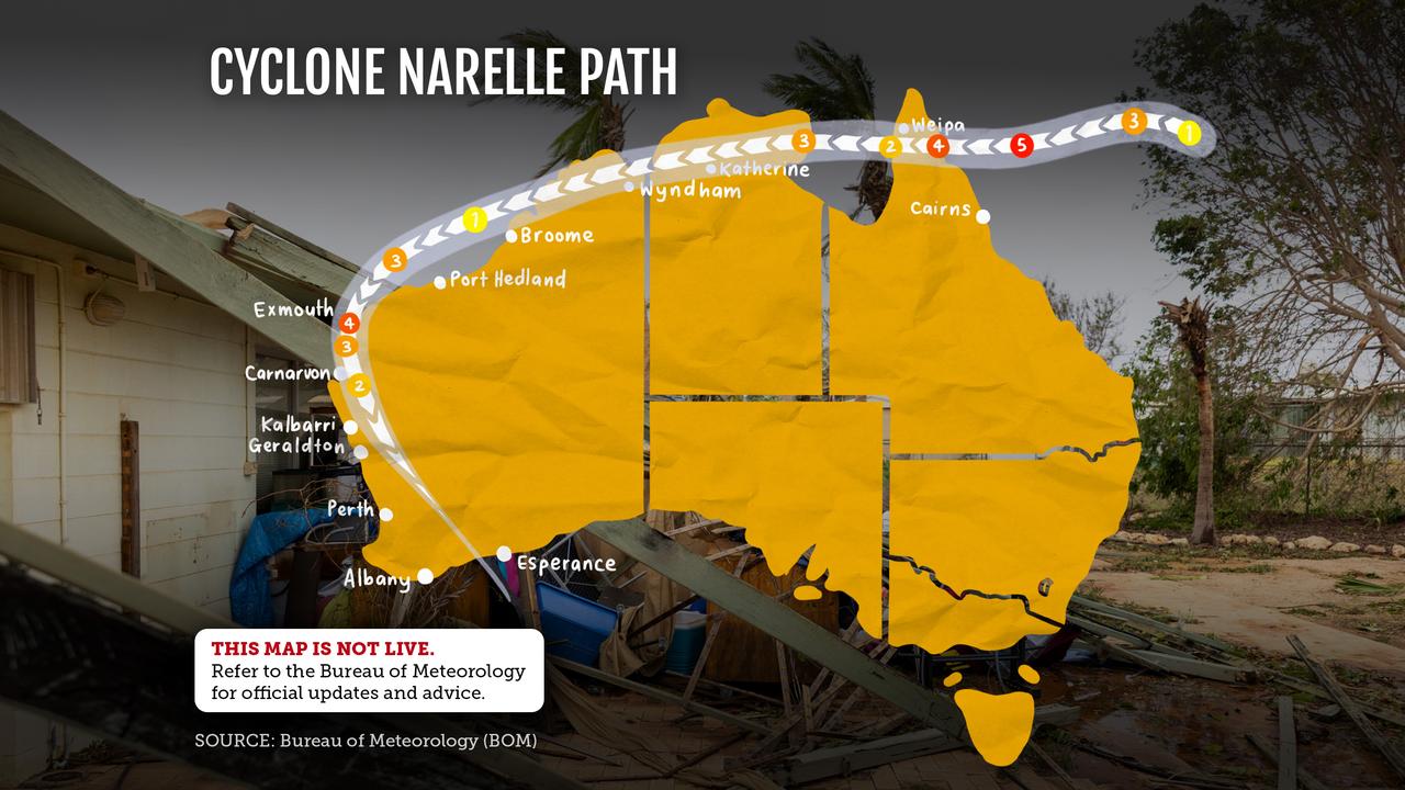
Narelle left a trail of destruction across the far north with trees downed, infrastructure damaged and homes flooded, highlighting the absence of cyclone shelters and dedicated disaster management centres.
There is a strong push for funding to build safe places and cyclone shelters in towns that can be cut off during severe weather.
Communication failures have also frustrated recovery efforts, with Telstra outages leaving some residents without coverage despite assurances about backup systems.
Community representatives say they have been raising concerns about reliability of small cell towers for years.
Narelle crossed the Cape York and the Northern Territory before intensifying again off Western Australia and devastating the state's northwest.
Narelle is only the third storm in recorded history to make landfall as a cyclone in three jurisdictions in Australia, joining Ingrid (2005) and Steve (2000).