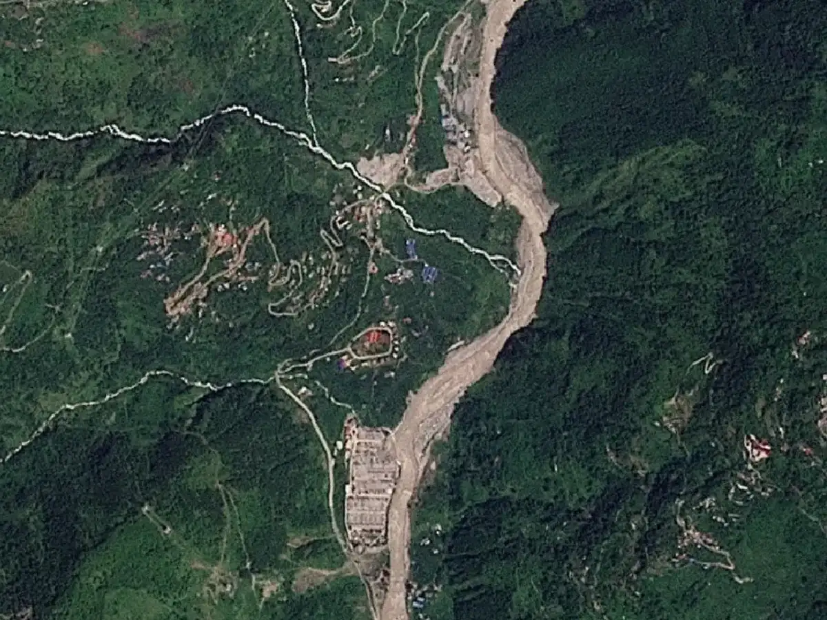
For two decades, the landscape around Nepal’s Lhende–Trishuli river corridor has steadily filled with roads, bridges, hotels, truck yards, substations and hydropower infrastructure, leaving a violent mountain river with less room to absorb sudden surges. A comparison of satellite imagery over the period helps explain why the latest floods were so devastating, according to a report by TOI’s Chandrima Banerjee .
The geography has always been brutal: a narrow Himalayan gorge, steep slopes and very little level ground. But what has changed dramatically is the scale of development packed into that constrained space.