
Get all your news in one place.
100's of premium titles.
One app.
Start reading
LiveScience
LiveScience
Skyler Ware

NASA satellite captures wave of warm water hundreds of miles long that signals a devastatingly strong El Niño

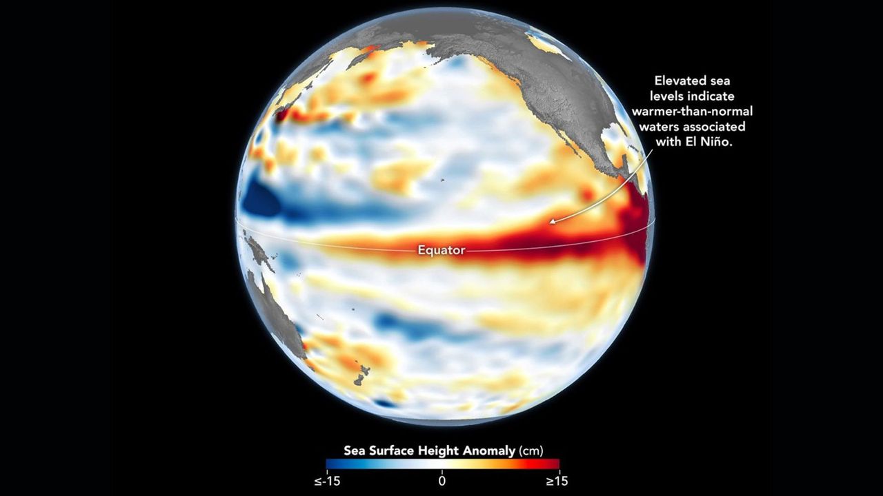
A heatmap of the Earth showing sea surface heights with red areas around the equator.

A massive wave of warm water is making its way across the Pacific Ocean as the newly declared El Niño gets into full swing, satellite images show.

The band, called a Kelvin wave, marks a swell of higher-than-average sea levels that stretches hundreds of miles along the equator. The anomaly is caused by warmer waters linked to El Niño — the warm phase of a natural climate pattern whose current iteration could become one of the strongest ever recorded.

Sign up to read this article
Read news from 100's of titles, curated specifically for you.
Already a member? Sign in here
Related Stories
Top stories on inkl right now
One subscription that gives you access to news from hundreds of sites
Already a member? Sign in here
Our Picks
Fourteen days free
Download the app
One app. One membership.
100+ trusted global sources.