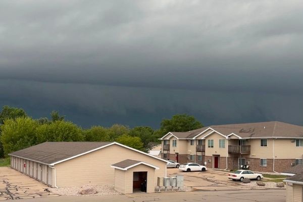
The Met Office has issued fresh weather warnings for ice and rain in parts of the southwest after the region was hit by flooding from Storm Chandra.
Sodden ground and wet surfaces could turn icy as temperatures drop below zero overnight in Devon and Cornwall.
The Met Office has issued a yellow warning for ice for the whole of the southwest, as well as most of Wales and Northern Ireland, warning of the risk of slips and patches of ice on the roads.
The warning, which is in force until 9am on Monday, is followed by a further warning of heavy rain and possible flooding in the southwest from midday.
⚠️ Yellow weather warnings issued ⚠️
— Met Office (@metoffice) February 1, 2026
Ice across Northern Ireland, Wales and South West England during Sunday night
Latest info 👉 https://t.co/QwDLMfRBfs
Stay #WeatherAware⚠️ pic.twitter.com/jUvcXcbhhb
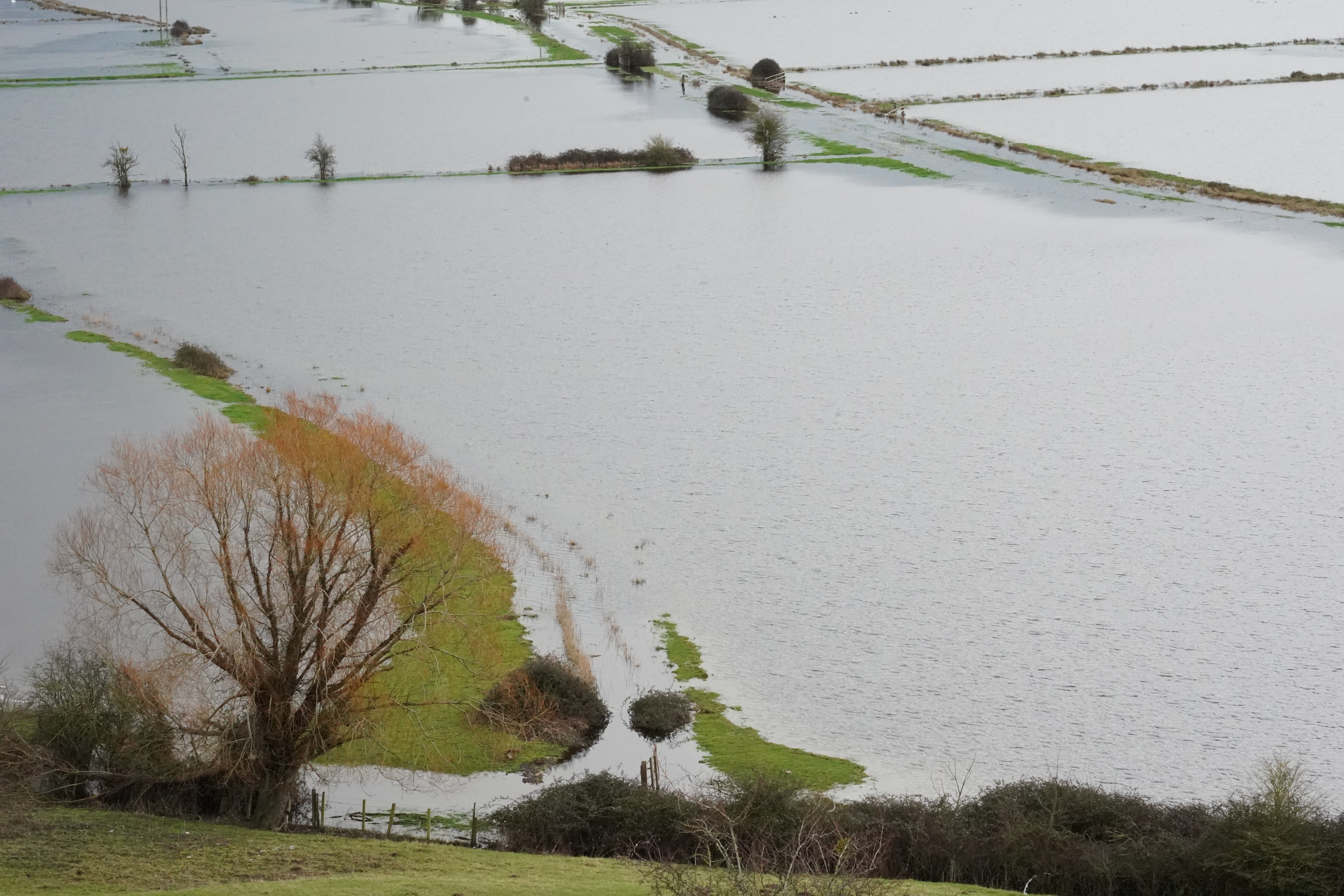
As much as 30-50mm of rainfall is forecast over Dartmoor, with accumulations of 10-20mm expected widely across Devon, Cornwall, Dorset and Somerset.
There is a small chance that homes and businesses could be flooded and fast flowing or deep floodwater causing danger to life, according to the yellow warning, which is in force until 9am on Tuesday.
It comes a week after the region was hit Storm Chandra, which forced schools to close due to the adverse weather and widespread disruption.
Somerset Council said an estimated 50 properties had been affected by flooding across Ilminster, West Coker, Taunton, Mudford and West Camel following the deluge.
Met Office meteorologist Kathryn Chalk warned further rain is on the way following a wet January, as she urged those in the southwest to take care.
Temperatures will fall and could drop below freezing overnight in the region as well was western parts of Wales and Northern Ireland, according to the forecaster.
This risks frost and icy conditions on Monday, with mist and fog expected, before more rain arrives.
“There is already a yellow rain warning in force, so we could see further disruption and more flooding,” she added.
“So do take care, and do keep an eye on the forecast for this if you're based in the south west.
“Otherwise, as for temperatures, it's actually going to be feeling quite chilly, especially towards the north and east towards the south, highs of up to 10 or 11 degrees.”

The Met Office’s five-day weather forecast:
Sunday:
Rather cloudy day with outbreaks of rain for most. Some of the rain could be showery and heavy across Wales and in the west. Rain moving eastwards through the day, leaving clear or even sunny spells in the west later.
Sunday night:
Cloud and rain continue to move eastwards, but staying cloudy for many. Clear spells to the west, leading to frost and fog patches. Cloud then returns to the southwest later.
Monday:
A cloudy start to the week for many with outbreaks of light rain and showers. Dry in the southwest to start with but more persistent rain moves in later.
Outlook for Tuesday to Thursday:
Remaining unsettled with showers or longer spells of heavy rain affecting most areas, coupled with brisk winds at times. Further snow on northern hills. Below average temperatures in the north.
Met Office issues fresh rain warnings in parts of UK hit by Storm Chandra flooding
UK weather map: Where heavy rain is expected to hit after Storm Chandra flooding
Major incident declared and patients evacuated after hospital fire
Second woman claims she was sent by Epstein to UK for sex with Andrew, lawyer says
Andrew should testify before US Congress over links to Epstein, says Starmer
What are the main revelations from the new Epstein files release?