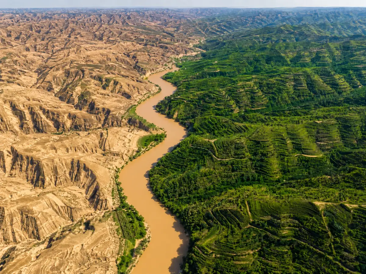
Imagine a piece of land larger than France, stripped so bare that its dust once blew all the way to Beijing. By the late 1990s, that was the state of the Loess Plateau in northern China. Then something shifted. Farmers planted trees, and the hillsides were green again. And a World Bank feature story on the project noted that the soil washing into the Yellow River had been cut by more than 100 million tons a year.
A landscape that was falling apart

The Loess Plateau covers over 640,000 square kilometers across various provinces in China, per World Bank project records. The plateau takes its name from the soil type, loess, which has been transported by the winds in the area for many thousands of years. The soil is fertile, but also fragile. Centuries of agricultural use, livestock grazing, and deforestation have removed all the vegetation that once protected the soil from erosion. By the late 20th century, the area had become one of the most severely eroded places on the Earth. With every monsoon, rain tore across the bare hillsides, carrying soil into the Yellow River. That’s how the river got its name. The muddy water is said to have pushed riverbeds downstream, making floods perilous for millions of people. Meanwhile, the plateau’s farmers were trapped in poverty. Poor soil meant poor harvests, which pushed farmers to cultivate even the steepest, most fragile slopes.