Get all your news in one place.
100's of premium titles.
One app.
Start reading
The Economic Times
The Economic Times

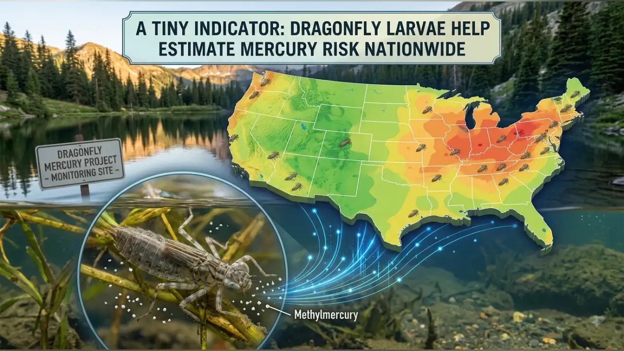
In 2012, researchers began collecting dragonfly larvae to reveal mercury pollution in protected waters. 13 years later, 21,000 samples helped create a model that can estimate freshwater mercury risk without testing every waterway

A tiny creature living beneath the surface of ponds, lakes and streams has helped scientists develop a new way to estimate mercury risk across freshwater ecosystems in the United States.

Researchers from the US Geological Survey and National Park Service used data from 21,000 dragonfly larvae collected over 13 years to develop a national-scale model that can estimate freshwater mercury risk in areas where direct monitoring data may not be available, as per a report.

The model combines mercury concentrations measured in dragonfly larvae with commonly collected information about water chemistry and landscape characteristics. Researchers say it could help scientists, resource managers and policymakers assess mercury risks and decide where additional monitoring may be needed, as per a USGS report.

13 years of dragonfly data helped build the model

The model was developed using data collected through the Dragonfly Mercury Project, a nationwide initiative involving researchers, park staff and public participants.

Over 13 years, the project collected 21,000 dragonfly larvae from freshwater ecosystems across the United States. The data gave researchers information about mercury concentrations across different landscapes.

Dragonfly larvae are useful indicators of mercury pollution because they live in freshwater and are found across a wide range of environments. Mercury levels in their tissues can provide information about exposure within the ecosystems where they live.

READ ALSO: In 1981, climate researchers began tracking hourly temperatures that would eventually span 43 years of global data. 47 years later, their projections show hot days could contain more than 4 extra hours of extreme heat, revealing risks daily averages miss

The model can estimate mercury risk in untested areas

One of the main advantages of the new model is that it can estimate mercury levels in areas where direct monitoring data are not available.

The model combines mercury concentrations in dragonfly larvae with information about water chemistry and land cover to estimate how mercury risk varies across landscapes.

This could be particularly useful on protected lands and in remote areas, including national parks, wildlife refuges and national forests, where monitoring mercury can be time-consuming and costly.

The researchers say the model also provides insight into factors that may influence mercury methylation, the process through which microorganisms convert inorganic mercury into a more toxic organic form.

Earlier monitoring showed mercury levels can vary widely

The long-term Dragonfly Mercury Project data used in developing the model showed that mercury concentrations can differ substantially between locations.

In the earlier national assessment, average mercury concentrations at the site with the highest levels were 135 times higher than at the site with the lowest levels.

The project also found differences between waterbody types. Dragonfly larvae from rivers and streams generally had higher mercury concentrations than those from ponds and lakes.

Mercury concentrations also differed between ecoregions. After accounting for habitat type, dragonfly larvae from the North American Deserts had the highest average mercury concentrations, while those from the Great Plains had the lowest.

These earlier findings demonstrated why environmental and landscape conditions are important when assessing mercury risk.

READ ALSO: Since 2025, University of Manchester researchers modelled 2,300 urban canal sections across Great Britain and Ireland. Now, the study shows canals can lower nearby temperatures by as much as 2.3°C during heatwaves

Dragonfly mercury can provide clues about fish

Earlier Dragonfly Mercury Project research also found that mercury concentrations in dragonfly larvae could predict mercury levels in fish and amphibians collected from the same sites.

This makes dragonfly larvae useful for assessing mercury exposure across freshwater ecosystems, particularly because they are found in many types of waterbodies.

That research found that about 80% of the mercury in dragonfly larvae was methylmercury. Because measuring methylmercury can be more time-consuming and expensive, researchers found that total mercury measurements in dragonfly larvae could be used to represent the risks posed by methylmercury.

The model could guide future testing

The new model could help scientists and resource managers identify areas where additional water and fish testing may be useful.

It could also provide information to help inform fish consumption advisories and identify communities that may face higher mercury exposure where monitoring data are limited.

The researchers specifically noted that this could help identify potential risks for some Tribal Nations near protected lands that rely on local fish for food.

Christopher Kotalik, a USGS research ecologist and lead author of the study, said that, “By predicting mercury risk in freshwater ecosystems on or near protected lands, the model can provide decision makers with data to guide water and fish testing efforts and help inform fish consumption advisories that protect the public,” as quoted by USGS.

National Park Service ecologist Colleen Flanagan Pritz, a co-author, said that, “the new mercury predictive model will help park managers assess mercury risks in national park freshwater bodies and guide research, monitoring and management decisions for national parks,” as quoted in the report.

READ ALSO: In 1913, the Army Corps launched construction of Troy's Federal Dam, using engineers experienced on the Panama Canal. 113 years later, the lock and dam still supports New York's Hudson River navigation and remains a landmark of American engineering

The model can be used in remote ecosystems

The model can be applied to protected lands and remote regions away from urban and industrial mercury sources.

Researchers also say it could provide insights into how land management and restoration activities, including controlled burning used for forest management, may alter mercury risk.

The national scale of the model is a significant step beyond earlier mercury prediction methods that were limited to smaller local or regional areas.

Sign up to read this article
Read news from 100's of titles, curated specifically for you.
Already a member? Sign in here
Related Stories
Top stories on inkl right now
One subscription that gives you access to news from hundreds of sites
Already a member? Sign in here
Our Picks
Fourteen days free
Download the app
One app. One membership.
100+ trusted global sources.