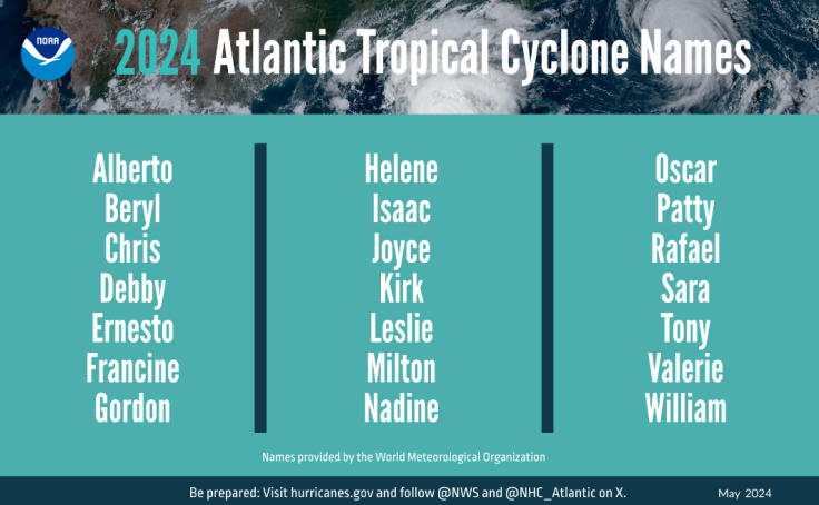
SEATTLE - Earlier this year, National Oceanic and Atmospheric Administration forecasters at the Climate Prediction Center predicted an above-normal hurricane season for 2024 which runs from June 1 to November 30 each year. This theory only intensified with the appearance of Hurricane Beryl, which formed during the evening of June 29th and rapidly increased into a major Category 4 storm on June 30th.
Hurricane Beryl took just 42 hours to go from a tropical depression to a Category 3 storm according to meteorologist Sam Lillo. "This has been done six other times in Atlantic hurricane history," he said on his X account.
Studies have shown that climate change is one of the main factors of the appearance of such a strong storm so early in the hurricane season. Climate change is raising the likelihood that tropical storms and hurricanes rapidly intensify compared to decades ago, and they are making leaps in intensity too.
Hurricane Beryl set a record for the earliest Category 4 storm to form anywhere in the Atlantic Ocean, beating the old record by more than a week. It is also the strongest June Atlantic hurricane on record.
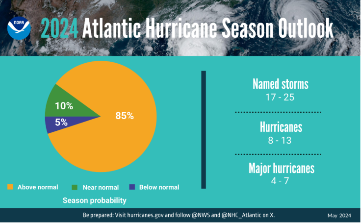
National Weather Service forecasters at the NOAA predicted an 85% chance of an above-normal season for this year, a 10% chance of a near-normal season and only a 5% chance for a below-normal season.
The NOAA is forecasting a range of 17 to 25 total named storms, or storms that reach winds of 39 mph or higher. Out of those, eight to 13 are expected to become hurricanes (winds of 74 mph or higher), including four to seven major hurricanes (Category 3, 4 or 5 with winds of 111 mph or higher).
On average, a normal hurricane season consists of 12 tropical storms and only six of them tend to become hurricanes over the Atlantic Ocean, Caribbean Sea or the Gulf of Mexico. In the Pacific Ocean that number is lower, with an average of three tropical storms, out of which only an average of two become hurricanes.
According to the NOAA, over a typical two-year period, the United States coastline is struck by an average of three hurricanes and at least one of those is classified as a major hurricane with winds of 111 mph or higher.
Something that is clear from the rapid rise with Hurricane Beryl's is that this year will be anything but a normal hurricane season. Typically, these types of storms don't form until August or September, when ocean waters are warmer. This year, the waters of the North Atlantic Ocean Basin are at a record to near-record highs. With warmer waters, the odds for early season storms is higher.
According to the NOAA, human-caused climate change is warming the oceans globally and in the Atlantic basin, and melting ice on land, leading to sea level rise which can increase the risk of storm surges. Experts say that sea level rise represents a clear human influence on the damage potential from a given hurricane.


© 2024 Latin Times. All rights reserved. Do not reproduce without permission.


