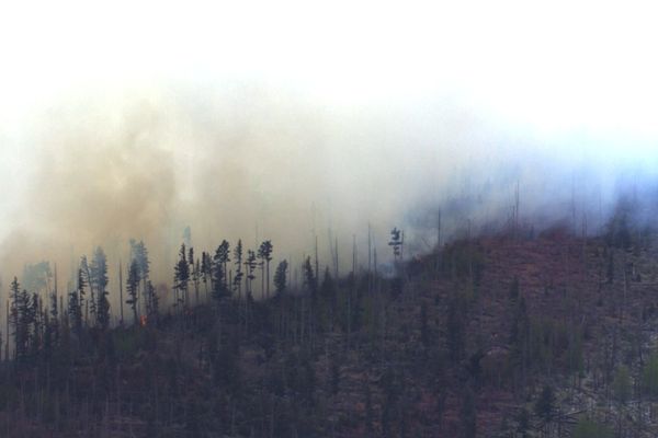
Heavy rains have brought relief to western Canada, in what crews hope could be a “turning point” in a protracted fight against wildfires, but officials also warned the much-needed downpour could lead to catastrophic flooding – and fresh blazes from lightning strikes.
Officials in Alberta said that cool, wet weather over the weekend – and more forecast for the coming days – promised a respite after the worst start to a fire season on record, in which 512 wildfires have already consumed more than 945,000 hectares – surpassing the previous record 615,00 hectares for the same period in 2019.
“This could be a turning point for the firefighters working out there on the fires,” Christie Tucker of Alberta Wildfire told reporters, adding that everyone was “relieved to see some rain” after weeks of battling aggressive fires. “Most areas of the province have now seen rain, lower temperatures and higher humidity, all of which will help firefighters gain ground on these wildfires.”
Alongside the rains, cooler temperatures and more moisture in vegetation, are giving fire crews an added boost in taming the blazes.
The province is still contending with 81 fires, including 23 classified as out of control. Within Alberta, 10,000 people remain under evacuation order.
“Many fires of this size will certainly not be extinguished after a few days of rain,” said Tucker, adding that nearly 3,000 firefighters from 17 agencies and been deployed, along with 400 soldiers from the Canadian military.
Environment and Climate Change Canada said that by midweek, as much as 75mm of rain could fall in the western parts of the province.
In Calgary, the rains offered respite from a thick, orange haze of smoke that has blanketed the province’s largest city for days, at one point making it the most polluted major city on Earth, with fine particulate matter in the air exceeding Lahore, Pakistan.
In neighbouring British Columbia – where as much as 100mm was expected to fall in some areas – heavy rains meant all evacuation orders in the north-eastern part of the province were lifted or downgraded.
Forrest Tower of BC Wildfire told reporters the rains would have a “drastic short-term impact” on the largest of the nearly 90 wildfires burning across the province.
More than 2m hectares of Canada have burned in the spring season, an area roughly the size of Wales. The bulk of which have been in Alberta and Saskatchewan, with new fires in British Columbia quickly adding to the total.
Despite the rains, fire officials in both British Columbia and Alberta warned heavy precipitation could also bring thunderstorms and lightning strikes, igniting new blazes and highlighting the “Whac-a-Mole” reality of managing wildfires.
Severe thunderstorm watches were issued earlier this week for eastern British Columbia, including near the out-of-control wildfire in Kootenay national park, measuring more than 250 hectares in size. The fire was started by a lightning strike last week and is currently listed as “out of control”, with crews deploying “full suppression efforts” according to Parks Canada.
The River Forecast Centre in British Columbia has issued flood watches for much of east-central swaths of the province warning that hot conditions last week accelerated melting of the mountain snowpack. With more waters entering rivers, the centre warned of flooding or debris flows.
Experts have previously warned that increasingly hot wildfires can scald the ground and inhibit water from absorbing into the soil. When heavy rains fall on charred areas, water is pushed off the landscape and into swollen rivers, leading to flooding or slides.


