Parts of the New South Wales south coast have received more than 100mm of rainfall, with more heavy falls and storms forecast to hit the state over the weekend.
Some of the highest falls overnight on Friday were at Moruya (146mm) and Bodalla (136mm) with the weather system moving northward on Saturday.
Bureau of Meteorology senior meteorologist Dean Narramore said the Illawarra, Sydney, Central Coast and Hunter regions could expect showers and thunderstorms that could “easily see” 30-50mm of rainfall and isolated falls of 80-100mm.
Heavy storms hit the north Parramatta area on Saturday morning dumping 35mm of rain in half an hour, he said.
“That’s what we’re going to continue to see today with storms,” he said. “Showers will continue in the south [of the state] with heavy falls and storms more through the Illawarra, Sydney and up to the Central Coast and Hunter.”
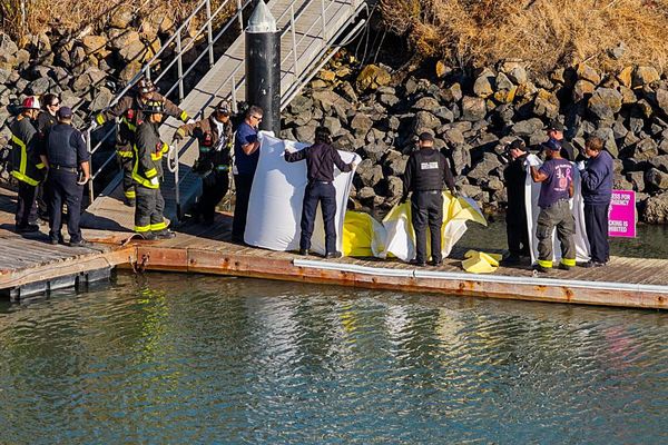
The NSW State Emergency Service said 880 people had requested assistance in areas affected by the wild weather. Heavy rainfall caused flash flooding in Mona Vale and Palm Beach on Saturday afternoon and about 750 SES volunteers were on the ground responding to the impact of thunderstorms.
The NSW SES state duty commander, acting assistant commissioner Sonya Oyston, encouraged people to monitor weather warnings, with heavy rain and storms expected to continue in many areas for the next 48 hours.
Sign up: AU Breaking News email
“We’re starting to see many catchments become wet and we have already seen the impacts of flash flooding right across the coast and ranges, so it’s important people take the necessary precautions [and] don’t become complacent,” she said.
Oyston said flood rescues in Albion Park, Picton and Marulan for people in vehicles trapped by flash flooding were among the incidents SES crews had attended in the past 24 hours.
NSW’s wet weekend comes days after severe storms dumped 180mm in six hours on Victoria’s Lorne and Wye River, trigging flash flooding along the Great Ocean Road that damaged campgrounds and swept away vehicles and tents.
Warnings were in place for hazardous surf on the east coast at beaches stretching from Newcastle down to Batemans Bay, as well as the Eden coast.
NSW police urged people to consider staying out of the water and avoid walking near surf-exposed areas.
Rock fishers should avoid coastal rock platforms exposed to the ocean and seek a safe location sheltered from the surf, police said.
Central Coast councillor Jared Wright said a number of popular beaches in the region had been closed to the public, including North Avoca, Terrigal and Copacabana, while conditions at others, including Avoca Beach, were being monitored closely.
Coramba, a town north-west of Coffs Harbour, received 5-7cm hailstones on Friday and more storms were expected in the region on Saturday.
Narramore said north-east NSW, including the mid-north coast and the Northern Rivers, and south-east Queensland could see another round of severe storms that could bring large hail, damaging winds and heavy rainfall.
There would be more wet weather in NSW on Sunday before conditions eased on Monday, with westerly winds and hot weather forecast to return later next week.
Narramore said the “good news” was that conditions were easing in Victoria after the severe downpours in holiday regions along the Great Ocean Road.
He said only some isolated showers and thunderstorms were forecast for far-eastern and north-east Victoria.
Widespread flood warnings remained in place for much of inland, northern and western Queensland. Severe storms were forecast for the state’s south-east on Saturday, with showers and storms to continue across much of eastern and northern Queensland on Saturday and Sunday.
A tropical low was also expected to bring heavy storms and rainfall to the Top End and Kimberley regions through the weekend.
The climate crisis is making Australia more vulnerable to extreme weather and natural disasters, including flash flooding. The World Meteorological Organization this week said 2025 had continued a three-year streak of “extraordinary global temperatures”, during which surface air temperatures averaged 1.48C above preindustrial levels.
– with AAP