Get all your news in one place.
100's of premium titles.
One app.
Start reading
The Economic Times
The Economic Times
Piyush Shukla

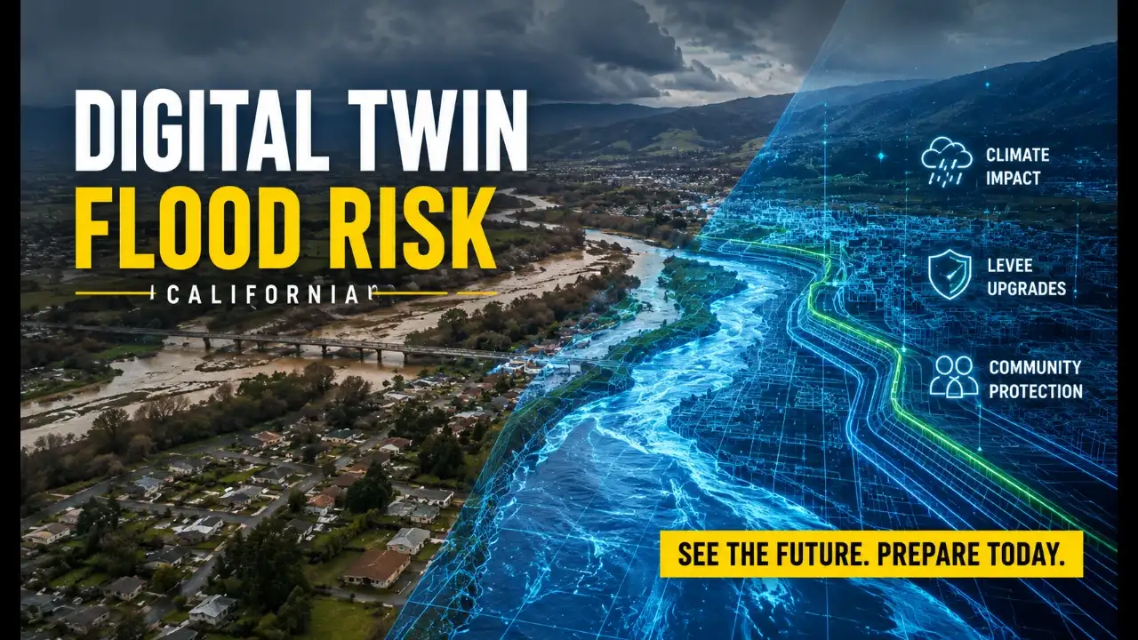
Five major floods followed Pajaro's 1949 levee construction; a 2023 breach sent water through homes within 3 hours and costing $300 million; UC Berkeley researchers are now recreating the watershed digitally to show how new barriers could change the next flood

A flood map can tell you that water may reach your neighborhood, but it rarely tells you what that experience will actually look like. A blue-shaded area on a screen cannot easily show how quickly water could enter a home, which roads might become impassable, or how a levee project could change the flow. UC Berkeley researchers are trying to close that gap by creating a highly detailed digital twin of California’s Lower Pajaro River Valley. The virtual model could allow residents and policymakers to watch flood scenarios unfold while accounting for climate change, ecosystems, infrastructure and social equity.

The project focuses on Watsonville and Pajaro, two communities located on opposite sides of the Lower Pajaro River in Central California. The region has experienced five major floods since the Pajaro River levee system was completed in 1949. One of the worst came in March 2023, when the river broke through its levees after weeks of heavy rainfall and flooded the community of Pajaro. The disaster caused an estimated $300 million in damage and exposed how difficult it can be to protect vulnerable communities using conventional approaches to flood planning.
Anna Serra-Llobet, a senior scientist at the Berkeley Center for Smart Infrastructure, is leading the project with Civil Engineering Associate Professor Adda Athanasopoulos-Zekkos. Their collaborators include Berkeley Ph.D. candidate Gabriela Paredes, researchers from Vienna Research Center for Visual Computing, or VRVis GmbH, and North Carolina State University Professor Kofi Boone. The team is also working with the Pajaro Regional Flood Management Agency, along with state, municipal and community organizations that have direct knowledge of the region.

Why the Lower Pajaro River is an important test case

The Lower Pajaro River is an unusually revealing place to test this technology because flood risk there is tied to more than rainfall and river levels. The surrounding communities have a long and complicated history involving agriculture, infrastructure, land values and unequal exposure to environmental hazards. Pajaro, in particular, is a predominantly farmworking community where residents have historically faced significant flood risk despite the relatively low economic value assigned to the properties protected by the levee system.

That economic calculation helped delay major flood protection for decades. Congress authorized new Pajaro River levees in 1966, but the project repeatedly fell behind other infrastructure proposals because the estimated cost of protection was high compared with the property values in the area. The March 2023 disaster demonstrated the human consequences of that approach. The flood submerged the community of about 2,800 people, forced rescues and affected more than 200 homes, while contaminated agricultural land and disrupted strawberry production.

Construction of a new levee system finally began in 2025 after the Pajaro Regional Flood Management Agency was established in 2021 to help overcome administrative and planning obstacles. The new system is designed to provide 100-year flood protection for Watsonville and Pajaro, along with a mixture of 100-year and 25-year protection for nearby unincorporated areas. Importantly, parts of the project use setback levees, which move the barrier farther away from the river and create additional room for water.

A levee can reduce flooding and change an ecosystem

That design illustrates why the researchers want the digital twin to represent more than water depth. A conventional levee keeps floodwater away from developed areas, but a setback levee can also reconnect parts of a river with its former floodplain. That additional space can slow and spread floodwater while creating opportunities for wetlands, groundwater recharge, habitat restoration and recreational areas.

The tradeoff is that moving a levee can affect people who already live or work in the area. A project that produces ecological benefits in one location could create displacement or other costs elsewhere. Those consequences may be difficult to see when flood management is evaluated through separate maps for flood hazards, land use, ecosystems and social vulnerability.

A digital twin could bring those layers together. Researchers could potentially model a proposed levee configuration, then examine how water moves through the landscape while considering ecological restoration and the communities affected by the change. That does not make the technology a decision-maker. Instead, it gives residents, engineers and policymakers a common visual environment in which the consequences of different choices can be examined before construction or an emergency.

This is one of the most important differences between a digital twin and a conventional flood map. A map generally describes where a particular flood could occur under a defined set of assumptions. A dynamic simulation can show how that flood develops, how conditions change through time and how infrastructure decisions may influence the result. For communities facing increasingly uncertain weather patterns, that temporal dimension could become especially useful.

Climate change makes the problem harder

The need for better flood modeling is growing as California's climate changes. Atmospheric rivers can produce intense rainfall over short periods, while rising temperatures can alter precipitation patterns and increase pressure on water and ecological systems. At the same time, urban development changes how rainfall moves across the ground, and aging infrastructure must continue functioning despite repeated exposure to extreme events.

These processes interact. A stronger storm does not operate on an untouched landscape. It meets rivers that have been engineered, levees that have aged, roads and buildings that alter drainage, agricultural fields with their own water demands and ecosystems that have changed over time. Understanding flood risk therefore requires looking at the entire system rather than treating the river as an isolated source of danger.

The Berkeley researchers also see digital twins as a possible tool for monitoring infrastructure after it has been built. When combined with sensors, a digital model could help engineers track how levees behave as they experience repeated flooding, weather and other stresses. Kenichi Soga, a Berkeley professor and director of the Berkeley Center for Smart Infrastructure, has emphasized that this kind of monitoring could help engineers understand the actual behavior of infrastructure and potentially extend its useful life.

The March 2023 flood shows what a map can miss

The need for that understanding became painfully clear on March 11, 2023. Shortly after midnight, the swollen Pajaro River breached its levees roughly three miles east of Pajaro. Water spread rapidly across nearby strawberry fields before entering homes during the early morning hours.

Residents woke to floodwater inside their houses, while emergency crews worked to rescue people from a community that was soon largely submerged. The disaster was not simply a matter of water reaching a mapped flood zone. It was a fast-moving chain of physical and social events involving rainfall, river flow, infrastructure failure, evacuation, housing and the agricultural economy.

That is the kind of complexity the Pajaro Hydro-Twin project is designed to capture. The researchers want to move flood planning away from the idea that risk can be represented by a single colored region on a map. Their broader argument is that risk changes as climate, infrastructure, ecosystems and communities change.

The project is still under development, so the digital twin is not yet a finished forecasting system for the public. Researchers are working to determine how best to combine technical modeling with community knowledge and environmental justice considerations. If the approach succeeds, however, the Lower Pajaro River could become a model for a different kind of flood planning in California.

The larger idea is surprisingly simple: people may understand risk differently when they can see it move. A three-dimensional simulation cannot prevent an atmospheric river from arriving or guarantee that a levee will hold. But it could help communities examine difficult choices before the next disaster, revealing how a decision made for flood protection might affect water, ecosystems, infrastructure and people at the same time. In a state where flood risk is becoming harder to separate from climate change, that ability to see the future more clearly could become an important part of preparing for it.

Sign up to read this article
Read news from 100's of titles, curated specifically for you.
Already a member? Sign in here
Related Stories
Top stories on inkl right now
One subscription that gives you access to news from hundreds of sites
Already a member? Sign in here
Our Picks
Fourteen days free
Download the app
One app. One membership.
100+ trusted global sources.