Get all your news in one place.
100's of premium titles.
One app.
Start reading
LiveScience
LiveScience
Harry Baker

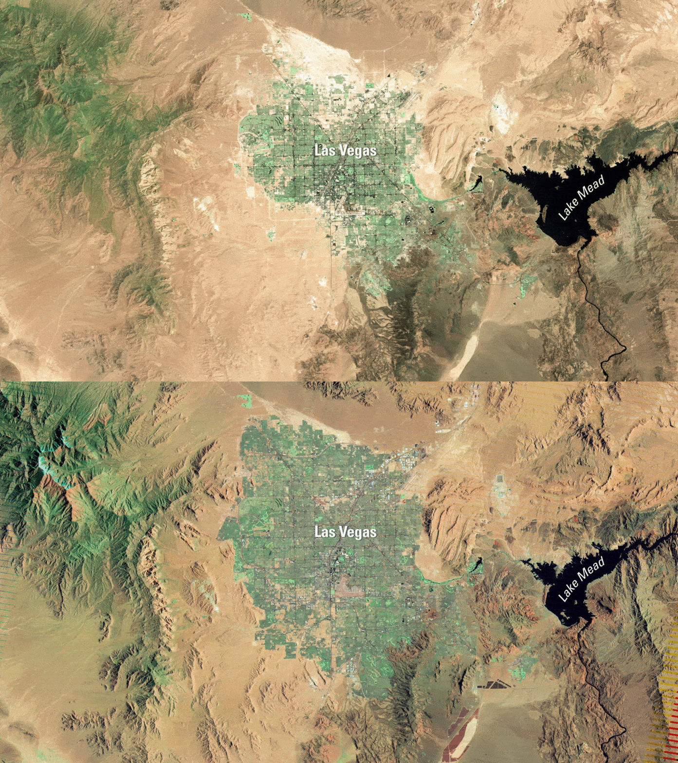
Final photo from iconic US satellite shows how Las Vegas has 'doubled' in size over the last 25 years — Earth from space

Looped slideshow of two satellite photos showing Las Vegas in 1999 and 2004.
QUICK FACTS

Where is it? Las Vegas, Nevada [36.10457930, -115.1448612]

What's in the photos? Aerial shots taken at the start and end of a satellite's operational lifespan

Which satellite took the photos? Landsat 7

When were the photos taken? July 4, 1999 and May 28, 2024

The last image captured by the recently decommissioned Landsat 7 satellite shows the sprawling mass of Las Vegas flowering in the heart of the Mojave Desert. The final photo also mirrors one of the satellite's first-ever shots, highlighting how "Sin City" has rapidly expanded during the iconic spacecraft's 25-year lifespan.

Sign up to read this article
Read news from 100's of titles, curated specifically for you.
Already a member? Sign in here
Related Stories
Top stories on inkl right now
One subscription that gives you access to news from hundreds of sites
Already a member? Sign in here
Our Picks
Fourteen days free
Download the app
One app. One membership.
100+ trusted global sources.