Where is it? Sahara Desert, Chad [19.09146866, 19.23480321]
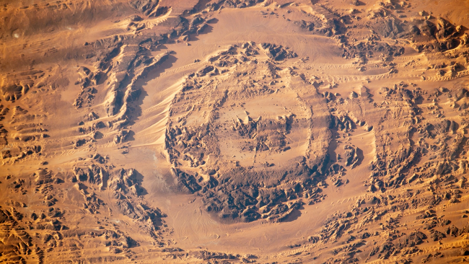
What's in the photo? The eye-shaped Aorounga impact structure surrounded by moving sand dunes
Who took the photo? An unnamed astronaut onboard the ISS
When was it taken? Jan. 6, 2013
This striking astronaut photo shows off an "eye-catching" impact crater in the Sahara Desert. The oculus-like structure is surrounded by migrating sand dunes that are capable of traveling more than 100 feet (30 meters) every year.
The Aorounga structure is a 7.8-mile-wide (12.6 kilometers) impact crater located in the southeast Sahara in northern Chad. The crater is made up of two rings that give the structure its eye-like appearance: An inner ring with a central hill, or uplift structure, that looks like a pupil; and an outer ring that looks like an eyelid. The rings rise around 330 feet (100 m) above the surrounding ground but have been heavily eroded over time — similar to other ancient impact craters — and were likely even taller and wider originally.
Experts believe that the structure formed around 345 million years ago and was likely created by a meteor around 2,000 feet (600 m) across, according to estimates from the Lunar and Planetary Institute. An impactor of this size, known as a "city-killer" asteroid, would have caused widespread damage across the north of Africa and may have even triggered climatic effects on a global scale.
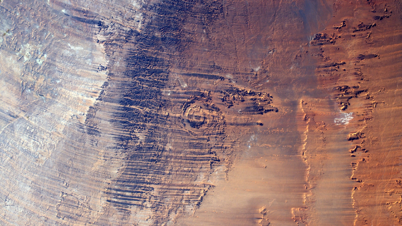
The structure also has several dark lines running across both of its rings, which are sections of massive ridges, known as yardangs, according to the U.S. Geological Survey. These ridges, which can reach up to 100 feet (30 m) above ground level, stretch across the surrounding areas for dozens of miles, as you can see in the 2016 astronaut images below.
Related: See all the best images of Earth from space

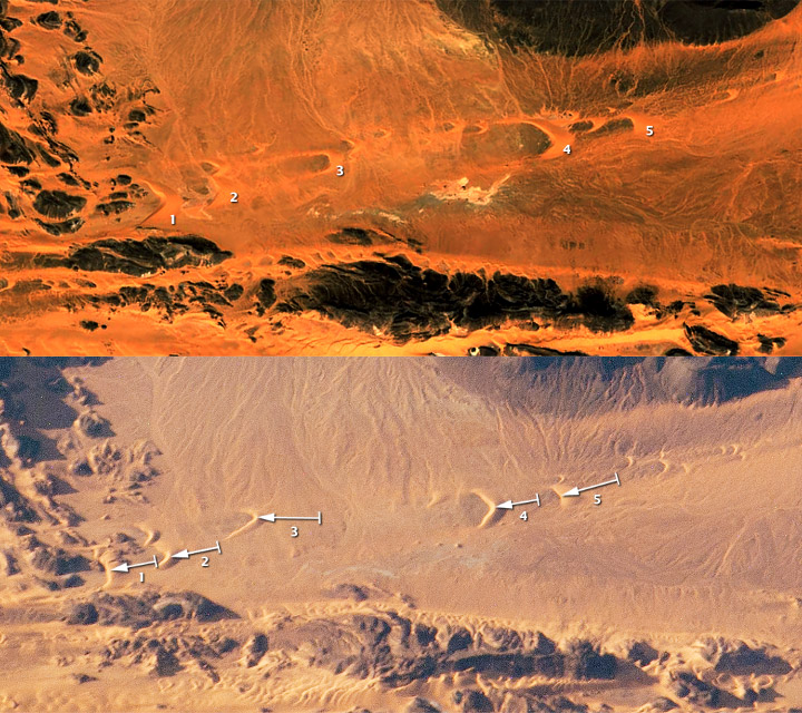
A group of five barchan, or "horned," sand dunes can be seen in a zoomed-in version of the 2013 photo (see below). Over time, these arrowhead-shaped piles of sand are pushed across the desert by the wind and move in the opposite direction that their "horns" are pointed in, according to NASA's Earth Observatory.
By comparing their location in this image with satellite images of the same area in late 2003, researchers were able to work out exactly how far they had moved in just over nine years. From left to right, the five dunes — labeled 1, 2, 3, 4 and 5 — moved by 1,037 feet (316 m), 902 feet (275 m), 1,329 feet (405 m), 1,043 feet (318 m), and 1,250 feet (381 m) respectively.

The biggest migrators, 3 and 5, are also the smallest dunes, which is consistent with what we know about how these dunes move, according to the Earth Observatory. Dunes smaller than these can be ripped apart within a decade.
Barchan dunes have long been known to migrate across the Sahara. However, scientists are only just beginning to work out exactly how far they can travel by tracking their movements with satellite images. Researchers hope these advancements could be used to forecast the sand's movements, which could help mitigate problems caused by the dunes obstructing roads and smothering agricultural land, according to the Earth Observatory.
Radar images of the Aorounga structure taken from space in the late 1990s have also revealed that the eye-shaped rings could be part of a "crater chain." At least two other smaller craters were identified on either side of the structure, suggesting that smaller parts of the Aorounga meteor broke off from the falling asteroid and impacted the surrounding areas, according to The Planetary Society.


