QUICK FACTS
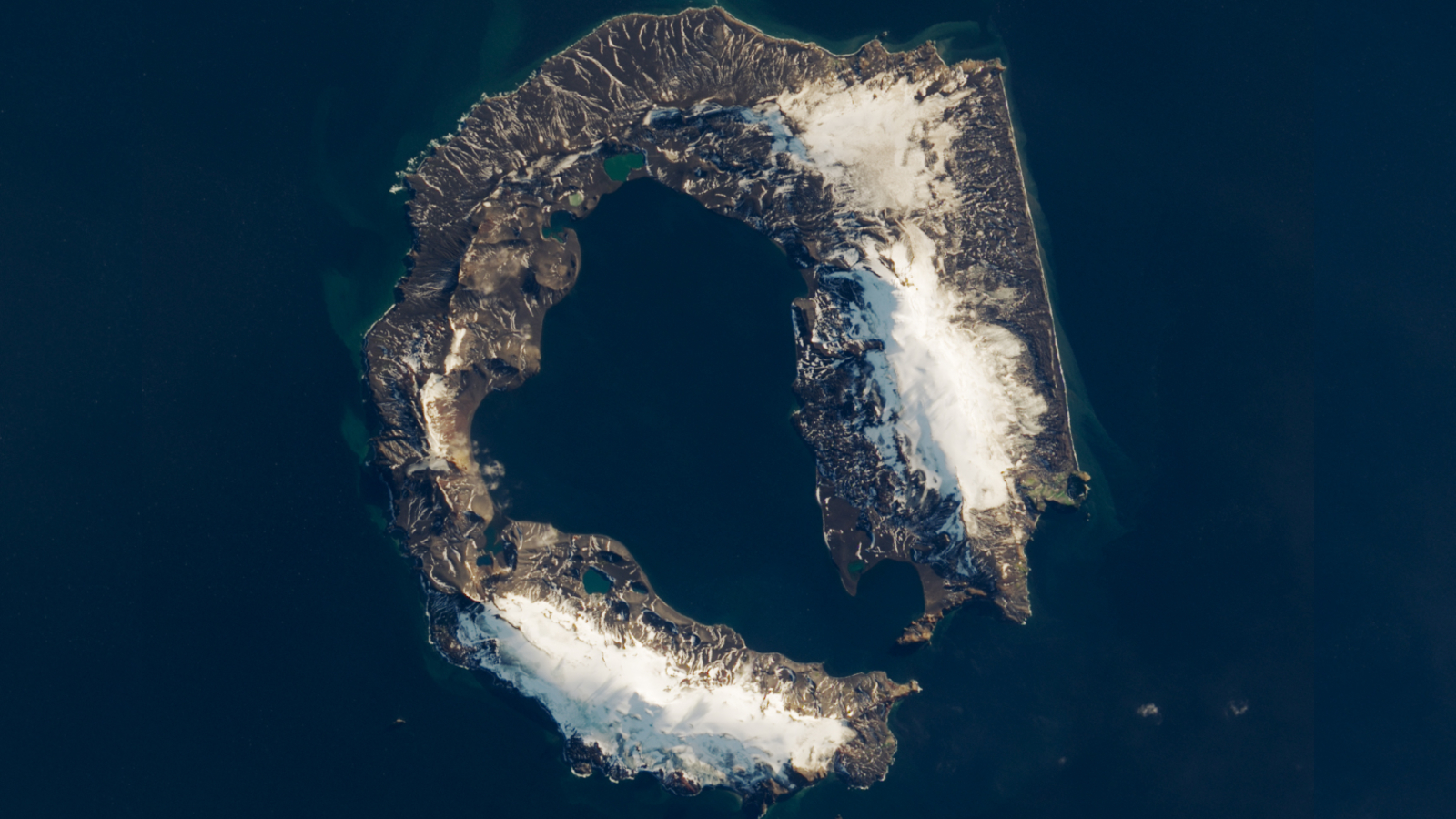
Where is it? Deception Island, South Shetland Islands [-62.953381585, -60.627783743]
What's in the photo? A semi-submerged, active volcanic caldera partially covered in snow
Which satellite took the photo? Landsat 8
When was it taken? March 23, 2018
This striking satellite photo shows off the unique shape of Antarctica's "Deception Island" — a semi-submerged, active volcanic caldera created by one of the region's largest known eruptions, which now provides a haven for ships and researchers exploring the area around the South Pole.