Meteorologists are urging people in parts of the Midwest and southern U.S. to be ready Friday for dangerous weather including tornadoes, saying the conditions are similar to those a week ago that unleashed a devastating twister that killed at least 21 people in Mississippi.
An outbreak of severe thunderstorms has the potential to cause hail, damaging wind gusts and tornadoes that could be strong and move on the ground over long distances, according to the National Weather Service’s Storm Prediction Center.
The major population centers at greatest risk for storms starting Friday afternoon include Memphis, Tennessee, Jonesboro, Arkansas, and Cedar Rapids, Iowa, as of Thursday afternoon's forecast. But people throughout eastern Iowa, western and northern Illinois, Missouri and Arkansas should also be prepared, said Northern Illinois meteorology professor and tornado expert Victor Gensini.
“There will be lots of thunderstorms ... tornadoes, damaging winds, and large hail,” he said.
People in those areas should stock emergency supplies, prepare for power outages, avoid getting stranded in places vulnerable to falling trees or severe hail, and park vehicles in garages if possible, meteorologists said.
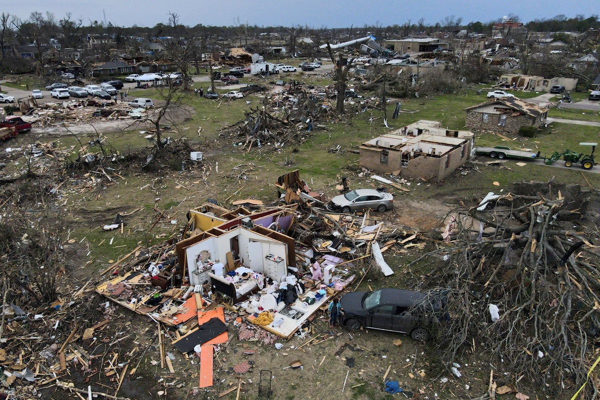
Last Friday night, a vicious tornado in Mississippi killed at least 21 people, injured dozens and flattened entire blocks as it carved a path of destruction for more than an hour. About 2,000 homes were damaged or destroyed, according to the Mississippi Emergency Management Agency.
The toll was especially steep in western Mississippi's Sharkey County, where 13 people were killed in a county of 3,700 residents. Winds of up to 200 mph (322 kph) barreled through the rural farming town of Rolling Fork, reducing homes to piles of rubble, flipping cars and toppling the town’s water tower.
President Joe Biden and first lady Jill Biden are scheduled to visit Rolling Fork on Friday.
Gensini said Friday’s atmospheric setup is similar to the conditions that were present during Mississippi’s deadly storm.
The hazardous forecast is a result of strong southerly winds transporting copious amounts of moisture from the Gulf of Mexico north, where they will interact with the strengthening storm system.
The weather service is forecasting another batch of intense storms next Tuesday in the same general area as last week. At least the first 10 days of April will be rough, Accuweather meteorologist Brandon Buckingham said earlier this week.
Bill Bunting, the weather service’s Storm Prediction Center chief of forecasting operations, said people need to have a severe weather plan in place that includes multiple ways to receive storm warning information.
“We’ve all seen the coverage of the heartbreaking situations in other parts of the country. Our fervent hope is that people pay attention to the forecasts that have been out for several days now regarding Friday’s threat,” Bunting said.


