Get all your news in one place.
100's of premium titles.
One app.
Start reading
The Times of India
The Times of India
World
Prisha Roy

Before and after: Satellite images reveal how Himalayan flood erased Nepal-China border crossing

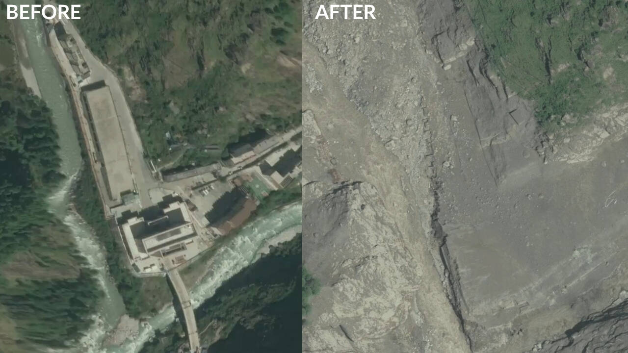
New satellite imagery has captured the scale of destruction caused by the Himalayan flash flood at the Nepal-China border, showing the Rasuwagadhi crossing virtually erased after a torrent of rock, ice, mud and water tore through the region on August 26.

Get breaking news anytime, anywhere. Download the TOI app now!

High-resolution before-and-after images released by commercial satellite company Vantor compare the area on April 19, 2024, with imagery captured on August 27, 2026, a day after the disaster. The earlier image shows a large multi-storey border facility, roads, paved areas and other infrastructure alongside the river. In the post-flood image, much of that infrastructure has disappeared beneath a wide expanse of rock, mud and debris.

Sign up to read this article
Read news from 100's of titles, curated specifically for you.
Already a member? Sign in here
Related Stories
Top stories on inkl right now
One subscription that gives you access to news from hundreds of sites
Already a member? Sign in here
Our Picks
Fourteen days free
Download the app
One app. One membership.
100+ trusted global sources.