
Get all your news in one place.
100's of premium titles.
One app.
Start reading
LiveScience
LiveScience
Ben Turner

Alaska's ice is melting in front of our eyes, staggering satellite shots show

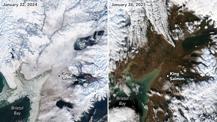
NASA satellite image showing melt on Alaska.

New satellite images reveal the stark pace of global warming in Alaska, with last year's snow vanishing and leaving behind miles of bare ground.

The images, taken by the Moderate Resolution Imaging Spectroradiometer (MODIS) instrument on NASA's Terra and Aqua satellites, show Bristol Bay Borough in southern Alaska. Anchorage, which is located to the northeast, had an average January snow depth of 13 inches (33 centimeters) between 1998 and 2025.

Sign up to read this article
Read news from 100's of titles, curated specifically for you.
Already a member? Sign in here
Related Stories
Top stories on inkl right now
One subscription that gives you access to news from hundreds of sites
Already a member? Sign in here
Our Picks
Fourteen days free
Download the app
One app. One membership.
100+ trusted global sources.