Get all your news in one place.
100's of premium titles.
One app.
Start reading
The Times of India
The Times of India
World
TOI World Desk

A Thai fishing pier reshaped the coastline over 13 years, study finds

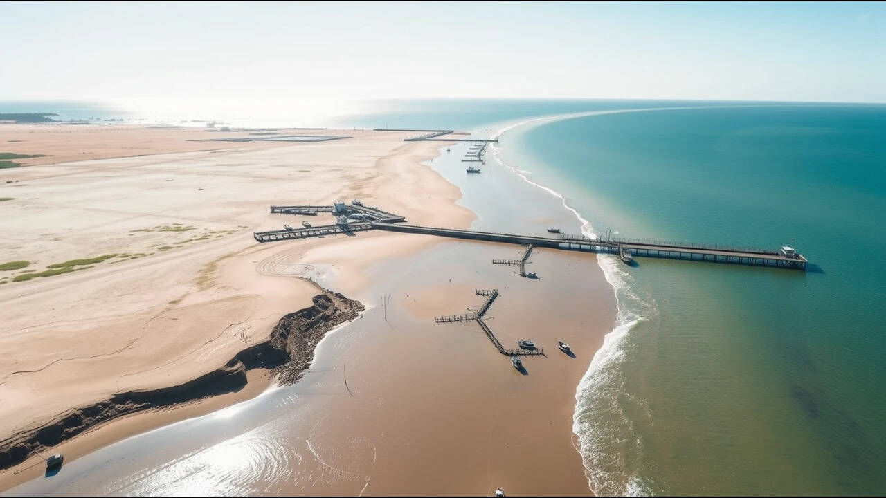
A 400-metre fishery pier on Thailand’s Ban Khlong Wan coastline was followed by dramatic changes in the shape and composition of the shore, with one section of beach advancing by as much as 250 metres. The findings come from a study published in Scientific Reports on August 22, 2025, titled Unintended coastal transformation from small-scale infrastructure and land use change . Researchers combined historical shoreline records, high-resolution LiDAR observations, beach sediment analysis and upstream land-use data to reconstruct how the coastline changed between 1966 and 2023. They found that the pier disrupted the movement of sand along the coast, while changes upstream contributed additional fine sediment. The result was not a simple story of erosion caused by coastal structures. Instead, the researchers found that infrastructure, sediment transport and changes to wetlands and aquaculture interacted to transform different sections of the coastline in different ways. Scientific Reports study

Get breaking news anytime, anywhere. Download the TOI app now!

The coastline was relatively stable before the coastal development

The researchers analysed shoreline positions along the Ban Khlong Wan coastline from 1966 to 2023, dividing the record into a pre-development period from 1966 to 2002 and a post-development period from 2002 to 2023. The study area was divided into the 1.5-kilometre Khlong Wan coastline in the north and the 5-kilometre Wa Ko coastline in the south. Before the coastal development, the Khlong Wan coastline experienced substantial retreat. Table 1 shows that 82.5% of the Khlong Wan transects were classified as retreating, with a mean shoreline change rate of −0.28 metres per year. The researchers summarised this by stating that 83% of the area was eroding at an average rate of approximately −0.3 ± 0.08 metres per year.

Wa Ko was more stable during the same period. Table 1 shows that 39.4% of the coastline was stable and 33.3% was accreting. The mean shoreline change rate there was 0.04 metres per year, while the mean accretion rate was 0.24 metres per year. Overall, the average shoreline change rate across both coastlines was less than ±0.5 metres per year. Several structures were introduced during the broader 2004 to 2008 development period. These included a 400-metre fishery pier and a 700-metre breakwater. Twelve detached breakwaters were constructed by the Harbour Department in 2007 and 2008, while Khlong Wan Municipality constructed a seawall in 2005 for a public park.

The 400-metre pier trapped sand on one side

The most dramatic shoreline change occurred along the Wa Ko coastline, south of the pier. Within 400 metres of the structure, the shoreline advanced by as much as 250 metres, corresponding to an accretion rate of approximately 12 metres per year. The researchers estimated that the resulting land accretion covered approximately 40,000 square metres. They attributed this primarily to the pier interrupting longshore sediment transport and trapping sand on its updrift side. The pattern also supported the researchers’ conclusion that sediment was predominantly moving from south to north along this stretch of coastline.

The shoreline position data show that the seaward advance associated with the pier stopped by 2021. The researchers suggested that the sediment-trapping capacity of the pier may have reached an equilibrium after about 13 years. Table 1 records a maximum shoreline movement of 250 metres for the Wa Ko coastline during the post-development period. Its maximum accretion rate was 11.89 metres per year, while the mean shoreline change rate was 0.28 metres per year.

The northern coastline responded differently

The Khlong Wan coastline showed a markedly different pattern after construction. Its mean net shoreline movement was 18 metres, while shoreline change rates ranged from −0.16 to 3.67 metres per year according to Table 1. The table records accretion across 96.8% of the Khlong Wan coastline during the post-development period. The paper's text rounds this figure to 97%. Before development, by comparison, only 8.0% of the Khlong Wan coastline was classified as accreting, while 82.5% was retreating.

Part of the later shoreline advance was associated with deliberate sand placement. The Harbour Department added approximately 90,500 cubic metres of sand as an erosion-control measure. This means the post-development changes along Khlong Wan cannot be attributed to the coastal structures alone. The area within 50 metres north of the pier also experienced substantial accretion, with shoreline advances ranging from 6 to 77 metres.

Wetland conversion changed the upstream landscape

The researchers also examined land-use changes upstream of the coastline. A wetland area covering about 180 hectares was located approximately 3 kilometres upstream from the Ban Khlong Wan coast and served as part of the catchment supplying sediment to the Khlong Wan Channel. Historical aerial photographs and satellite imagery showed that the area was predominantly natural wetland between 1966 and 1976. By 1995, approximately 100 hectares had been converted into aquaculture farms. The paper describes this as 58% of the wetland area, but that percentage does not correspond mathematically to the 100-hectare and 180-hectare figures reported in the same section. To avoid reproducing an internally inconsistent calculation, the figures can be stated without the percentage.

The conversion involved changes including land occupation, dike construction, vegetation clearance and soil excavation. After 2002, interventions by the Royal Forest Department led to the reclamation of some illegally encroached areas. By 2021, the area used for aquaculture had fallen to approximately 50 hectares. The researchers argued that these upstream changes were relevant because the Khlong Wan Channel was the main source of fine sediment reaching this part of the coast. The wetland-to-aquaculture conversion therefore formed part of the wider change in sediment supply, alongside the interruption of longshore sand transport by the pier.

The coastline changed because several processes interacted

The Ban Khlong Wan case shows why coastal changes cannot always be explained by looking at a single structure. The 400-metre pier altered the movement of sand and produced pronounced accretion on its updrift side. At the same time, breakwaters and seawalls affected sediment deposition and shoreline stability, while upstream land-use changes influenced the supply of fine sediment reaching the coast. The researchers concluded that the transformation from a predominantly sandy coastline to a muddier environment resulted from the interaction of engineered modifications, disrupted longshore sediment transport and increased riverine inputs of fine sediment, rather than from seawalls and breakwaters alone. They recommend integrated coastal management that considers infrastructure, sediment processes and upstream land use together. The study also highlights the usefulness of high-resolution monitoring, including UAV-based LiDAR, for tracking changes in complex coastal environments.

Sign up to read this article
Read news from 100's of titles, curated specifically for you.
Already a member? Sign in here
Related Stories
Top stories on inkl right now
One subscription that gives you access to news from hundreds of sites
Already a member? Sign in here
Our Picks
Fourteen days free
Download the app
One app. One membership.
100+ trusted global sources.