A record number of states are experiencing drought conditions this month, as warm and windy weather continues to affect regions around the country.
Nearly 150 million Americans are impacted by the ongoing drought, according to the US Drought Monitor. Its map released at the end of October showed more than 54 percent of the contiguous US is in moderate-to-severe drought and 87 percent is abnormally dry or in drought.
That same day, NOAA’s National Integrated Drought Information System (NIDIS) also said a record had been set: 48 states were drought-stricken, the most in the Drought Monitor’s nearly 25-year-long history. The National Drought Mitigation Center said that the Lower 48 had not seen this much drought since 2022.
Stats on the now record-setting Fall 2024 drought
— NIDIS Drought.gov (@NOAADrought) October 31, 2024
48 states have some drought, most in #DroughtMonitor history.
87.2% of the Lower 48 and 73.2% of the US are Abnormally Dry (D0) or in drought, both #DroughtMonitor records.https://t.co/a7q2jKPfan @NOAA pic.twitter.com/swYNBk635v
But, there should be some good news when an updated drought map is released on Thursday. Paul Pastelok, AccuWeather senior meteorologist and the lead US long-range forecaster, told The Independent on Tuesday that he believes drought levels will lower significantly, with storm systems across Illinois, Missouri, Oklahoma, and Texas eating away at it.
While AccuWeather had predicted droughts in July, Pastelok said he didn’t think they would be as extreme.
“I thought it would be some areas. Not every one,” he said.
New York City, the most populous city in the country, declared a drought watch this week.
“All New Yorkers must do their part to conserve water,” the city said in a post on social media. Forecasts showed the possibility of rain on Sunday.
“It may take until we get into December to get some back and forth action, to get enough precipitation to knock this drought down,” Pastelok said.
While some parts of the US were forecast to feel some relief this week, others won’t likely see it until much later.
Drought, strong winds, and above-normal temperatures have resulted in Red Flag conditions in many regions. On Tuesday, the National Weather Service issued an extremely critical fire weather outlook for Southern California: the first extreme fire risk issued in California since December 2020.
Warm and dry conditions were forecast for much of the Northeast and mid-Atlantic on Tuesday, with severe storm and tornado threats moving from Texas to Louisiana.
“Lack of rain in October led to rapidly expanding dry conditions in the Southeast. Additional drought development and impacts are expected into early November, with uncertainty for the winter months ahead,” NIDIS said last week.
The Lower 48 has not seen this much #drought since Dec. 2022, with D1-D4 coverage of 54.08% this week. With the area continuing to see impacts from a recent dry pattern, this was a big week of changes for the USDM. Current D0-D4 coverage of 87.16% is a new record. (1/2) pic.twitter.com/XQMUjhEL4a
— Drought Center (@DroughtCenter) October 31, 2024
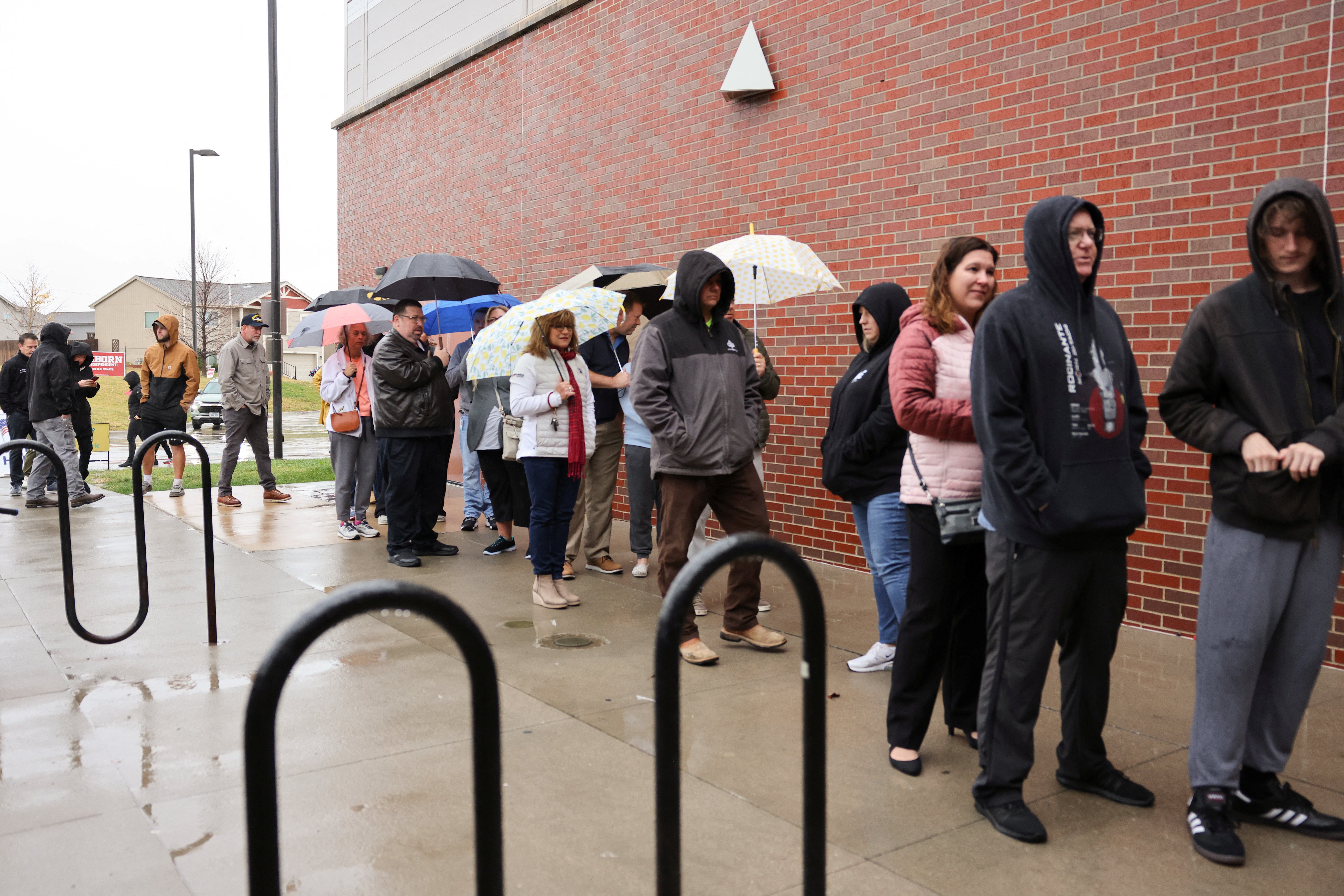
Rain is also forecast in Michigan on Tuesday, and areas from Texas to Iowa will receive inches of rain on Tuesday, according to AccuWeather. Voters were seen wearing rain gear in polling center lines in Texas and Nebraska.
While heavy rainfall has hit the south-central US for a couple of days now, the system is moving eastward. Those hazards shift toward the Mississippi Valley, and scattered showers and thunderstorms will remain around the Ohio and Tennessee Valleys by Thursday.
Tropical Storm Rafael is forecast to bring more impacts to the Florida Keys by the end of the week.

“Believe it or not, a lot depends on what happens in the Tropics,” Pastelok said, regarding rain expected in the Northeast.
“It sets up the patterns around this storm to get us in a good position to get some rain.”
Right now, the jury’s still out. But, Pastelok says more events are expected in the future. More severe and longer droughts are expected in a warming world, although it is unclear if this event is tied to climate change. This may be the hottest year on record.
“The water temperatures have been warm for the last several years, above average. And, the last two years have been near record level, if not record level in some parts of the [ocean] basins. All that warm water is causing changes in our upper patterns during seasonal time periods, kind of missing the norm,” he explained.
“So, when that happens, it becomes a greater effect on something else. And so, the more amplified something becomes, the more extreme that we could be looking at.”


