Get all your news in one place.
100's of premium titles.
One app.
Start reading
The Conversation
The Conversation
Jun Wang, Professor of Chemical and Biochemical Engineering, University of Iowa

Is that wildfire smoke plume hazardous? New satellite tech can map smoke plumes in 3D for better air quality alerts at neighborhood scale

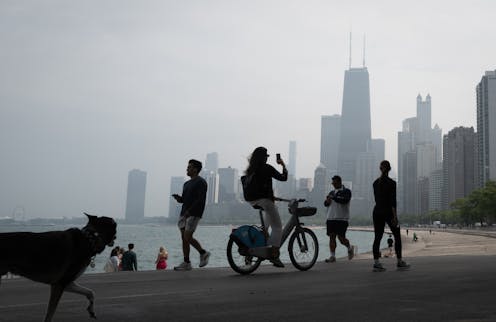
Smoke from Canadian wildfires prompted air quality alerts in Chicago as it blanketed the city on June 5, 2025. Scott Olson/Getty Images

Canada is facing another dangerous wildfire season, with burning forests sending smoke plumes across the provinces and into the U.S. again. The pace of the 2025 fires is reminiscent of the record-breaking 2023 wildfire season, which exposed millions of people in North America to hazardous smoke levels.

For most of the past decade, forecasters have been able to use satellites to track these smoke plumes, but the view was only two-dimensional: The satellites couldn’t determine how close the smoke was to Earth’s surface.
Sign up to read this article
Read news from 100's of titles, curated specifically for you.
Already a member? Sign in here
Related Stories
Top stories on inkl right now
One subscription that gives you access to news from hundreds of sites
Already a member? Sign in here
Our Picks
Fourteen days free
Download the app
One app. One membership.
100+ trusted global sources.