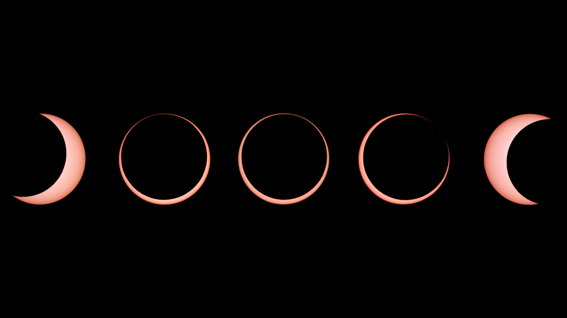
Where to go for the annular solar eclipse on October 14, 2023, is largely down to where the eclipse path is.
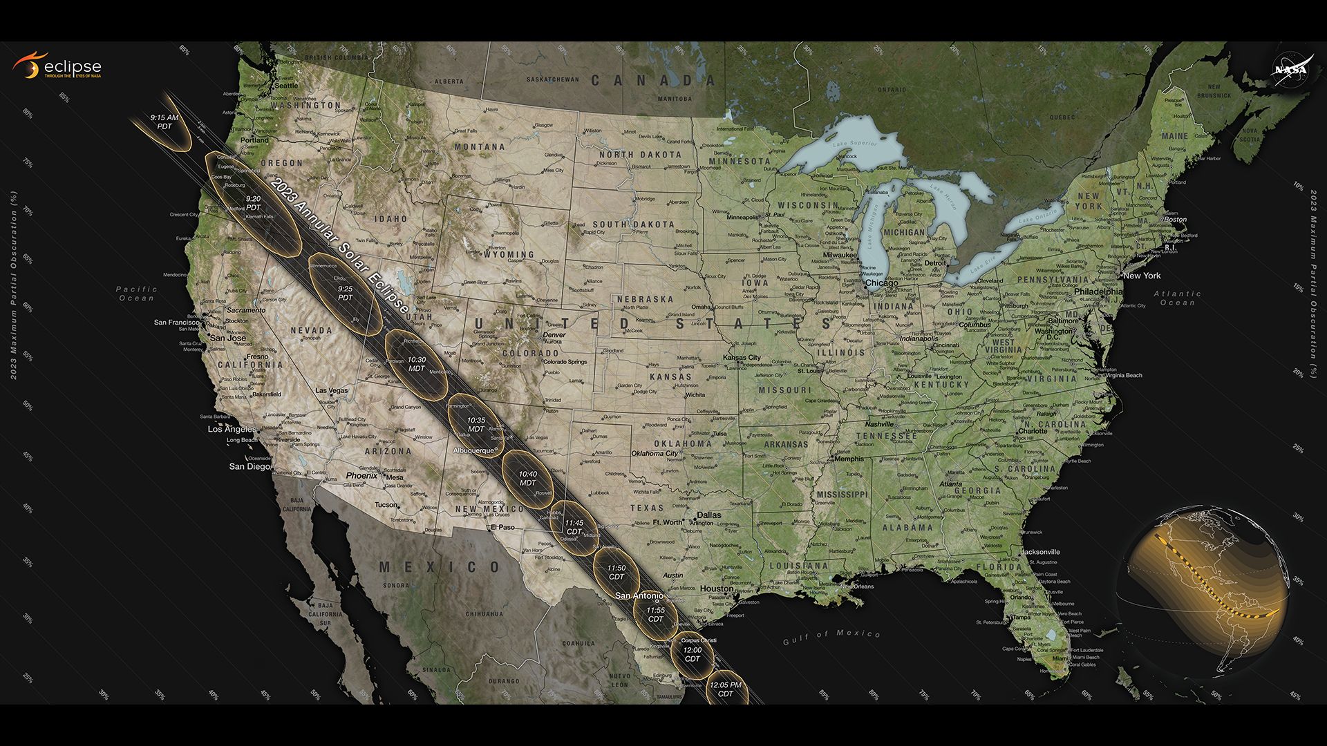
On that day the entire Americas will experience a partial solar eclipse, but the 'ring of fire' will only be visible from within a 125-mile (200-kilometer) wide path heading from the northwest U.S. through Central America to Brazil.
That path of the eclipse is the moon's antumbra, where the moon appears completely within the sun's disk to create the 'ring of fire' effect. The light levels will also noticeably fade as 90% of the sun is covered. Outside of the path is the moon's penumbra — its fuzzier outer shadow — where a partial solar eclipse will be visible across North, Central and South America
Related: How to read and understand a solar eclipse map
Although it won't be as dramatic as the total solar eclipse 177 days later on April 8, 2024, in Mexico the U.S. and Canada, this annular solar eclipse will be worth watching. "The 'ring of fire' will be a spectacle all of its own," Michael Zeiler, cartographer and eclipse-chaser at GreatAmericanEclipse.com told Space.com during a Zoom interview. "With eclipse glasses, you'll see the eerie sight of the sun appearing as a brilliant ring of sunlight."
How to make a plan for the 'ring of fire' solar eclipse
When planning where to go, research where has the best climate and likelihood of clear skies. "I would recommend the U.S. National Parks in the 'Four Corners' area where Colorado, New Mexico, Utah and Ariana meet because it's a sunny time of year after the monsoon season and before the winter storms," says Zeiler. "An ideal trip would be to rent an RV and visit some of the magnificent places in the area at a time of year when you're not going to encounter huge crowds, except on eclipse day." However, it would be wise to stay mobile and keep plans relatively fluid, checking weather apps like Windy in the days before the eclipse and re-locating if necessary.
It all begins with the position of the path of annularity on October 14, 2023. Only eight U.S. states, from Oregon through Texas, will see the 'ring of fire' (we've not included Idaho since only a tiny sliver of that state is crossed by the path). Here's where you need to be on the day of the eclipse to see the most of what this solar eclipse has to offer.
1. Southern Oregon

When: 9:15-9:24 a.m. PDT
Maximum duration of 'ring of fire': 4 mins and 32 secs.
Key locations: Crater Lake National Park, Oregon Dunes National Recreation Area, Klamath Falls.
Climate: High chance of cloud west of the Cascades, likely clear to the east
As the 'ring of fire' arrives in the Beaver State it will be just 17 degrees up in the southeast, so photographers will likely line its beautiful coast between Lincoln Beach and Denmark. However, it's an often misty coast, so it's a risky choice.
Ditto the sight of the 'ring of fire' reflecting in America's deepest lake at Crater Lake National Park. Nearby is Klamath Falls and its EclipseFest 2023. Clear skies are more likely on the eastern side of the Cascade mountain range, with the Oregon Outback Scenic Byway in the arid high desert potentially a good option. Either way, it could get busy in Oregon. "The path is a two-hour drive south from Portland and six hours from Seattle," says Zeiler. "That's a lot of people."
Related: 10 breathtaking locations to see October 2023's 'ring of fire' annular solar eclipse
2. Northeastern California
When: 9:18-9:22 a.m. PDT
Maximum duration of 'ring of fire': 4 mins and 39 secs
Key locations: Lava Beds National Monument, Tule Lake National Wildlife Refuge
Climate: Clear skies likely
Although the annular solar eclipse comes to California, the path only clips its northeast corner. "It's a very lightly populated part of California," says Zeiler, who doesn't think the area will get too many visits from within the state. "For people in the San Francisco Bay area or southern California, their shortest journey into the path takes them into Nevada or Utah." One scenic location within California is Lava Beds National Monument close to the northern edge of the path, where a long display of Baily's beads is expected.
Related: 'Ring of fire' from US national parks: 7 great places to see the annular solar eclipse 2023
3. Northern Nevada
When: 9:18-9:28 a.m. PDT
Maximum duration of 'ring of fire': 4 mins and 37 secs.
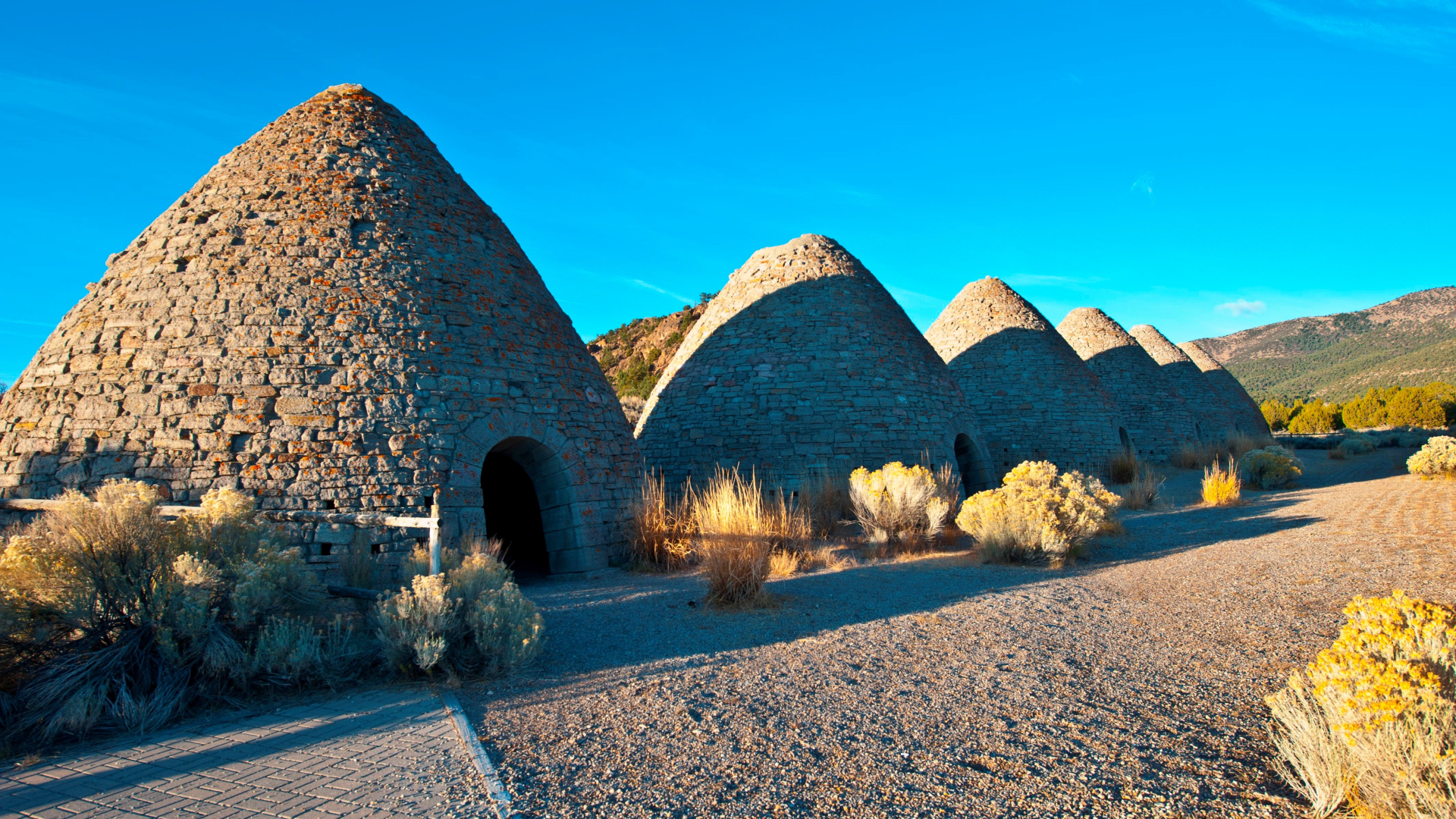
Key locations: Great Basin National Park, Ely, Winnemucca
Climate: Clear skies likely
Massacre Rim Dark Sky National Conservation Area in remote northwestern Nevada might attract the adventurous, but most will head from California or Salt Lake City on Interstate 80 (which intersects the path and passes many small towns, such as Winnemucca), or from Las Vegas in the south. A popular target will be Great Basin National Park in the Snake Range. Nearby Ely will host a NASA live-streaming team at its Ring of Fire Eclipse Festival.
4. Southern Utah
When: 10:24-10:35 a.m. MDT
Maximum duration of 'ring of fire': 4 mins and 40 secs.
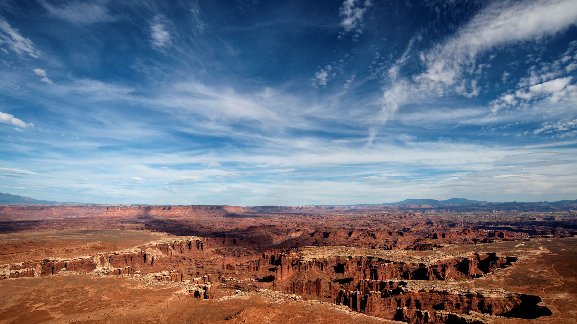
Key locations: Capitol Reef National Park, Bryce Canyon National Park, Grand Staircase-Escalante National Monument, Natural Bridges National Monument, Hovenweep National Monument and Bears Ears National Monument, Canyonlands National Park
Climate: Clear skies likely
The path through Utah crosses some of the most iconic landscapes in the U.S. Visitors from Salt Lake City and Las Vegas can intersect the path using Interstate 15, but to its southeast are U.S. National Parks including Bryce Canyon, Capitol Reef and Canyonlands. However, choices are almost endless, with other beauty spots in the path including State Parks like Kodachrome Basin, Goosenecks and Goblin Valley, the National Monuments of Natural Bridges, Bear Ears and Hovenweep. Valley of the Gods near Mexican Hat is also in the path.
Related: Dark Sky Utah: A complete guide to astro-travel in America's darkest state
5. Southwest Colorado
When: 10:30-10:35 a.m. MDT
Maximum duration of 'ring of fire': 4 mins and 30 secs
Key locations: Mesa Verde National Park, Canyon of the Ancients National Monument, Yucca House National Monument
Climate: Clear skies expected
Colorado is another state just shaved by the eclipse path, but this Mesa Verde Region of the Colorado Plateau includes the famous Mesa Verde National Park and the less visited Canyons of the Ancients National Monument and Yucca House National Monument as well as the town of Cortez. A popular place — with the longest-lasting 'ring of fire' in Colorado — will be the Four Corners National Monument where Colorado meets Utah, New Mexico and Arizona.
Related: The ultimate guide to planning epic stargazing road trips in the US southwest
6. Northeastern Arizona
When: 10:29-10:35 a.m. MDT
Maximum duration of 'ring of fire': 4 mins and 26 secs.
Key locations: Monument Valley Navajo Tribal Park, Canyon de Chelly National Monument, Navajo National Monument
Climate: Clear skies likely
Monument Valley Navajo Tribal Park in Navajo Nation on the border with Utah is easily the most well-known destination in the area of Arizona crossed by the eclipse path. However, there are two others; Canyon de Chelly National Monument to the east and Navajo National Monument to the south. Eclipse-chasers at all of these locations should respect indigenous attitudes to eclipses. Popular tourist sites around Page, Arizona — such as Horseshoe Bend, Antelope Canyon and Lake Powell — are sadly just beyond the southern limits of the path.
7. New Mexico

When: 10:30-10:46 a.m. MDT
Maximum duration of 'ring of fire': 4 mins and 46 secs
Key locations: Chaco Canyon, Albuquerque Balloon Fiesta, Roswell
Climate: Highest chance of clear skies
The path dissects New Mexico from northwest to southeast, crossing some remote areas on either side of one of the biggest cities anywhere in the path. "Albuquerque is going to be 'ground zero' for the annular and it's the perfect place to see it," says Jayne Aubele from Albuquerque's New Mexico Museum of Natural History and Science. "The sun will be fairly high in the sky and it happens on the last Saturday of the Albuquerque International Balloon Fiesta." Albuquerque is going to be very busy on eclipse day, but there are plenty of other places to consider, from Shiprock, Aztec Ruins National Monument and Chaco Culture National Historic Park to Santa Fe and Roswell.
Related: How to build your own solar eclipse viewer (video)
8. Texas
When: 11:41-12:03 p.m. CDT
Maximum duration of 'ring of fire': 4 mins and 52 secs
Key locations: San Antonio, Texas Hill Country, Padre Island National Seashore
Climate: Likely clear in West Texas, potentially cloudy elsewhere
The most populous part of the entire eclipse path, Texas is the final U.S. state where a "ring of fire" will be visible. San Antonio and Corpus Christi both get the peak experience, with Odessa and Midland in the state's west ideal for a more remote experience (with a higher chance of clear skies). In between is Texas Hill Country, 120 square miles of which will also experience totality during the total solar eclipse on April 8, 2024. Places that will see both eclipses include Concan, Vanderpool, Bandera, Kerrville and Uvalde.
Related: 10 best events across the US to celebrate the Oct. 14 annular solar eclipse
Additional resources
For planning trips to see solar eclipses, the interactive Google Maps on Xavier Jubier's eclipse website is invaluable (and the source for the timings in this article), as are the simulations for the 2023 and 2024 solar eclipses on Eclipse 2024 and the beautiful eclipse maps on GreatAmericanEclipse.com. Climate and weather predictions by meteorologist Jay Anderson on Eclipsophile.com are equally instructive as are ex-NASA eclipse calculator Fred Espenak's Eclipse Wise and Mr. Eclipse.


