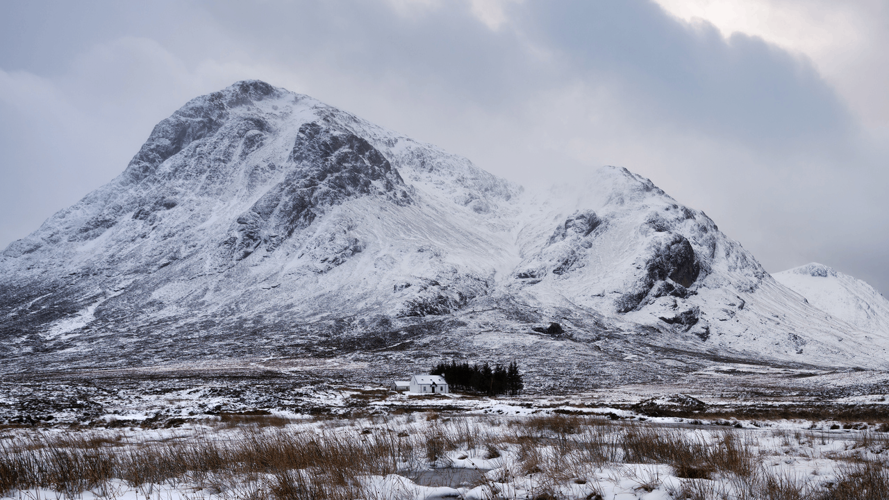
Having briefly flirted with the idea of spring, Britain is being dragged back into the icy clutches of winter as Arctic air blasts the country – a frigid relapse that will keep temperatures largely in the single digits and bring snow to many areas over the weekend.
The Met Office issued a yellow warning for snow and ice across central and north-west Scotland on Friday, where 2 to 5cm of snow is expected even at lower levels, with up to 10cm possible over higher ground.
Northern Ireland’s hills, the English Lakes and the Pennines may also receive a dusting of snow, while elsewhere, Friday will bring a tumultuous mixture of sunshine, rain, sleet, hail, thunder and the occasional rainbow.
Temperatures will struggle to reach double figures anywhere except the South East, and although the winds won’t be as ferocious as they were on Thursday, they will remain blustery enough to ensure nobody forgets how cold it is.
Showers will be squally, sharp and generally exacerbate the feeling of cold.
"A whiff of winter has returned to our weather," said Met Office meteorologist Alex Deakin. "Everywhere feeling colder than yesterday, and for some, a few snow flurries around."
While the snow is mostly forecast over the hills, he thinks "some will get down to lower levels", where sleet and also "hail mixed in with the showers" is another likely scenario.
This bitter medley could result in ice in some areas, leading to treacherous driving conditions later on Friday, the Met Office warned.
The cold snap is set to linger into the weekend. Scotland and Northern Ireland can expect a couple of frosty nights, with daytime temperatures remaining below average.
Saturday should largely begin bright and crisp, with spots of sunshine that might feel pleasant in brief moments when the Arctic winds die down. Scattered smatterings of rain will punctuate the afternoon in some areas.
Sunday, however, looks cloudier, windier and more shower‑ridden, with a renewed chance of wintry weather returning to the North by nightfall.
The colder air is expected to loiter until early next week, after which temperatures should finally begin to recover to something slightly above the mid‑March average as we head into spring – a modest consolation prize after a weekend being pelted by sleet and hail.
Why is it colder again?
Britain’s weather is being dictated by the origin of the air currently being funnelled over it, with this batch coming directly from the Arctic.
The chain reaction bringing this Arctic blast began in the United States, where warm air from the Gulf of Mexico collided with Arctic cold, producing deadly storms, tornadoes and record‑breaking hail in Illinois. This violent temperature clash supercharged the jet stream, which then barrelled across the Atlantic with wind speeds hitting more than 200mph.
In turn, this has spun a deep area of low pressure near Iceland. That system swept across the UK on Thursday, dragging down a fresh supply of Arctic air in its wake.
Iran war live: US confirms troops killed in Iraq plane crash as explosion hits Tehran
UK weather map: Where will see a sunny weekend after snow and wind warnings
Sister of Dunblane victim says UK gun laws ‘at risk’
Hundreds of mortgage deals vanish from the market as Britain’s economy flatlines
Beatrice and Eugenie ‘still have houses in Royal Palaces’
TfL considering extra charges for SUV drivers travelling in London