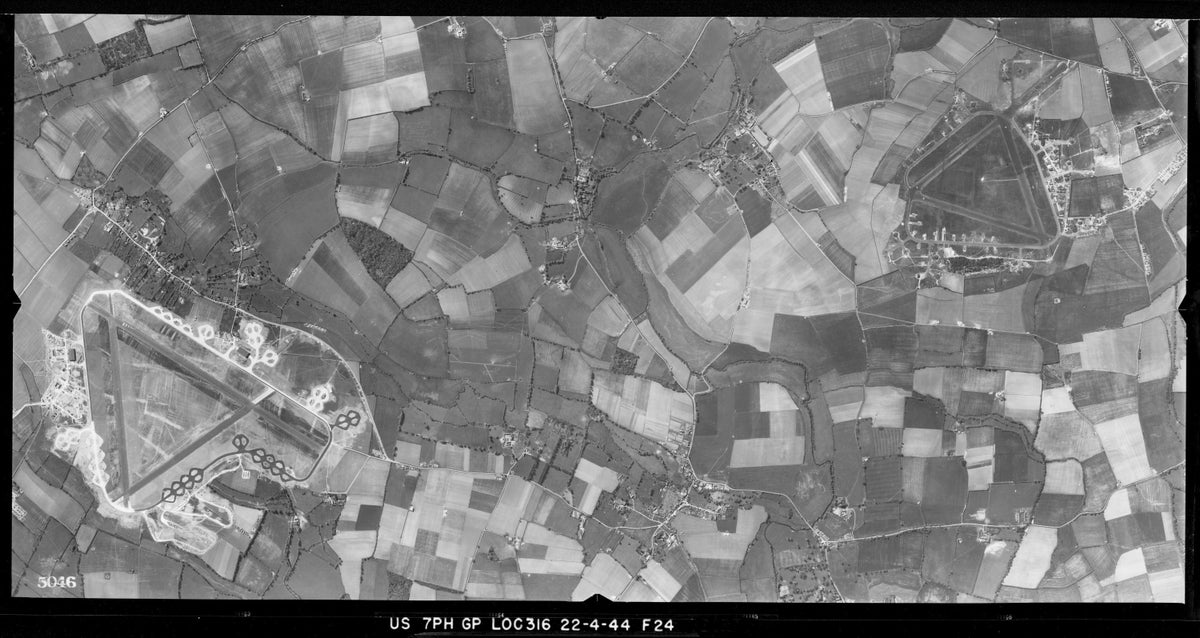
Way before Google Earth, there was photo reconnaissance by the U.S. Army Air Forces.
During World War II, specifically in 1943 and 1944, reconnaissance units of the USAAF — the predecessor to the U.S. Air Force — captured photos of the changing face of England, primarily around the American bases in the south of the country.