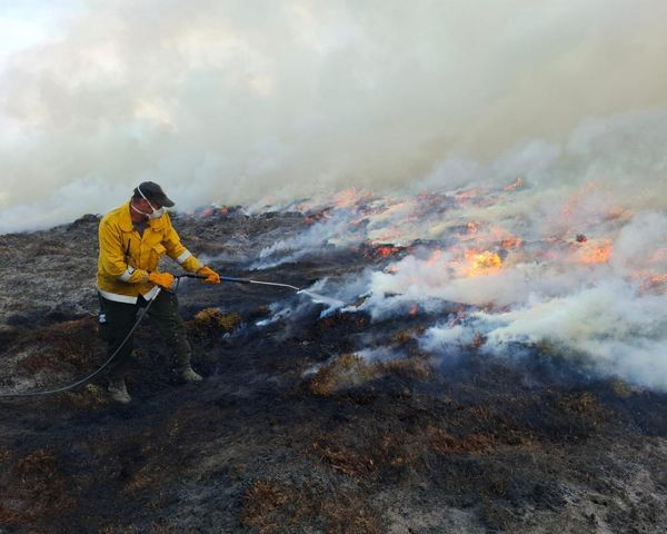
Another round of unseasonably wet weather is rolling across Queensland, with the central and southern interior of the state forecast to receive "well over" a month's worth of rain.
Some rivers have already reached minor to moderate flood levels, and the Bureau of Meteorology (BOM) has warned the downpour "hot on the heels" of last week's drenching will escalate the situation.
BOM senior forecaster Felim Hanniffy said the heaviest falls would saturate the southern interior on Thursday, with 20 to 40 millimetres predicted, along with severe thunderstorms.
"Around that kind of 20mm mark is usually what you'd expect for September," Mr Hanniffy said.
"River systems are already saturated and responding quickly to the rainfall that happened only late last week."
Ash Hart, who manages a caravan park in Winton, said western Queensland was normally "a dust bowl" without a tuft of grass.
"We finally have grass in the paddocks," Mr Hart said.
"[It's] completely transformed over the last six months — the outback is alive again — some people will only see it like this once in their lifetime."
Mr Hanniffy said the rain band will likely "run out of steam" by the time it reached the coast, but was still expected to deliver a "burst of wet weather" to the state's south-east.
"Probably Friday will be your main day for the south-east," he said.
Spring's sodden start follows Queensland's wettest winter in six years.
In July, Cairns recorded its wettest day since 1967, when 75mm fell at the airport.
In late August, Winton Airport received 69mm, which was more than five times its average rainfall for the month.
Coolest winter since 2007
And if residents in the southern half of the state felt like winter was colder than usual — they were right — daytime temperatures were cooler than average there.
Bundaberg recorded its coldest winter in 54 years, with an average temperature of 16.2 degrees Celsius.
Longreach was just 15.2C on average through winter — the coolest since 1990.
Brisbane Airport recorded its lowest daily maximum temperature this century — it only got to 20.5C — the lowest daily high since 1999.
Across the state, it was the coolest winter since 2007, with the mean maximum temperature 0.19C below average.
But in the tropical north, days were warmer than usual.
Coconut Island broke its 2010 winter heat record, when it hit 35.5C in July.
La Niña conditions building over Pacific Ocean
Mr Hanniffy puts the above average rain down to the negative Indian Ocean Dipole.
"That's associated with above average sea surface temperatures off north-west Australia that helps to draw moisture in across the interior of the state during the winter months and early spring," he said.
"That helps to fuel these cloud bands."
With La Niña conditions building over the Pacific Ocean for the third summer in a row, Mr Hanniffy said the wet season was likely to be wetter than usual – and with wetter soil compared to this time last year.
"We're starting into the spring period from a very, very wet position already and that means really little or no extra wiggle room or tolerance for any more additional rainfall, so that brings a significant risk," he said.
Mr Hanniffy said it was a "tale of contrast" to the northern hemisphere, where rivers are drying up in drought-stricken Europe and North America.