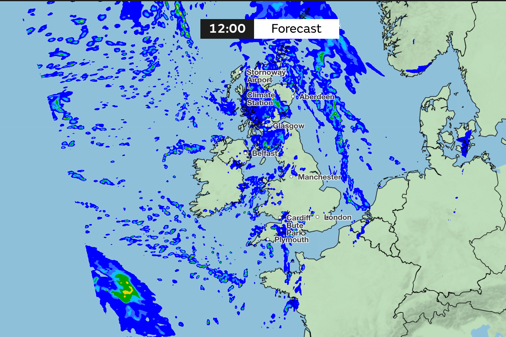
It will likely be a long time before Britons can put our winter coats away, as mixed weather conditions are expected to hit the UK this weekend. Further showers are predicted for many and snow may even fall in some parts of Scotland.
The Met Office has forecast some possible snowfall over the higher hills in east Scotland, as milder air filters in with a combination of rain and sleet.
“Eastern Scotland will continue to receive a feed of rain off the North Sea, with some snow possible over the higher hills. Snowfall amounts are not expected to be significant as milder air filters in, but the combination of rain, sleet and hill snow may still make conditions feel wintry”, the Met Office said.
Heavy showers are expected on Saturday in Wales and southwest England, which are likely to move into Northern Ireland later that day.
In contrast, eastern England is likely to be sheltered from the worst of the rainfall, with fewer showers and more dry intervals.
Western Scotland will enjoy the greatest likelihood of sunshine throughout Saturday.
Temperatures this weekend will be average for the mid-February season across England and Wales, with highs of around 10C to 11C. The air in these areas will feel relatively mild compared to the colder weather earlier in the month.
However, conditions will be vastly different further north in parts of Scotland, particularly in the east and northeast, where the weather will remain more on the cold side.
The temperature is expected to only reach 5C to 7C on Saturday and the brisk wind will make it feel noticeably colder.
The combination of wind and moisture will create a distinctly chilly feel at times, despite the modest temperature rises compared to previous days.
On Sunday, the Met Office predicted slow-moving showers and continued unsettled conditions.
“As the low-pressure system continues to weaken on Sunday, its slow movement means that rainfall patterns may be less well-defined. Bands of showers could linger across eastern Scotland, again raising concerns about the cumulative impact of wet weather in that region”, the Met Office stated.
Northeast England could see a wet start, although this depends on how the low-pressure evolves in the early hours of the day, the forecasters speculated.
Overall, England and Wales has a better chance of sunny spells developing during Sunday, as there will be more breaks in the cloud.
The Met Office said: “This will offer a welcome respite from the wetter conditions many have experienced recently. Once again, western Scotland looks favoured for dry and brighter weather thanks to shelter from the prevailing southeasterly flow.”
The national forecasting service said showers remain possible almost anywhere, but the best of the sunshine is likely across western Scotland and, at times, England and Wales.
Experts warn slashing climate aid would be act of ‘self-harm’ for UK
Readers slam ‘old boys’ club’ over Mandelson replacing Dame Karen Pierce
Average UK house price rises above £300,000 for the first time
Flooding could hit UK again after weather warnings issued
PM says Government wants to ensure ‘urgency and transparency’ in Mandelson files
Julia Donaldson on new book Gruffalo Granny: I’m a big fan of grandmotherhood