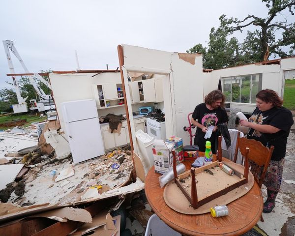
ORLANDO, Fla. — Tropical Storm Claudette is causing heavy rains and tropical-storm-force winds along portions of the northern Gulf Coast, according to the National Hurricane Center update at 11 a.m. EST.
A Tropical Storm Watch has been issued for a portion of the North Carolina coast from Cape Fear to Duck, including Pamlico and Albemarle Sounds.
The tropical storm keeps moving northeast with its maximum sustained winds at 40 mph and tropical-storm-force winds expanding outward up to 205 miles east of the center, according to the NHC report.
The Tropical Storm Warning issued from the Mouth of the Mississippi River westward to Morgan City, Louisiana, and for Lake Pontchartrain, Lake Maurepas, and Metropolitan New Orleans has been discontinued.
Meteorologists predict Claudette, the third named storm of the year, will weaken and become a tropical depression later today. However, Claudette is forecast to become a tropical storm again when it moves across the Carolinas Sunday night or early Monday.
Rainfall totals could fall between 5 and 10 inches and as high as 15 inches in some areas, the NHC said.
“As the system continues to lift northeast through the weekend, heavy rain will expand across central Alabama, central and northern Georgia, and into the Piedmont of the Carolinas, resulting in rainfall totals of 3 to 6 inches with isolated maximum amounts of 8 inches,” said John Cangialosi, an NHC senior hurricane specialist.
The NHC warned of flash, urban and small stream flooding as a result of the heavy rainfall and said river flooding could occur as the storm hits areas with elevated rivers. Tropical storm conditions, including high winds, are expected to continue along the coasts in the storm’s path through Saturday.
Tornadoes are possible today across southeast Alabama, the western Florida Panhandle, and southwest Georgia.
Storm surge could reach between 2 to 3 feet in areas from the mouth of Pearl River to the Okaloosa/Walton County Line in Florida and Mobile Bay.
Lake Pontchartrain, Lake Maurepas, and Lake Borgne, Panama City, Pensacola Bay, Choctawhatchee Bay, Saint Andrew Bay could see between 1 and 2 feet of storm surge, the NHC said.
A 1 to 3 feet storm surge is expected in areas from North Carolina to the North Carolina-Virginia border.
———
(Orlando Sentinel staff writer Katie Rice contributed to this report.)


