Get all your news in one place.
100's of premium titles.
One app.
Start reading
International Business Times UK
Seneca Cabrera

Tropical Cyclone Narelle Red Sky Explained: What Turned West Australia Bloody Red Right Before The Storm?

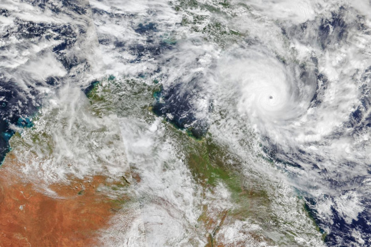
Tropical Cyclone Narelle churns over the Coral Sea in this image acquired on 19 March 2026, with the VIIRS (Visible Infrared Imaging Radiometer Suite) on the NOAA-21 satellite. (Credit: Michala Garrison/NASA Earth Observatory)

Residents across Western Australia reported deep red and orange skies ahead of Tropical Cyclone Narelle, with images widely shared online as the system approached the coast in late March. The phenomenon was observed in areas including Shark Bay on 27 March, shortly before the arrival of stronger winds and rainfall.

According to FOX Weather, the dust altered how sunlight travelled through the atmosphere, filtering out shorter wavelengths and allowing red tones to dominate. Meteorologists said the colour change was caused by iron-rich dust lifted into the atmosphere by the cyclone's outer winds.

Sign up to read this article
Read news from 100's of titles, curated specifically for you.
Already a member? Sign in here
Related Stories
Top stories on inkl right now
One subscription that gives you access to news from hundreds of sites
Already a member? Sign in here
Our Picks
Fourteen days free
Download the app
One app. One membership.
100+ trusted global sources.