The Tour de Romandie returns for six days of racing across the high alpine mountains of Switzerland from April 23-28, 2024. The WorldTour event serves as a proving ground for teams headed to the first Grand Tour of the season, the Giro d’Italia.
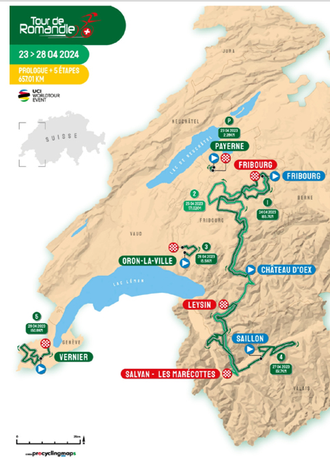
A total of 657.1km kilometres of racing includes 17.7km of time trialing, starting with a 2.28km prologue and then a 15.5km mid-race race against the clock. Romandie packs in 10,989 metres of elevation gain across the two time trials and four road days, including two mountaintop finishes on stages 2 and 4.
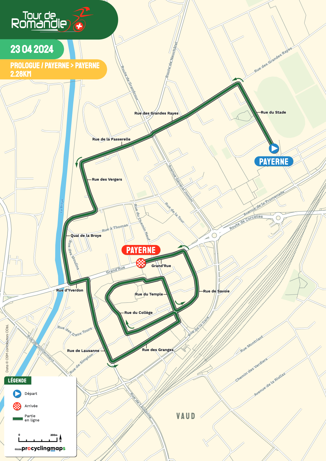
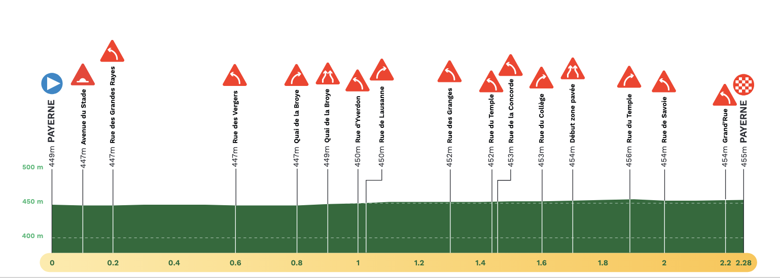
The week begins with a flat race against the clock with a 2.28km Prologue in Payerne, which sits to the east of Neuchâtel Lake in Switzerland. It is a sprint as compared to the 6.8km opening day last year. The opening section begins on Rue du Stade. The middle section of the course runs along Qui de la Broye along the Broye river and will have to make two quick 90-degree turns in a narrow, small section of Grand Rue to head to the final 1.2km with a city centre loop and then the finale back on Grand Rue for the finish.
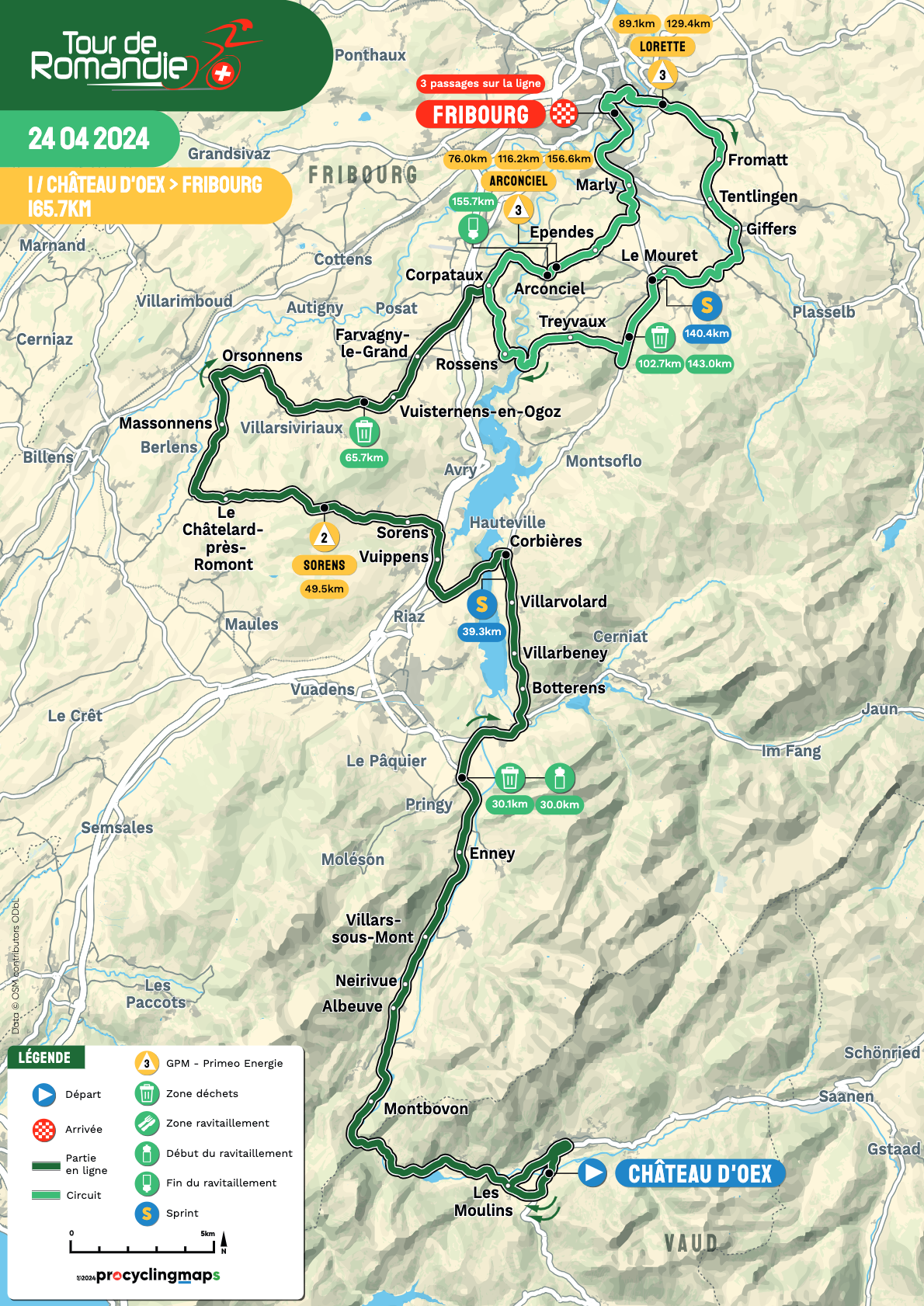
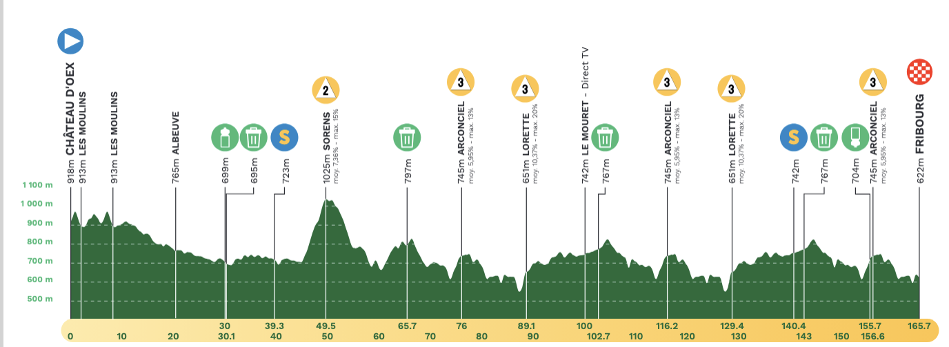
The second day of racing is stage 1 and begins with a short circuit in Château d’Oex and sets off for a total of 165.7km. Across the first 73km is one categorised climb at Sorens, that averages 7.3% with a section at 15%. From there, riders begin finish circuits of 40.3km each around Fribourg, which is fresh territory for this host venue, which last hosted a time trial in 2021. The circuit has category 3 climbs at Arconciel (2.2 kilometres at 5.9%) and Lorette (1.1 kilometres at 10.4%), each done twice before the final loop. From the top of the climb of Lorette, which has a section reaching 20% gradient, riders will be able to see the town below. Across the final 35km, a third trip up Arconciel then leads to the final 10km for the finish in Fribourg on Boulevard Pérolles.
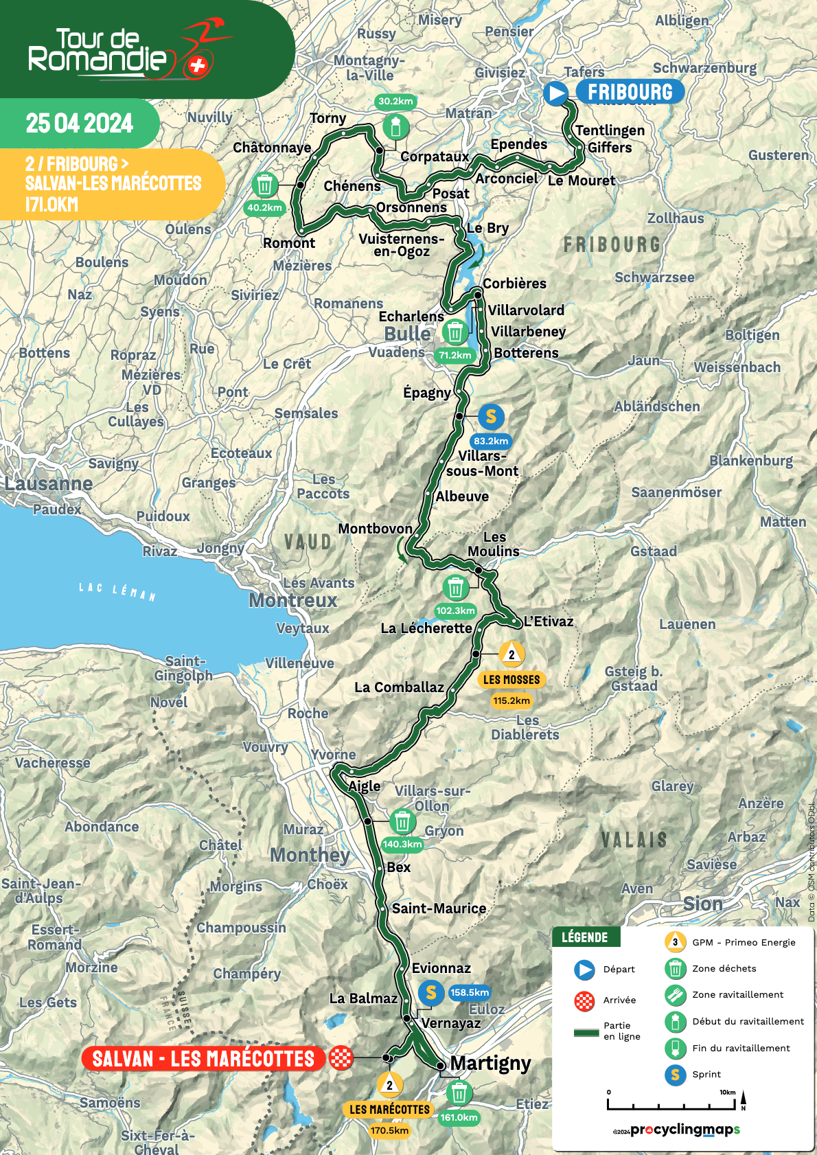
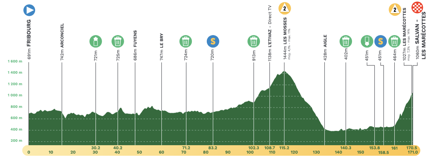
Stage 2 begins where the previous day ended in Fribourg with 171km on tap in a southerly direction to Salvan-Les Marécottes. The first half of the route is rolling and then it is all about just two climbs - Les Mosses (13.4km at 4.1%) with 56km to go and a summit finish to the ski station to Les Marécottes (7.8km at 7.3%). After descending Les Mosses, the riders can shake out the legs along the Rhône river to make the approach to the final climb, with pitches that reach 16%, and the first summit finish of the week.
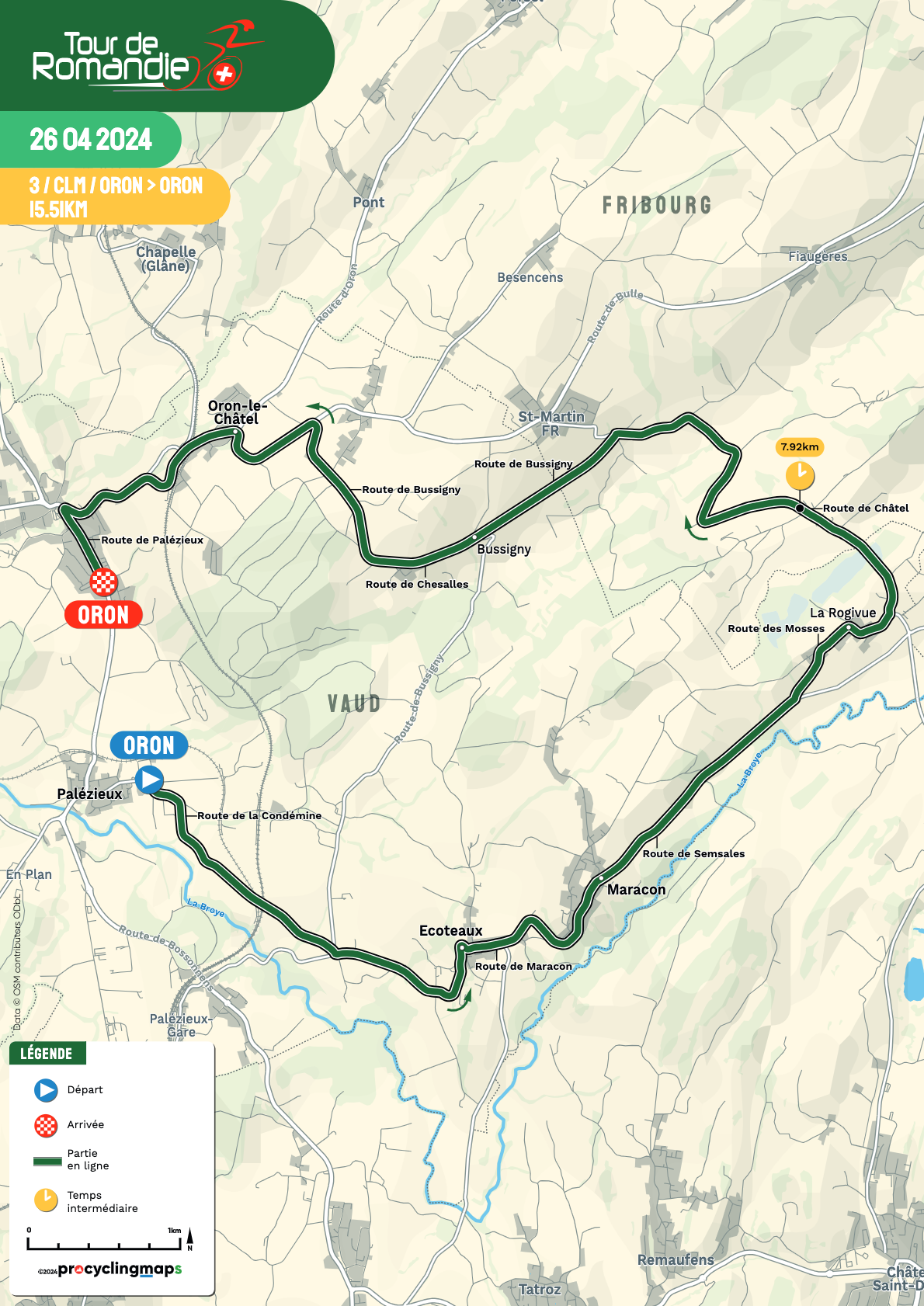
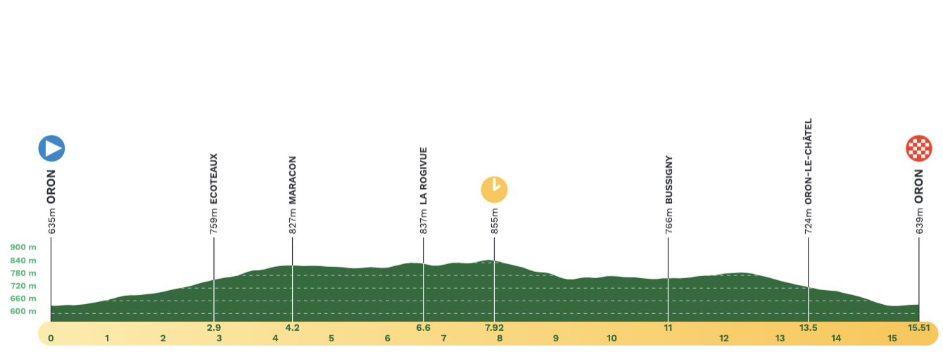
For a second consecutive year, the ITT is slotted in the middle of the week, this one 3km shorter than 2023. The stage 3 time trial is 15.5km rolling route that makes a counter-clockwise loop on the east side of Oron. The start is on Route de la Condémine with a steady incline to the intermediate time check after passing through the town of La Rogivue with 8km to go. The course has just a pair of tight corners headed back to Oron, with a final sharp corner with 500 metres to go on Route de Palézieux to stop the clock.
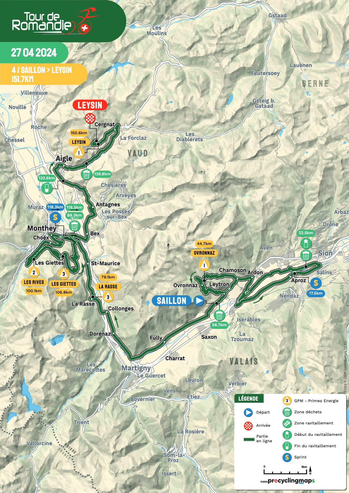
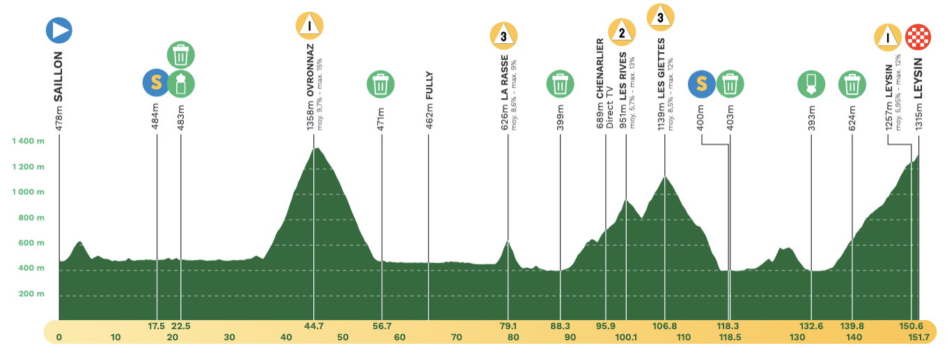
Saturday is the queen stage, stage 4, with 3,536 metres of elevation gain across 151.7km. There are five categorised climbs in all, the final one being a mountaintop finish at Leysin. The first ascent begins after the opening 35km, a long 8.9km climb across Ovrtoninaz, with an average gradient of 9.7%. Once cresting the top, the route leads back through Saillon and then follows the Rhône river north towards Martigny. The flat stretch of a little over 20km then hits a short, sharp hill at La Rasse (2km at 8.6%).
After passing through Massongex, Les Rives (9.8km at 5.7%) and Les Giettes (4km at 8.5%) are back-to-back climbs leaving 45km to the finish. The route goes back through Massongex and soon hit a section with a small 1.1km climb with a 9.5% gradient. But the final 14km averages 6% and form a wall to the finish in Leysin, which last hosted the Tour de Romandie in 2017.
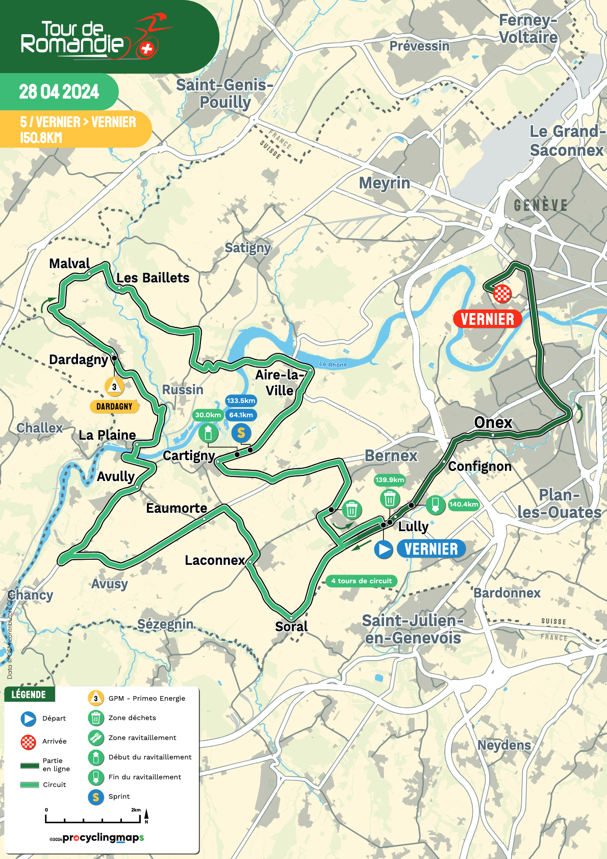
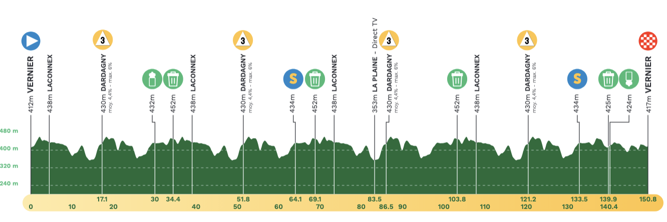
Stage 5 is set in the Geneva metropolitan area with a rolling route of 150.8km that begins and ends in Vernier. From the start, the main route is a 35km circuit completed four times, with one climb in the middle. A third-category climb, Dardagny is 1.5km long and averages 4.4%. On the final lap, the peloton then heads back into Vernier, racing the 10km section of road that was used for a neutral start.


